
Hide
Careby
hide
Hide
hide
Hide
hide
Hide
Hide
hide
Hide
"AUNBY, a chapelry in the parish of Careby, in the county of Lincoln. Stamford is its post town. The living is annexed to the rectory of Careby."
[Transcribed from The National Gazetteer of Great Britain and Ireland 1868]
by Colin Hinson ©2020
Hide
The Library at Bourne should prove useful in your research.
- The churchyard has a new lychgate made by local craftsmen to commemorate the Millenium.
- Rex NEEDLE has a photograph of the Careby church lychgate on Geo-graph, taken in July, 2000.
- Jonathan THACKER has a phtograph of the Churchyard at St. Stephen on Geo-graph, taken in March, 2020.
- The parish was in the Corby sub-district of the Bourne Registration District.
- Check our Census Resource page for county-wide resources.
- The table below gives census piece numbers, where known:
| Census Year | Piece No. |
|---|---|
| 1841 | H.O. 107 / 616 |
| 1851 | H.O. 107 / 2095 |
| 1861 | R.G. 9 / 2315 |
| 1871 | R.G. 10 / 3311 |
| 1891 | R.G. 12 / 2555 |
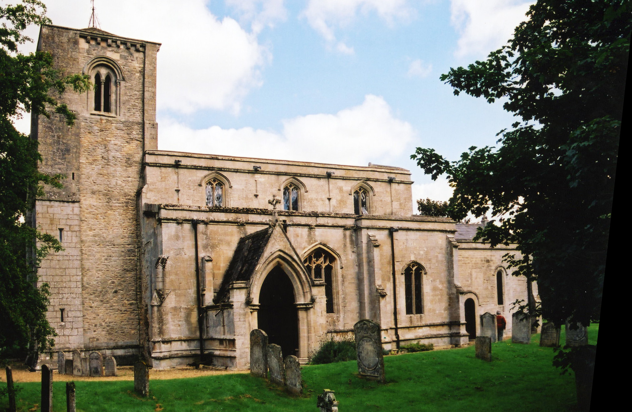
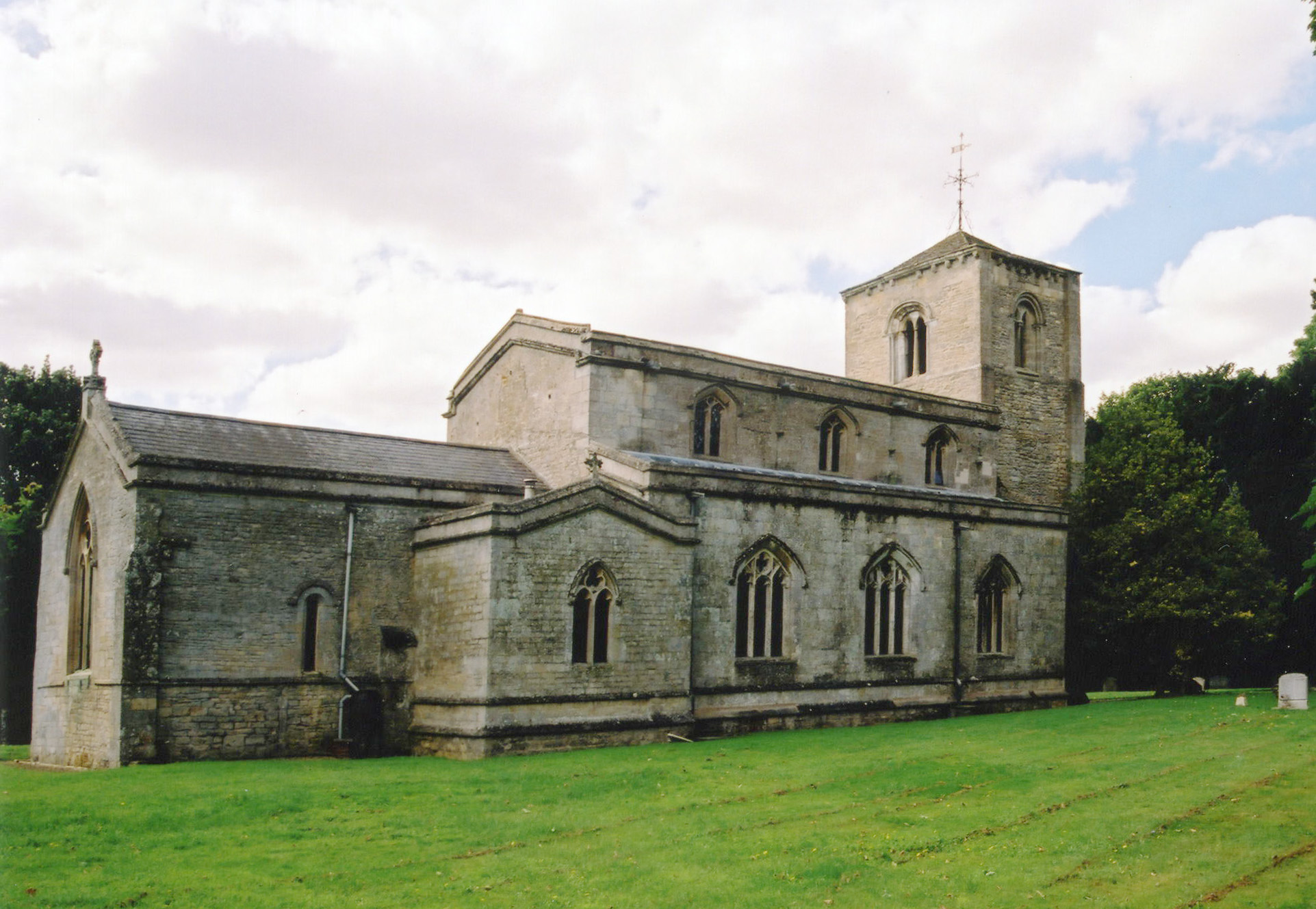
- The Anglican Church is dedicated to Saint Stephen.
- The church is an Early English style, but the tower is considered Norman.
- The curch porch was added in the 13th century. Robert HARVEY has a photograph of the Church Porch on Geo-graph, taken in May, 2017.
- The church was renovated in 1855-6.
- The church seats 150.
- The church is Grade I listed with British Heritage.
- There is a photograph of St. Stephen's Church on the Wendy PARKINSON Church Photos web site.
- Here are two photos of Saint Stephen's Church, taken by Ron COLE (who retains the copyright):
- Anclican parish registers exist from 1561.
- The Lincolnshire FHS has published several marriage indexes and a burial index for the Beltisloe Deanery to make your search easier.
- Kelly's 1913 Directory of Lincolnshire places this church in the Ness rural Deanery.
- Check our Church Records page for county-wide resources.
- The parish was in the Corby sub-district of the Bourne Registration District.
- Check our Civil Registration page for sources and background on Civil Registration which began in July, 1837.
Careby is both a village and parish which lies just east of the A1 trunk road, south of Little Bytham and just north of Stamford. The West Glen River passes down the East edge of the village. The parish covers about 1,450 acres.
If you are planning a visit:
- Tim HEATON has a photograph of Careby's main road on Geo-graph, taken in July, 2006.
- There is still an active rail line through Careby, but the web-page author does not know if there is passenger service.
- See our touring page for visitor services.
The National Gazetteer of Great Britain and Ireland - 1868
"AUNBY, a chapelry in the parish of Careby, in the county of Lincoln. Stamford is its post town. The living is annexed to the rectory of Careby."
- Ask for a calculation of the distance from Careby to another place.
- The Willoughby Arms Hotel is on Station Road midway between Careby and Little Bytham. It was originally named "The Steam Plough" when built in the 19th century. It had that name in 1868.
- Bob HARVEY has a photograph of the Willoughby Arms on Geo-graph, taken in October, 2014.
- These are the names associated with the Willoughby Arms in various directories:
| Year | Person |
|---|---|
| 1868 | John JOHNSON |
| 1872 | George CASEWELL, butcher |
| 1882 | John CHAMBERLAIN, victualer |
| 1900 | Dnl. CHARLESWORTH |
| 1913 | Walter MEDWELL, butcher |
| 1930 | W. MEDWELL |
- In 1900 Colonel Charles BIRCH-REYNARDSON apparently owned the Hall. The Colonel was born in Holywell, LIN, in 1846.
- Kelly's 1913 Directory of Lincolnshire refers to "some remains of the ancient mansion" of the HATCHER family.
- The national grid reference is TF 0316.
- You'll want an Ordnance Survey Explorer map, which has a scale of 2.5 inches to the mile.
- See our Maps page for additional resources.
You can see maps centred on OS grid reference TF025165 (Lat/Lon: 52.736428, -0.48333), Careby which are provided by:
- OpenStreetMap
- Google Maps
- StreetMap (Current Ordnance Survey maps)
- Bing (was Multimap)
- Old Maps Online
- National Library of Scotland (Old Ordnance Survey maps)
- Vision of Britain (Click "Historical units & statistics" for administrative areas.)
- English Jurisdictions in 1851 (Unfortunately the LDS have removed the facility to enable us to specify a starting location, you will need to search yourself on their map.)
- Magic (Geographic information) (Click + on map if it doesn't show)
- GeoHack (Links to on-line maps and location specific services.)
- All places within the same township/parish shown on an Openstreetmap map.
- Nearby townships/parishes shown on an Openstreetmap map.
- Nearby places shown on an Openstreetmap map.
- The name derives from the Old Scandinavian Kariby or "village of a man named Kari," and first appears in 1199 as Careby.
[A. D. Mills, "A Dictionary of English Place-Names," Oxford University Press, 1991].
The name derives from the Old Scandinavian 'Kariby' or "village of a man named Kari," and first appears in 1199 as Careby.
- This place was an ancient parish in Lincoln county and became a modern Civil Parish when those were established.
- The parish was in the ancient Beltisloe Wapentake in the South Kesteven district in the parts of Kesteven.
- You may contact the joint Careby, with Holywell and Aunby parish council concerning civic or politcal issues, but they are NOT staffed to assist you with family history searches.
- For today's district governance, contact the South Kesteven District Council.
- Bastardy cases would be heard in the Bourne petty session hearings.
- As a result of the 1834 Poor Law Amendment Act reforms, this parish became part of the Bourne Poor Law Union.
- For an example of a local man experiencing a Settlement Examination, check out this Careby Settlement Example:.
- Submitted by Anne Cole
----------------------------
Cheshire Quarter Sessions Ref: QJF 171/4/71 & 72
SETTLEMENT EXAMINATION 7 October 1743. John BURTON. He was born in the parish of Carbey [sic] in the county of Lincoln that his father's name was John BURTON and had a considerable estate at Carbey aforesaid and this examinant saith that he hath not gained any other legall settlemnet since his birth as he believes. John BURTON [signed]
VAGRANCY PASS dated 8 October 1743. John Burton was apprehended in the township of [blank] as a vagabond, to be conveyed to the House of Correction at Midlewich then to Carbey in the county of Lincoln.
- A school was built here in 1869 for 60 children. The school was enlarged in 1879 and again in 1895.
- The school closed in the 1960s.
- See our Schools page for more information on researching school records.