Hide
Claypole
hide
Hide
hide
Hide
hide
Hide
Hide
[Transcribed from The National Gazetteer of Great Britain and Ireland 1868]
by Colin Hinson ©2020
Hide
- The parish was in the Claypole sub-district of the Newark Registration District.
- Check our Census Resource page for county-wide resources.
- The table below gives census piece numbers, where known:
| Census Year | Piece No. |
|---|---|
| 1841 | H.O. 107 / 616 |
| 1861 | R.G. 9 / 2482 |
| 1871 | R.G. 10 / 3545 |
| 1891 | R.G. 12 / 2716 |
- The Anglican parish church is dedicated to Saint Peter.
- The church dates from the 13th century.
- Gary BROTHWELL has a photograph of St. Peter's Church on Geo-graph, taken in August, 2010.
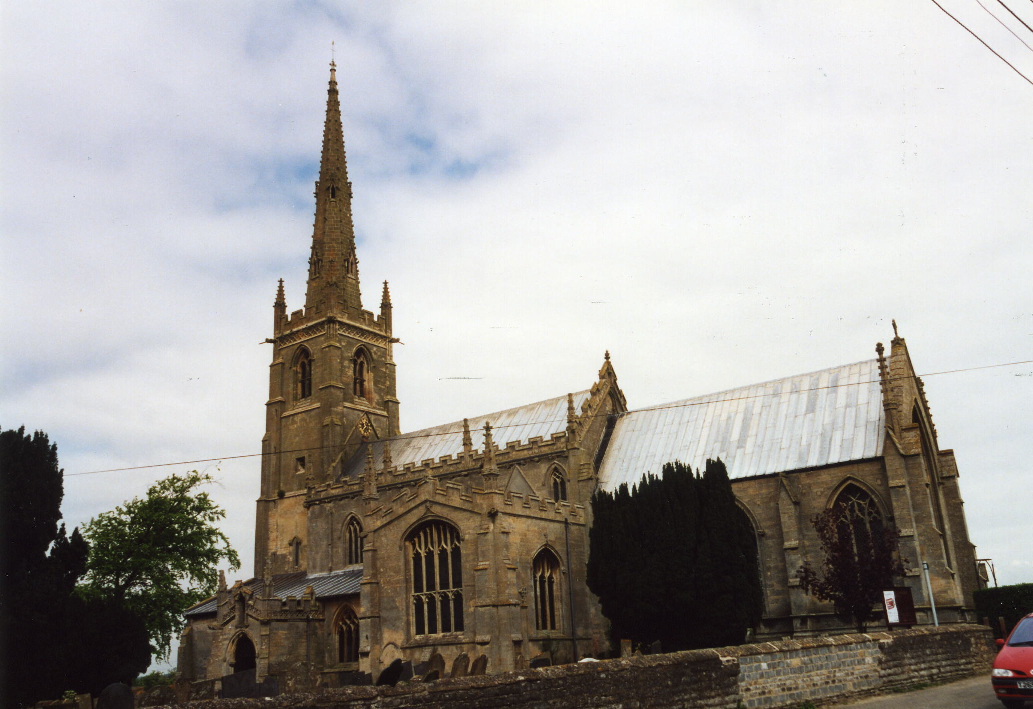
- Here is a photo of St. Peter's Church, taken by Ron COLE (who retains the copyright):

- Parish registers date from 1538.
- The Lincolnshire FHS has a Loan Library service which has the parish registers on microfiche for Baptisms from 1538 to 1812 and Marriages from 1538 to 1812.
- The LFHS has published several indexes for the Loveden Deanery to make your search easier.
- Parish registers are now on file at the Society of Genealogists, covering 1538 - 1837.
- Claypole marriages are in Boyd's Marriage Index, covering 1651 - 1837 and Pallot's Marriage Index, covering 1790 - 1837.
- We have a partial parish register extract. Your additions to this are welcome.
- Claypole had chapels for the Wesleyan Methodists and the Primitive Methodists. For information and assistance in researching these chapels, see our non-conformist religions page.
- J. THOMAS has a photograph of the Wesleyan Chapel on Geo-graph, taken in February, 2012.
- Check our Church Records page for county-wide resources.
- The parish was in the Claypole sub-district of the Newark Registration District.
- Check our Civil Registration page for sources and background on Civil Registration which started in July, 1837.
This village and parish lies just east of the A1 motorway as it heads north from Grantham to Newark. The River Witham flows northward along the west side of the parish. The county of Nottingham forms the western and northern border of the parish, with Fenton and Stubton parishes to the east and Dry Doddington to the south. The parish covers about 3,000 acres.
The village of Claypole is only five miles south-east of Newark-on-Trent and about 20 miles south-west of the city of Lincoln. If you are planning a visit:
- Jonathan THACKER has a photograph of the Village Sign on Geo-graph, taken in July, 2011.
- Visit our touring page for more sources.
The National Gazetteer of Great Britain and Ireland - 1868
- Ask for a calculation of the distance from Claypole to another place.
- In 1870, George NEVILE owned about 1,000 acres of the parish or about one-third of the land.
- The Great Northern Railway once ran through Claypole.
- Influenza outbreaks hit Claypole in 1891 and 1900.
- And check the history of the Wapentake at the Loveden Wapentake website.
- See our Maps page for additional resources.
You can see maps centred on OS grid reference SK846490 (Lat/Lon: 53.031604, -0.739928), Claypole which are provided by:
- OpenStreetMap
- Google Maps
- StreetMap (Current Ordnance Survey maps)
- Bing (was Multimap)
- Old Maps Online
- National Library of Scotland (Old Ordnance Survey maps)
- Vision of Britain (Click "Historical units & statistics" for administrative areas.)
- English Jurisdictions in 1851 (Unfortunately the LDS have removed the facility to enable us to specify a starting location, you will need to search yourself on their map.)
- Magic (Geographic information) (Click + on map if it doesn't show)
- GeoHack (Links to on-line maps and location specific services.)
- All places within the same township/parish shown on an Openstreetmap map.
- Nearby townships/parishes shown on an Openstreetmap map.
- Nearby places shown on an Openstreetmap map.
For a photograph of the Claypole War Memorial Plaques and the names on them, see the Roll of Honour site.
- The name Claypole is from the Old English claeg+pol, for "clayey pool". In the 1086 Domesday Book it first appears as Claipol.
[A. D. Mills, "A Dictionary of English Place-Names," Oxford University Press, 1991]
- This place was an ancient parish in Lincolnshire and became a modern Civil Parish when those were established.
- The parish was in the ancient Loveden Wapentake in the South Kesteven division of the county, in the parts of Kesteven.
- You can contact the Claypole Parish Council regarding civic or political issues, but they are NOT staffed nor funded to help you with family history searches.
- For today's district governance, contact the South Kesteven District Council.
- Bastardy cases would be heard in the Spittlegate petty session hearings.
- Care of the poor dates back to at least 1769 when tithes from 747 acres were set aside for their benefit.
- A large Workhouse for the poor was built in Claypole in 1817.
- After the Poor Law reforms of 1834, the parish became part of the Newark Poor Law Union.
- The Claypole Workhouse was enlarged to be used by the new Union.
- The Claypole Workhouse was closed in 1908 and has been demolished, but a photo of it appears in "Newark Before Victoria 1827-1837," by Rolf VERNON, published by Newark District Council Museums, 1984.
- A National School was erected here in 1868 and enlarged in 1899 to hold 136 children.
- The existing Church of England Primary School is at School Lane, Claypole, NG23 5BQ.
- In 1900, a new infant school was opened by the Dean of Lincoln on New Year's Day. The school was built to accommodate 45 children.
- The parish also had an adult school established by the local rector in the mid-19th century.
- For more on researching school records, see our Schools Research page.
