Hide
Corringham
hide
Hide
hide
Hide
hide
Hide
Hide
hide
Hide
"AISBY, a hamlet in the parish and wapentake of Corringham, in the county of Lincoln, 4 miles to the N.E. of Gainsborough,"
"CORRINGHAM PARVA, a hamlet in the parish and wapentake of Corringham, parts of Lindsey, in the county of Lincoln."
"DUNSTALL, a hamlet in the parish and hundred of Corringham, parts of Lindsey, in the county of Lincoln, 4 miles N.E. of Gainsborough."
"SOMERBY, a hamlet in the parish and wapentake of Corringham, parts of Lindsey, county Lincoln, 2½ miles E. of Gainsborough."
[Transcribed from The National Gazetteer of Great Britain and Ireland 1868]
by Colin Hinson ©2020
Hide
The Gainsborough Library is an excellent resource with both a Local History section and a Family History section.
- The parish was in the Willingham sub-district of the Gainsborough Registration District.
- In 1891, the parish was reassigned to the Marton sub-district of the Gainsborough Registration District.
- Check our Census Resource page for county-wide resources.
- The table below gives census piece numbers, where known:
| Census Year | Piece No. |
|---|---|
| 1841 | H.O. 107 / 631 |
| 1851 | H.O. 107 / 2120 |
| 1861 | R.G. 9 / 2410 |
| 1871 | R.G. 10 / 3448 |
| 1881 | R.G. 11 / 3297 |
| 1891 | R.G. 12 / 2636 |
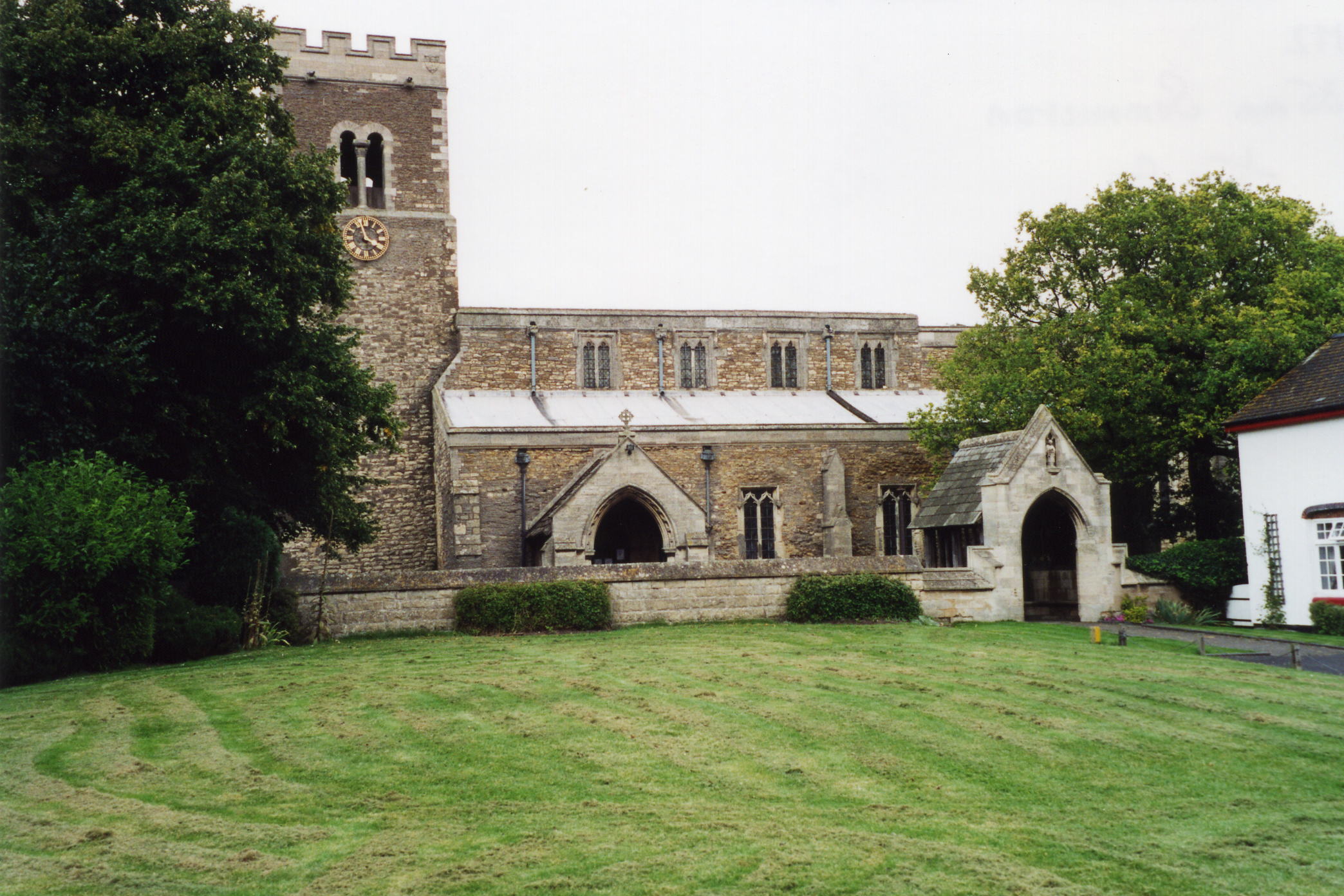
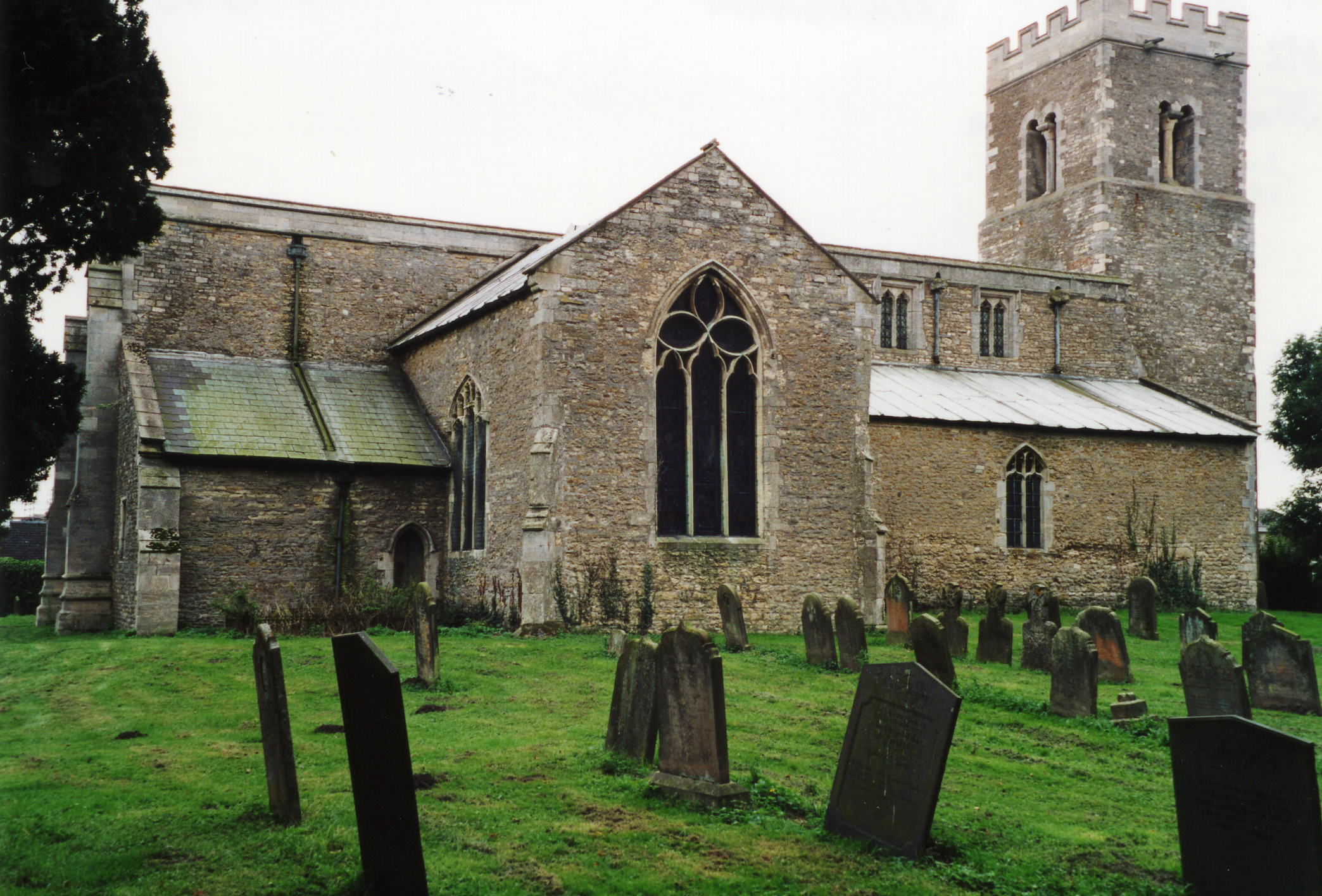
- The Anglican parish church in Great Corringham is dedicated to Saint Lawrence.
- The church here once belonged to the Templars.
- The church underwent extensive repairs in 1849.
- The church was completely restored in 1882-84.
- The church seats 350.
- Richard CROFT has a photograph of St.Laurence's Church on Geo-graph, taken in 2006.
- Richard CROFT also has a photograph inside the church chancel on Geo-graph, taken in 2008.
- There is a photograph of the Anglican parish church on the Wendy PARKINSON Church Photos web site.
- Here are two photographs of St. Lawrence Church supplied by Ron COLE (who retains the copyright):


- The Anglican parish registers exist from 1643.
- The Lincolnshire FHS has published several marriage and burial indexes for the Corringham Deanery to make your search easier.
- The parish had a Wesleyan Methodist chapel, rebuilt in 1878. The Primitive Methodists built their chapel in 1858 and replaced it in 1910. For more on researching these chapel records, see our non-conformist religions page.
- Check our Church Records page for county-wide resources.
- The parish was in the Willingham sub-district of the Gainsborough Registration District.
- In an 1890 re-organization, the parish was reassigned to the Marton sub-district of the Gainsborough Registration District.
- Check our Civil Registration page for sources and background on Civil Registration which began in July, 1837.
Corringham is both a parish and two villages, Great Corringham and Little Corringham, which form one long village about two miles east of Gainsborough and nine miles south of Scunthorpe. The parish itself is bordered on the north by Pilham parish, on the east by Willoughton parish, to the south by Springthorpe parish. The parish covers 6,300 acres and includes the hamlets of Somerby, Dunstall and Yawthorpe.
The villages are between two branches of the River Eau. If you are planning a visit:
- Take the A631 trunk road east out of Gainsborough and turn left at Corringham.
- Visit our touring page for more sources.
The National Gazetteer of Great Britain and Ireland - 1868
"AISBY, a hamlet in the parish and wapentake of Corringham, in the county of Lincoln, 4 miles to the N.E. of Gainsborough,"
"CORRINGHAM PARVA, a hamlet in the parish and wapentake of Corringham, parts of Lindsey, in the county of Lincoln."
"DUNSTALL, a hamlet in the parish and hundred of Corringham, parts of Lindsey, in the county of Lincoln, 4 miles N.E. of Gainsborough."
"SOMERBY, a hamlet in the parish and wapentake of Corringham, parts of Lindsey, county Lincoln, 2½ miles E. of Gainsborough."
- Ask for a calculation of the distance from Corringham to another place.
Gowin KNIGHT, the first principal librarian of the British Museum and a British physicist was born here on 10 September 1713.
- Roger GEACH has a photograph of The Beckett Arms on Geo-graph. taken in August, 2011.
- Somerby Park is described in White's 1872 Directory as "a commodius ancient mansion, in the Elizabethan style."
- Somerby Park is the ancestral home of the FAIRFAX family.
- The national grid reference is SK 8791.
- You'll want an Ordnance Survey Explorer #271 map, which has 2.5 inches to the mile scale.
- See our Maps page for additional resources.
You can see maps centred on OS grid reference SK871914 (Lat/Lon: 53.412448, -0.691195), Corringham which are provided by:
- OpenStreetMap
- Google Maps
- StreetMap (Current Ordnance Survey maps)
- Bing (was Multimap)
- Old Maps Online
- National Library of Scotland (Old Ordnance Survey maps)
- Vision of Britain (Click "Historical units & statistics" for administrative areas.)
- English Jurisdictions in 1851 (Unfortunately the LDS have removed the facility to enable us to specify a starting location, you will need to search yourself on their map.)
- Magic (Geographic information) (Click + on map if it doesn't show)
- GeoHack (Links to on-line maps and location specific services.)
- All places within the same township/parish shown on an Openstreetmap map.
- Nearby townships/parishes shown on an Openstreetmap map.
- Nearby places shown on an Openstreetmap map.
Corringham has a World War 1 and 2 memorial in a side chapel of St Laurence Church in the form of a Roll of Honour with hand-written inscriptions with the lettering written in black and red ink. You can see all the memorials at the Roll of Honour website.
- Corringham gives its name to the Wapentake it is in, as well as to a deanery and a prependary.
- The parish was in the ancient Corringham Wapentake in the West Lindsey district in the parts of Lindsey.
- The parish was also in the Soke of Kirton in Lindsey.
- Today's district governance is provided by the West Lindsey District Council.
- Bastardy cases would be heard in the Gainsborough petty session hearings.
- In 1724, William ASHWIN left £50 to purchase land for the poor.
- In 1808, Sarah HILL left £5 to parcel out as 5 shillings per year to the poor.
- In 1834, with the passage of the Poor Law Amendment, the parish became part of the Gainsborough Poor Law Union.
- The Common Lands of about 2,800 acres were enclosed in 1851.
Year Inhabitants 1801 427 1821 479 1831 559 1851 684 1861 717 1871 790 1881 744 1891 704 1901 566 1911 597 1921 546 1931 528 1951 448 1961 426
- A National School was built here in 1868 and enlarged in 1875 to hold up to 130 children.
- For more on researching school records, see our Schools Research page.
