
Hide
Denton
hide
Hide
hide
Hide
hide
Hide
Hide
hide
Hide
[Transcribed from The National Gazetteer of Great Britain and Ireland 1868]
by Colin Hinson ©2020
Hide
The Library at Grantham will prove useful in your research.
- Brenda PASK has written a book on "Denton" (Parish Officers, letting parish land, school rules, and Inventories), 2000. ISBN 9-78-0951688830.
Alan MURRAY-RUST has a photograph of one of the Belvoir Angel headstones on Geo-graph, taken in October, 2016.
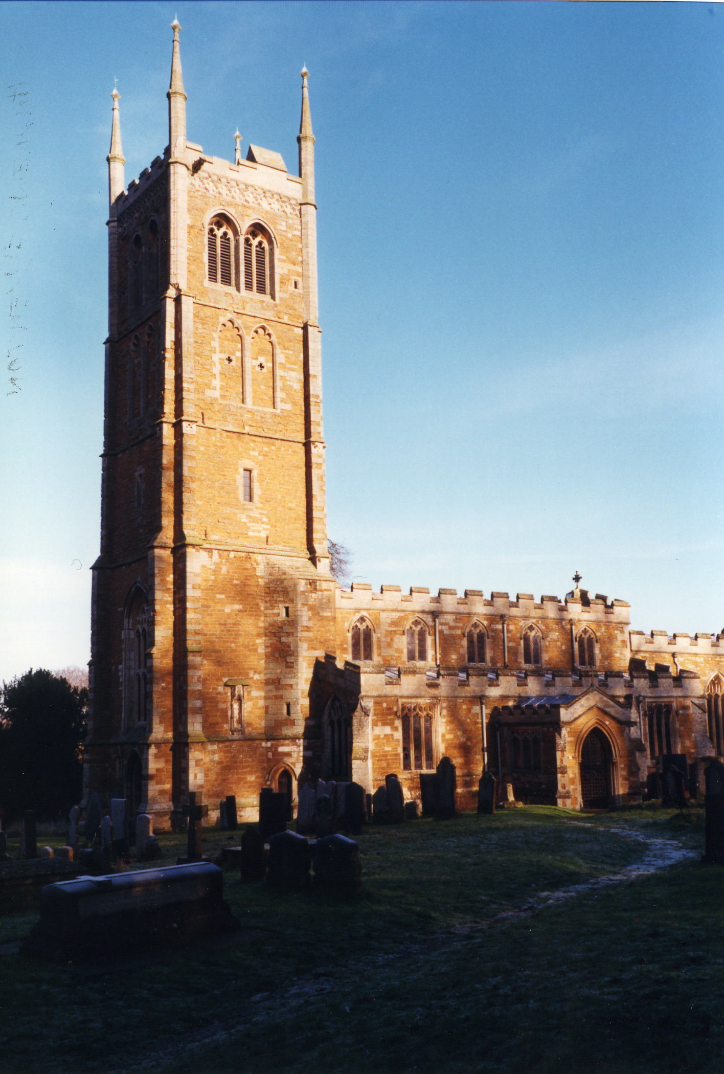
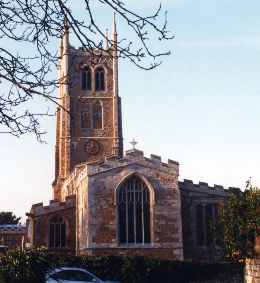
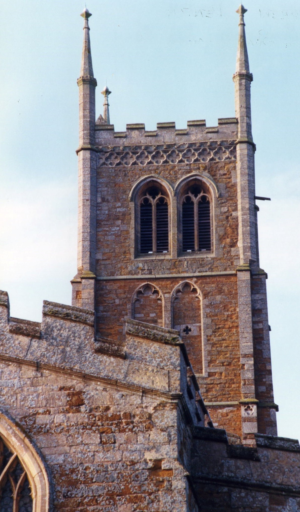
| St Andrew, Denton, Church of England |
- The parish was in the Denton sub-district of the Grantham Registration District.
- In an 1890 district re-organisation, the parish was allocated to the new "Grantham South" sub-district of the Grantham Registration District.
- Check our Census Resource page for county-wide resources.
- The table below gives census piece numbers, where known:
| Census Year | Piece No. |
|---|---|
| 1841 | H.O. 107 / 617 |
| 1851 | H.O. 107 / 2102 |
| 1861 | R.G. 9 / 2349 |
| 1871 | R.G. 10 / 3357 |
| 1891 | R.G. 12 / 2583 |
| St Andrew, Denton, Church of England |
- The Anglican parish church is dedicated to Saint Andrew and is built from local stone.
- "Word of mouth" tells us that the church was originally built in 1200.
- The tower was restored in 1904.
- The church seats 300.
- A photograph of the Anglican Church exists at the Wendy PARKINSON English Church Photographs site.
- Kate JEWELL has a photograph of the church interior on Geo-graph, taken in November, 2007.
- Here are several photographs of St. Andrew's Church, taken by Ron COLE (who retains the copyright):
- Parish registers exist from 1538. Bishop's Transcripts exist from 1562 to 1833.
- We have a partial register extract. Your additions would be welcome.
- Parish registers are on file at the Society of Genealogists, covering 1558 - 1837.
- Parish marriages from 1651-1750 are covered in Boyd's Marriage Index.
- The LFHS has published several marriage and burial indexes for the Grantham Deanery to make your search easier. In the early 1900's, the parish was in the South Grantham Deanery.
- The Independent Methodists had a chapel here in 1865. For information and assistance in researching these chapels, see our non-conformist religions page.
- Check our Church Records page for county-wide resources.
- The parish was in the Denton sub-district of the Grantham Registration District.
- In an 1890 district re-organisation, the parish was allocated to the new "Grantham South" sub-district of the Grantham Registration District.
- Check our Civil Registration page for sources and background on Civil Registration which began in July, 1837.
Denton is both a village and a parish. The parish is about 4 miles southwest of Grantham on the old Melton Mowbray road (now the A607). The parish itself is bounded on the north by Barrowby, on the east by Harlaxton parish, to the west by Woolsthorpe and Harston (Leicestershire) parishes, and on the south by Wyville parish. The parish covers about 2,650 acres.
The village of Denton is about a mile south of the Grantham and Nottingham Canal, which effectively forms the border with Barrowby parish. A rivulet, which rises from near Denton House, supplies a small reservoir and feeds into the Grantham Canal. If you are planning a visit:
- It is probably easiest to take the A607 southwest off the A1 Motorway for about three miles.
- Visit our touring page for more sources.
The National Gazetteer of Great Britain and Ireland - 1868
- Ask for a calculation of the distance from Denton to another place.
- There is a remnant of a 14th century churchyard cross in the churchyard. Alan MURRAY-RUST has a photograph of that medieval cross on Geo-graph, taken in October, 2016.
- In 1705, Richard WELBY was high sheriff of Lincolnshire.
- In 1727, a mosaic pavement, likely the floor of a Roman villa, was found in Denton field
- Check the history of the Wapentake at the Loveden Wapentake website.
- Kate JEWELL has a photograph of The Welby Arms on Church street at Geo-graph, taken in October, 2005.
- Jonathan THACKER also has a photograph of the Welby Arms on Geo-graph, taken in May, 2019.
- In 1841, nearly all of the parish was held by Sir William Earle WELBY, baronet of Denton House, with some land held by Mr. Gregory GREGORY of Harlaxton Manor. A few small landowners also held plots here.
- In 1871, most of the parish was held by Sir Glynne Earle WELBY-GREGORY, baronet.
- In 1913, almost the entire parish was held by Sir Charles Glynne Earle WELBY, baronet.
- Denton House was a handsome stone mansion built on a wooded hill. It was nearly all rebuilt in 1816-17. There is a spring near the house, St. Christopher's Well, said to possess medicinal and healing powers. In 1842, The WELBY family held the manor at Denton.
- In 1913, Denton Manor was the seat of Sir Charles Glynne Earle WELBY, baronet. This manor house was built in the tudor style in 1879-83 to replace the one above.
- The Manor was demolished in 1938.
- Trevor RICHARD has a photograph of the Denton Manor Gatehouse on Geo-graph, taken in July, 2012.
- The national grid reference is SK 8632.
- Consider getting an Ordnance Survey "Explorer 247" map which will show detail of 2.5 inches to 1 mile scale.
- See our Maps page for additional resources.
You can see maps centred on OS grid reference SK868326 (Lat/Lon: 52.88379, -0.711021), Denton which are provided by:
- OpenStreetMap
- Google Maps
- StreetMap (Current Ordnance Survey maps)
- Bing (was Multimap)
- Old Maps Online
- National Library of Scotland (Old Ordnance Survey maps)
- Vision of Britain (Click "Historical units & statistics" for administrative areas.)
- English Jurisdictions in 1851 (Unfortunately the LDS have removed the facility to enable us to specify a starting location, you will need to search yourself on their map.)
- Magic (Geographic information) (Click + on map if it doesn't show)
- GeoHack (Links to on-line maps and location specific services.)
- All places within the same township/parish shown on an Openstreetmap map.
- Nearby townships/parishes shown on an Openstreetmap map.
- Nearby places shown on an Openstreetmap map.
There is a glass-encased Roll of Honour on the north wall of the Church Nave. It has 136 names from World War One, only three of whom died.
There is a circular stone tablet on the south wall of the Nave, honouring those who served in World War Two. Three men from the parish died in that war, also.
- Denton is a common place-name across England. The name derives from the Old English dene+tun, meaning "village in a valley". It appears as Dentune in the 1086 Domesday Book.
A. D. Mills, "A Dictionary of English Place-Names," Oxford University Press, 1991.
- White's 1842 Directory lists the following surnames in the parish: AUGER, BECK, BELL, BREWSTER, BRICE, BURGIN, CABORN, COLLINGWOOD, FERNELLEY, GEESON, GREEN, HILL, HODSON, HOLMES, INGLE, LANE, LEAK, MORRIS, STARKEY, STEVENS, SWANSON, TRYNER, TYLER, WATSON, WINTER and WELBY.
- White's 1872 Directory lists the following surnames in the parish: AUGER, AVERY, BECK, BREWSTER, BULLOCK, CABORN, CHAPMAN, COLLINGWOOD, GEESON, GREEN, GREENWOOD, HOLMES, HOLT, INGLE, JACKSON, JOHNSON, LANE, LEAK, MORGAN, POTCHETT, REMMINGSTON, ROSE, STREETON, TYLER, WATSON, WELBY-GREGORY, WINTER and WRIGHT.
- Kelley's 1913 Directory lists the following surnames in the parish: BLANKLEY, COLLAR, COOPER, CRASTER, DOVE, GEESON, GREEN, JACKSON, JOHNSON, MALTBY, MITCHELL, OGDEN, PYKETT, SCOFIELD, SMITH and WELBY.
- This place was an ancient parish in Lincoln county and became a modern Civil Parish when those were established.
- The parish was in the ancient Loveden Wapentake in the South Kesteven district in the parts of Kesteven.
- The parish is also within the boundaries of the Grantham Soke.
- Alan MURRAY-RUST has a photograph of Denton Village Hall on Geo-graph, taken in August, 2013. This was a corrugated iron shed, formerly a World War I barrack hut.
- Ypou may contact the local parish council regarding civic and political matters but they are NOT funded to do family history work for you.
- For today's district governance, contact the South Kesteven District Council.
- Bastardy cases would be heard in the Spittlegate (Grantham) petty session hearings.
- The parish had an almshouse for six poor people, founded in 1653 by another William WELBY. It was located not far from Denton Manor house. In 1842 each resident received one shilling per week and 22cwt of coal yearly.
- In 1696, the parish purchased a cottage and 13 acres of land in Harlaxton to house a poor family.
- In 1714, Rebecca WELBY left the interest on £10 for the six alms-people above.
- The parish common fields were enclosed in 1789.
- In 1790 William WELBY left a legacy of £12 per year for the schooling of poor children. By 1871 that had been increased to £20.
- As a result of the 1834 Poor Law Amendment Act, the parish became part of the Grantham Poor Law Union in 1837.
- In 1842, six cottages in the village were given to poor people, but the donor was unknown. There was also an additional cottage and eight tenements, built by the poor, who paid only a ground rent for their use.
- Timothy HEATON has a photograph of the Former almshouses, Casthorpe Road on Geo-graph, taken in June, 2020. They are Grade II listed with English Heritage.
- An Infant School was erected here by Sir Glynne Earle WELBY-GREGORY, baronet, in 1720. The school was rebuilt as a Public Elementary School in 1855.
- A new Public Elementary School was erected in 1893 to house 125 children. In 1913 it was fearfully overcrowded, with 160 children attending.
- In addition to the "National School" above, the parish had a Congregational School.
- For more on researching school records, see our Schools Research page.