Hide
Doddington
hide
Hide
hide
Hide
hide
Hide
Hide
hide
Hide
"WHISBY, a township and chapelry in the parish of Doddington, county Lincoln, 6 miles S.W. of Lincoln."
[Transcribed from The National Gazetteer of Great Britain and Ireland 1868]
by Colin Hinson ©2020
Hide
- The parish was in the "South West" sub-district of the Lincoln Registration District.
- Check our Census Resource page for county-wide resources.
- The table below gives census piece numbers, where known:
| Census Year | Piece No. |
|---|---|
| 1841 | H.O. 107 / 617 |
| 1851 | H.O. 107 / 2104 |
| 1861 | R.G. 9 / 2355 |
| 1871 | R.G. 10 / 3366 |
| 1891 | R.G. 12 / 2587 |
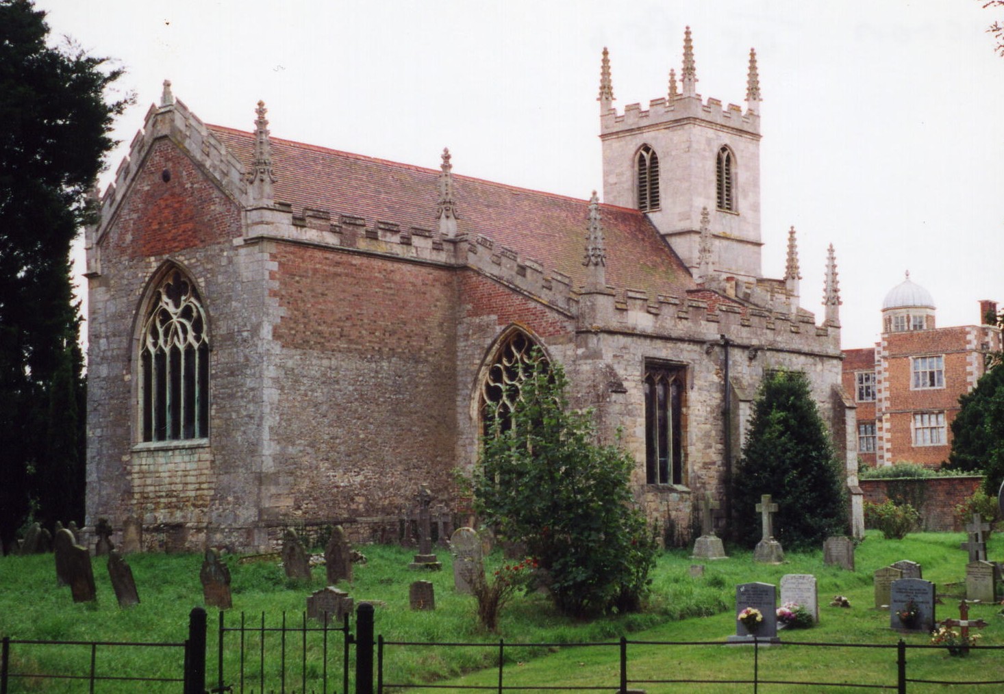
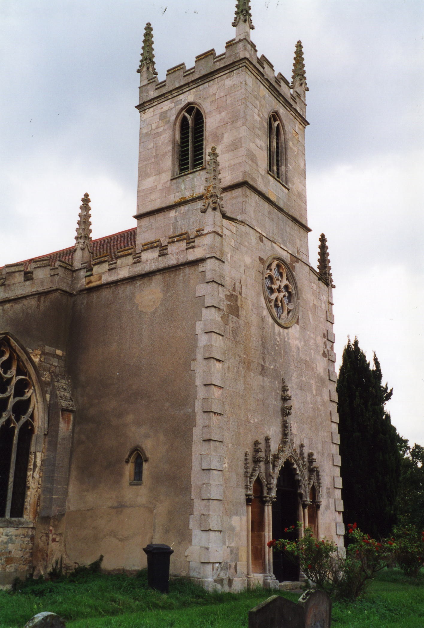
- The Anglican parish church is dedicated to Saint Peter.
- The church was almost entirely rebuilt in stone in 1771.
- The church seats 200.
- Here are two photos of St. Peter's Church, taken by Ron COLE (who retains the copyright):


- The parish register dates from 1690.
- We have a partial parish register extract text file. Your additions would be welcome.
- The LFHS has published several marriage indexes and a burial index for the Graffoe Deanery to make your search easier.
- Check our Church Records page for county-wide resources.
- The parish was in the "South West" sub-district of the Lincoln Registration District.
- Check our Civil Registration page for sources and background on Civil Registration which began in July, 1837.
This village and parish lie just west of Lincoln in Lincolnshire, just south of the Fossdyke Canal. Skellingthorpe parish is to the north-east and Thorpe on the Hill parish is to the south. The parish is bounded on the west by Nottinghamshire. The parish covers about 2,500 acres.
The village of Doddington is just outside the suburbs of the city of Lincoln. Whisby is a hamlet in the parish. If you are planning a visit:
- By automobile, take the B1190 arterial road between North Hykeham and the Fossdyke Canal west off of the A46 trunk road.
- There are camping facilities just south-west of the village.
- Check our Touring page for additional resources.
The National Gazetteer of Great Britain and Ireland - 1868
"WHISBY, a township and chapelry in the parish of Doddington, county Lincoln, 6 miles S.W. of Lincoln."
- Ask for a calculation of the distance from Doddington to another place.
- The parish was served by a railway station 2 miles north-west of the village on a line of the Lancashire, Derbyshire and East Coast railway.
- There is a good book on local history: R. E. G. COLE, History of the manor and township of Doddington: otherwise Doddington-Pigot, in the county of Lincoln, and its successive owners, with pedigrees, Lincoln: J. Williamson, printer, 1897, 276 pgs.
- Doddington Hall was formerly the seat of the DELAVAL or de LAVAL family.
- In 1841, the manor belonged to Colonel George Ralph Payne JARVIS.
- In 1912, the manor belonged to George Eden JARVIS.
- The national grid reference is SK 9070. The grid reference for Whisby is SK 9067.
- You'll want an Ordnance Survey "Explorer 272" map, which has 2.5 inches to the mile scale.
- See our Maps page for additional resources.
You can see maps centred on OS grid reference SK900700 (Lat/Lon: 53.21944, -0.653544), Doddington which are provided by:
- OpenStreetMap
- Google Maps
- StreetMap (Current Ordnance Survey maps)
- Bing (was Multimap)
- Old Maps Online
- National Library of Scotland (Old Ordnance Survey maps)
- Vision of Britain (Click "Historical units & statistics" for administrative areas.)
- English Jurisdictions in 1851 (Unfortunately the LDS have removed the facility to enable us to specify a starting location, you will need to search yourself on their map.)
- Magic (Geographic information) (Click + on map if it doesn't show)
- GeoHack (Links to on-line maps and location specific services.)
- All places within the same township/parish shown on an Openstreetmap map.
- Nearby townships/parishes shown on an Openstreetmap map.
- Nearby places shown on an Openstreetmap map.
- Richard CROFT has a photograph of the War Memorial inside the church on Geo-graph, taken in May, 2008.
Inscription reads:
TO THE GLORY OF GOD, AND IN EVER GRATEFUL MEMORY OF THOSE WHO FROM THIS PARISH OF DODDINGTON WITH WHISBY, SERVED IN THE GREAT WAR 1914 1918 OF WHOM THE FOLLOWING LAID DOWN THIER LIVES FOR THEIR COUNTRY. GREATER LOVE HATH NO MAN THAN THIS, THAT A MAN LAY DOWN HIS LIFE FOR HIS FRIENDS. ST JOHN XV. 13.
Names are:
BAYES , George Albert
GODDARD , Alfred Edwin
MEDLEY , John William
NEWTON, John T
SPIKINGS, A / Albert
STAPLETON, Joseph
- This place was an ancient parish in Lincoln county and became a modern Civil Parish when those were established.
- The parish was in the Lower Division of the ancient Graffoe (or Boothby Graffoe) Wapentake in the North Kesteven division of the county, in the parts of Kesteven.
- In April, 1931, this Civil Parish was abolished and replaced by the Doddington and Whisby Civil Parish.
- For today's district governance, contact the North Kesteven District Council.
- Bastardy cases would be heard in the Lincoln South petty session hearings on the first and third Friday of each month.
- As a result of the 1834 Poor Law Amendment Act, this parish became part of the Lincoln Poor Law Union.
- A Public Elementary School was built here in 1851. In 1912, average attendance was only 26.
- See our Schools page for more information on researching school records.
