
Hide
East Barkwith
hide
Hide
hide
Hide
hide
Hide
Hide
"EAST BARKWITH, a parish in the eastern division of the wapentake of Wraggoe, parts of Lindsey, in the county of Lincoln, 3 miles to the N.E. of Wragby, its post town. The living is a rectory's in the diocese of Lincoln, of the value of £230, in the patronage of G. F. Heneage, Esq., to whom the manor belongs. The church is dedicated to St. Mary.
[Transcribed from The National Gazetteer of Great Britain and Ireland 1868]
by Colin Hinson ©2020
Hide
Ian S. has a photograph of St. Mary's Churchyard on Geo-graph, taken in May, 2018.
- The parish was in the Wragby sub-district of the Horncastle Registration District.
- Check with Sheila Richards for East Barkwith Census transcriptions.
- Check our Census Resource page for county-wide resources.
- The table below gives census piece numbers, where known:
Census
YearPiece No. 1841 H.O. 107 / 627 1851 H.O. 107 / 2107 1861 R.G. 9 / 2365 1871 R.G. 10 / 3378 1891 R.G. 12 / 2597
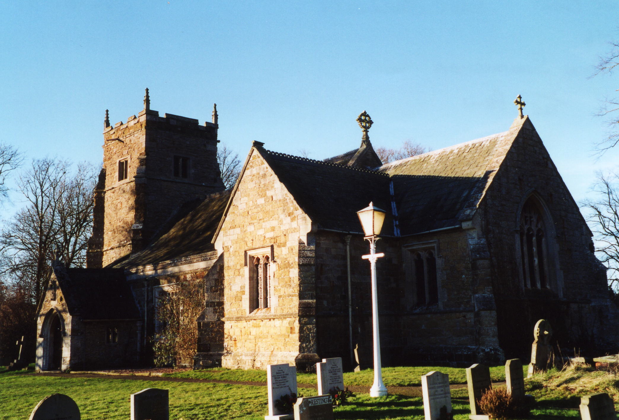
- Thee Anglican parish church is dedicated to Saint Mary the Virgin.
- The church was partially rebuilt in 1846 and further restored in 1868-69 when a porch was added.
- The church seats 202.
- Richard CROFT has a photograph of St. Mary's Church on Geo-graph, taken in December, 2005.
- Here is a photo of Saint Mary's Church, taken by Ron COLE (who retains the copyright):
- The Anglican parish register dates from 1695.
- The LFHS has published several marriage and burial indexes for the Westwold Deanery to make your search easier.
- Kelly's 1900 Directory of Lincolnshire reports, perhaps erroneously, that the church is rural Deanery of Wraggoe.
- The Anglican church is currently part of The Barkwith Group of the West Wold Deanery.
- In the 1800's the Wesleyan Methodists (1860) and the Free Methodists each had chapels. For information and assistance in researching these chapels, see our non-conformist religions page.
- There is a photograph of the Wesleyan Methodist chapel at Geo-graph taken by Richard CROFT in December, 2008.
- Check our Church Records page for county-wide resources.
- The parish was in the Wragby sub-district of the Horncastle Registration District.
- Check our Civil Registration page for sources and background on Civil Registration which began in July, 1837.
East Barkwith is both a village and a parish in the Wolds, 14 miles north-east of Lincoln and 8 miles north-east of Wragby. Panton parish lies to the south and West Torrington parish to the west. The parish covers about 1,000 acres.
If you are planning a visit:
- East Barkwith village lies astride the old Louth Road (now the A157) to Wragby and Lincoln.
- Passenger Rail service came in 1874, but ceased in May, 1951. Jonathan THACKER has a photograph of the Old Railway Station on Geo-graph, taken in December, 2012.
- Visit our touring page for more sources.
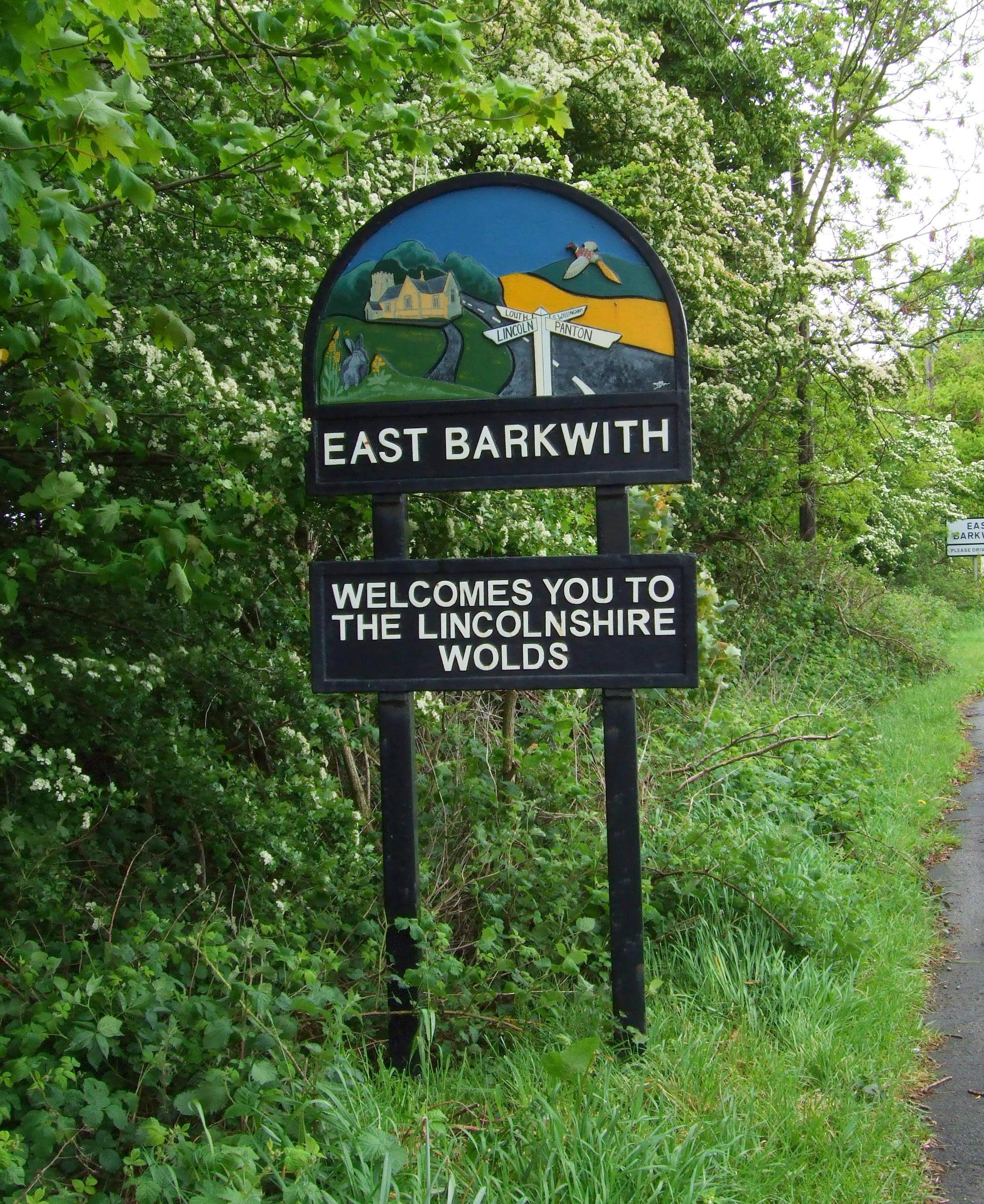
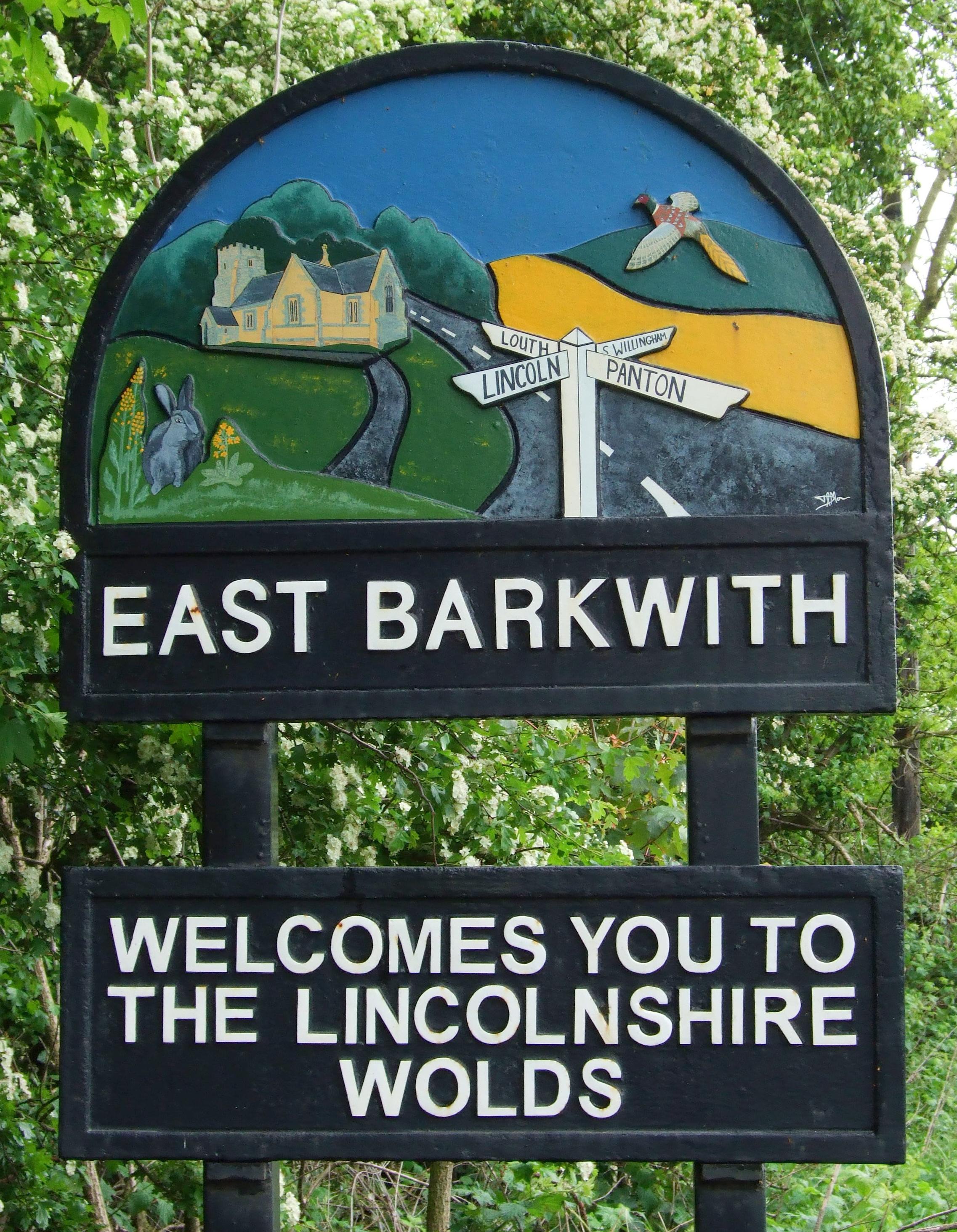
- It's a SIGN! Patricia McCRORY provides these village sign photographs to welcome you to your ancestors' village:
The National Gazetteer of Great Britain and Ireland - 1868
"EAST BARKWITH, a parish in the eastern division of the wapentake of Wraggoe, parts of Lindsey, in the county of Lincoln, 3 miles to the N.E. of Wragby, its post town. The living is a rectory's in the diocese of Lincoln, of the value of £230, in the patronage of G. F. Heneage, Esq., to whom the manor belongs. The church is dedicated to St. Mary.
- Ask for a calculation of the distance from East Barkwith to another place.
- Al PARTINGTON has a photograph of the Cross Roads Inn on Geo-graph, taken in March, 2008.
- William BRUMBY was the proprietor in 1885.
- See our Maps page for additional resources.
You can see maps centred on OS grid reference TF168815 (Lat/Lon: 53.317555, -0.248128), East Barkwith which are provided by:
- OpenStreetMap
- Google Maps
- StreetMap (Current Ordnance Survey maps)
- Bing (was Multimap)
- Old Maps Online
- National Library of Scotland (Old Ordnance Survey maps)
- Vision of Britain (Click "Historical units & statistics" for administrative areas.)
- English Jurisdictions in 1851 (Unfortunately the LDS have removed the facility to enable us to specify a starting location, you will need to search yourself on their map.)
- Magic (Geographic information) (Click + on map if it doesn't show)
- GeoHack (Links to on-line maps and location specific services.)
- All places within the same township/parish shown on an Openstreetmap map.
- Nearby townships/parishes shown on an Openstreetmap map.
- Nearby places shown on an Openstreetmap map.
- There is a joint war memorial shared by East Barkwith with West Barkwith. It is on the A157 junction in East Barkwith. It was unveiled in May, 1921.
- There is a photograph of the war memorial on Geo-graph, taken by Richard CROFT in December, 2008.
- Alan HEARDMAN also has a photograph of the War Memorial on Geo-graph, taken in October, 2011.
There is a list of the names from the memorial and other sources at the Roll of Honour site.
- This place was an ancient parish in Lincoln county and became a modern Civil Parish when those were established.
- The parish was in the ancient Wraggoe Wapentake in the East Lindsey district in the parts of Lindsey.
- The parish is governed by a joint East and West Barkwith Parish Council, which you can contact regarding civic or political issues, but they are NOT staffed to answer family history questions.
- For today's district governance, see the East Lindsey District Council.
- As a result of the 1834 Poor Law Amendment Act, the parish became part of the Horncastle Poor Law Union.
- Bastardy cases would be heard in the Wragby petty sessional hearings.
Year Inhabitants 1801 157 1811 198 1821 195 1831 187 1841 255 1851 321 1871 342 1881 339 1891 323 1911 308 1991 331
- A school was built here prior to 1900 for this parish and neighboring West Barkwith and East Torrington.
- There is a photograph of the old school on Geo-graph, taken by Brian WESTLAKE in February, 2011.
- This school has closed and is now a private residence.
- For more on researching school records, see our Schools Research page.
- The Parish History Group was formed in 2014.