Hide
Fulbeck
hide
Hide
hide
Hide
hide
Hide
Hide
[Transcribed from The National Gazetteer of Great Britain and Ireland 1868]
by Colin Hinson ©2020
Hide
- The parish was in the Claypole sub-district of the Newark Registration District.
- Check our Census Resource page for county-wide resources.
- The table below gives census piece numbers, where known:
| Census Year | Piece No. |
|---|---|
| 1841 | H.O. 107 / 618 |
| 1861 | R.G. 9 / 2482 |
| 1891 | R.G. 12 / 2716 |
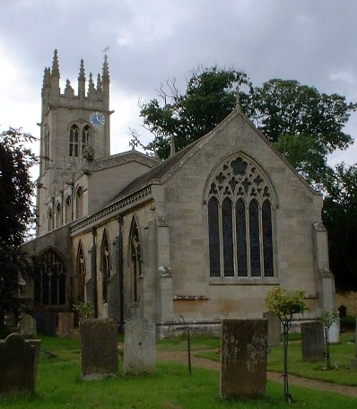
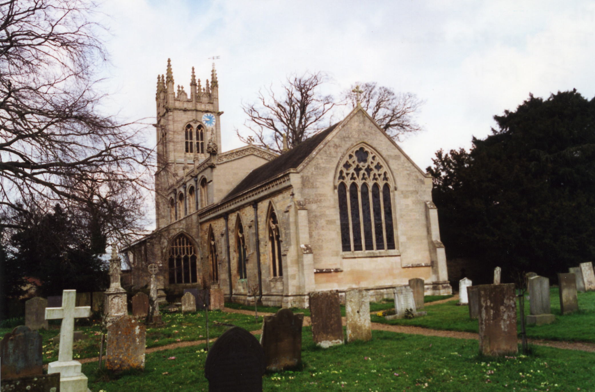
- The Anglican parish church is dedicated to Saint Nicholas and contains several monuments to the FANE family.
- The church seats 356 people.
- Gary BROTHWELL has a photograph of St. Nicholas' Church on Geo-graph, taken in September, 2010.
- Here is a photo of the church, taken by (and copyright of) Wendy PARKINSON.
- Here is a photo of the church, taken by Ron COLE (who retains the copyright):
- The parish register dates from 1562.
- We have a handful of entries in our Parish Register extract pop-up file. Your additions would be welcomed.
- The Lincolnshire FHS has a Loan Library service which has the parish registers on microfiche for Baptisms from 1563 to 1812 and Marriages from 1563 to 1812.
- The LFHS has published several marriage indexes for the Loveden Deanery to make your search easier.
- The Family History Library in Salt Lake City has cemetary transcriptions on film 1542303, Item 4, covering 1563-1954.
- The Wesleyan Methodists had a preaching room here in the mid-1800's. The Primitive Methodists had a chapel in the village. For information and assistance in researching these chapels, see our non-conformist religions page.
- Check our Church Records page for county-wide resources.
- The parish was in the Claypole sub-district of the Newark Registration District.
- Check our Civil Registration page for sources and background on Civil Registration which started in July, 1837.
Fulbeck is a parish and village just 117 miles north of London. It also lies 11 miles ESE of Newark-on-Trent and 11 miles north of Grantham. Caythorpe parish lies to the south, with Leadenham to the north. The parish covers about 3,800 acres. The parish is long on its east-west axis and narrow on the north-south one, extending west to the River Brant and east almost to Ermine Street. The parish includes the hamlet of Sudthorpe near the south end of the village. In 1871, there was a year-round spring, called Holywell, just a mile east of the village, and, near the western edge of the parish was a chalybeate spring.
The village of Fulbeck lies on a slight rise and a creek, The Beck, flows westerly in to the River Brant from just outside the village. If you are planning a visit:
- Take the A607 trunk road north out of Grantham.
- Visit our touring page for more sources.
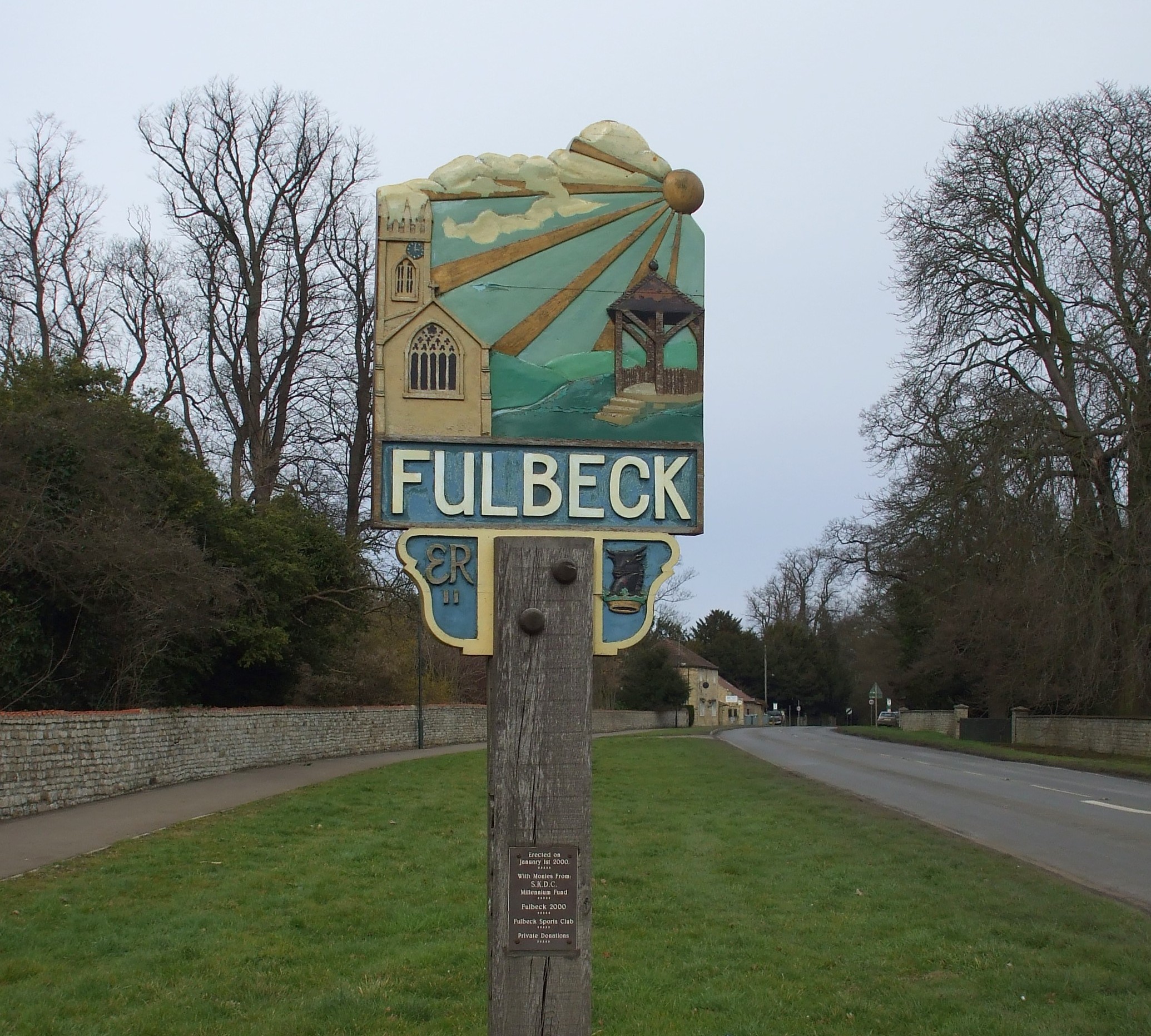
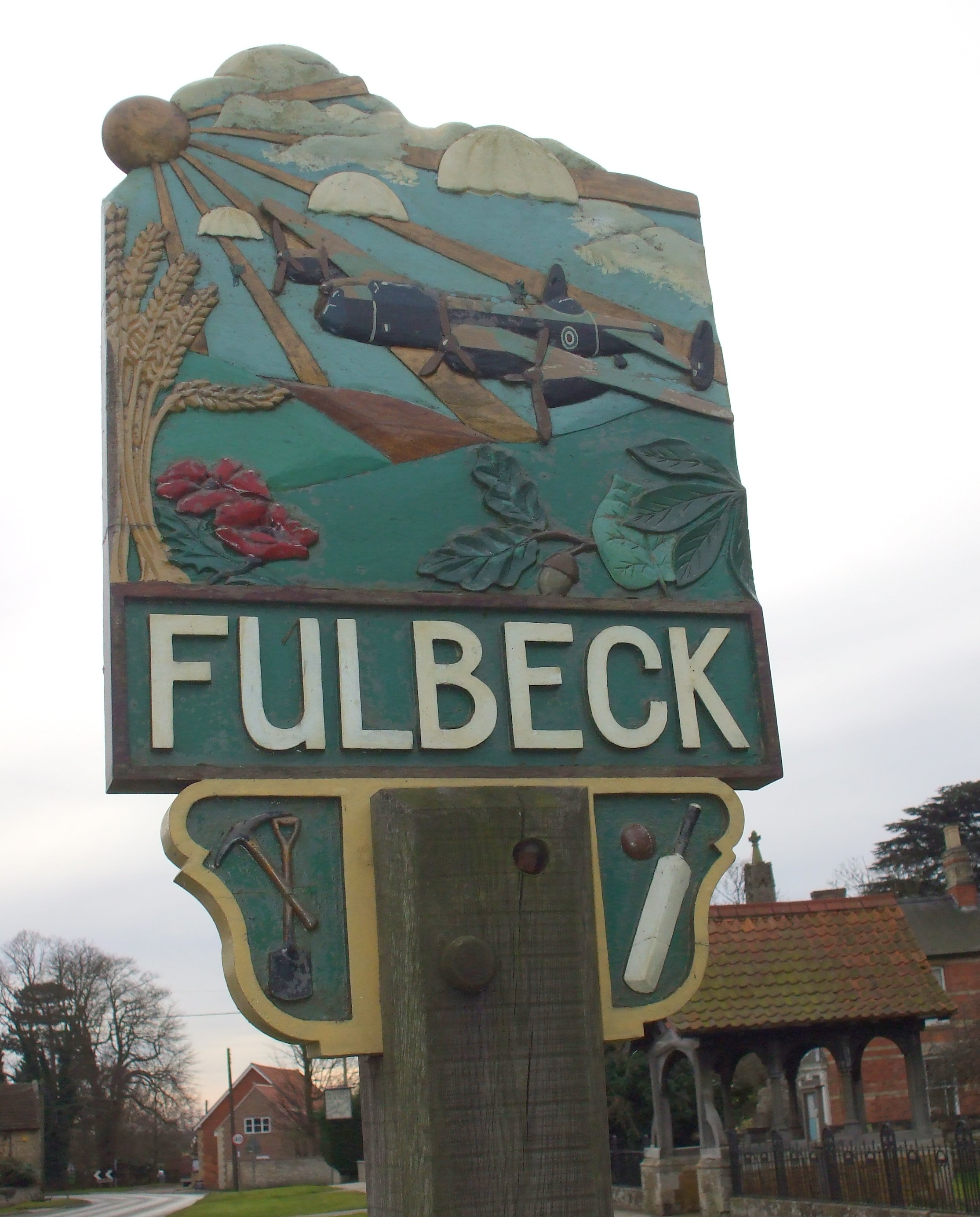
- Tony HIBBERD has a photograph of the Village Sign on Geo-graph, taken in March, 2013.
- Here are two photographs of the village sign, taken in 2008 by Patricia McCRORY (who retains the copyright):
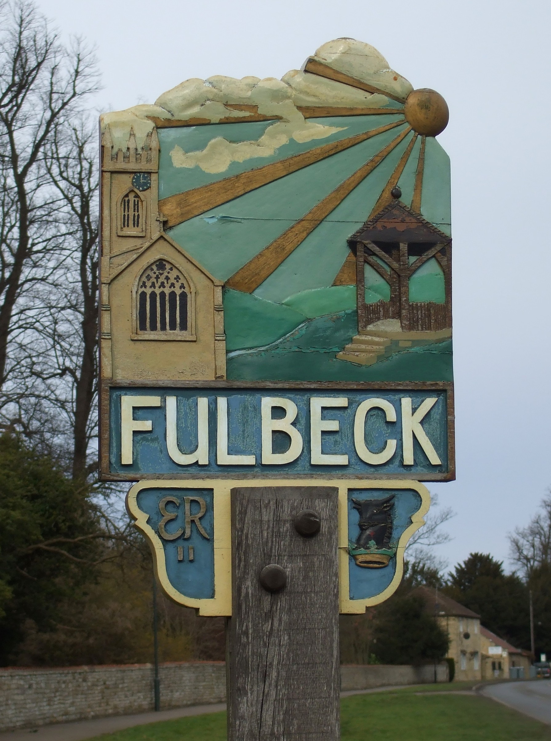
- This is one of the few village signs with a different scene on the reverse side. Here is back of the same sign, taken in 2008 by Patricia McCRORY (who retains the copyright):
The National Gazetteer of Great Britain and Ireland - 1868
- Ask for a calculation of the distance from Fulbeck to another place.
- Duncan PAYLING, Melbourne, Australia, has volunteered to answer questions about his favorite Lincolnshire village, Fulbeck. Contact him via e-mail at: Duncan PAYLING with your questions.
This obituary from The Times, Fri June 1885, was provided by M. E. MAXTED:
Major-General Walter FANE, of the Madras Staff Corps died on Tuesday, at Fulbeck, Lincolnshire, in his 58th year. The youngest son of the late Rev. Edward FANE, Rector of Fulbeck and Prebendary of Lincoln, by his marriage with Maria, daughter of Mr. Walter Parry HODGES, of Dorchester, he was born in 1828, entered the Army in 1845, and obtained a lieutenancy in 1853. He served in the Punjab Irregular Cavalry from 1849 to 1857, and was present in several engagements against the hill tribes on the North-West Frontier. He also took part in the pursuit and final capture of Tantia Topee in Central India, in 1859. The gallant officer was promoted to a captaincy in 1860, became major in 1861, lieutenant colonel in 1869, and colonel in 1875. He raised a regiment of irregular cavalry for service in China, and was present at the taking of the Peiho forts. He also commanded Fane's Horse in the engagement at Sinho, and in the actions of Chinkiawbaw and Pulli-chi-on, and the capture of Pekin. For these services he was nominated a Companion of the Order of the Bath. He was promoted to the rank of Major-General in 1879. General FANE, who was a kinsman of the Earl of Westmoreland, married, in 1879, Agnes, daughter of Sir Henry Bold HOUGHTON.
And check the history of the Wapentake at the Loveden Wapentake website.
The Hare and Hounds Pub on The Green is a 17th century public house and a Grade II building with English Heritage. It is still in operation.
Jonathan THACKER has a photograph of The Hare and Hounds Pub. on Geo-graph, taken in June, 2011.
These are the names associated with the Hare and Hounds in various directories:
| Year | Person |
|---|---|
| 1842 | Wm,LAMB, maltster and vict. |
| 1872 | George William JAMES, farmer, maltster and vict. |
| 1882 | Mrs. Ann JAMES, farmer, maltster and victualler |
| 1900 | Thomas NISBETT |
| 1913 | William Frederick LEVESLEY |
| 1930 | Frederick Richard FARMER |
- The principal landowners in 1871 were Colonel Henry FANE, Neville FANE, Mildmay W. WILSON, W. OSTLER and several smaller owners.
- In 1913, William V. R. FANE, Hugh Mounteney LELY and the Rev. Vere Frances WILLSON were the principal landowners.
- The Hall, a stone mansion, was the seat of the FANE family from the year 1632. It was the seat of Sir Henry FANE, former commander of the British forces in India. It passed to his son, Colonel Henry FANE, on his death.
- See our Maps page for additional resources.
You can see maps centred on OS grid reference SK948504 (Lat/Lon: 53.04209, -0.588026), Fulbeck which are provided by:
- OpenStreetMap
- Google Maps
- StreetMap (Current Ordnance Survey maps)
- Bing (was Multimap)
- Old Maps Online
- National Library of Scotland (Old Ordnance Survey maps)
- Vision of Britain (Click "Historical units & statistics" for administrative areas.)
- English Jurisdictions in 1851 (Unfortunately the LDS have removed the facility to enable us to specify a starting location, you will need to search yourself on their map.)
- Magic (Geographic information) (Click + on map if it doesn't show)
- GeoHack (Links to on-line maps and location specific services.)
- All places within the same township/parish shown on an Openstreetmap map.
- Nearby townships/parishes shown on an Openstreetmap map.
- Nearby places shown on an Openstreetmap map.
See the obituary in the History section, above.
- The RAF opened an airfield here in 1940.
- The field was one of four used by Troop Carrier Squadron 82.
- The field was turned over to the USAAF in April, 1943, also for troop carrier use.
- The field was closed in 1970.
- The control tower was finally demolished in 2006.
- The Fulbeck War Memorial lists the following servicemen from World War One: Provided by Mike Peck
| Surname | Given names | Notes |
|---|---|---|
| GRAVES | Walter R. | |
| OSBOURNE | Leonard | |
| FOOTMAN | Benjamin | |
| WILSON | Frederick | |
| MANSELL | George | Identified as Private 12919 G. Mansell MM of Notts & Derby Regt, died 3 Nov 1918 aged 26 |
| JACKSON | Albert | |
| BAGGLEY | Walter J. | |
| GOULD | Stephen | |
| GILKS | William | |
| BOOLES | Alfred | |
| DENT | William S | |
| BELLAMY | Jimmy | |
| BROWN | Walter | |
| ANDERSON | Sidney | |
| CARFORD | Charles | |
| HUTCHINSON | Edward | Age 31, killed at the battle of Festubert, son of Henry, husband to Emma. |
| COOLING | Albert E | |
| ALLIS | John | |
| HUTCHINSON | Ralph | Age 35, private, 2nd Lincs Regt., son of Henry, died 25 September, 1915 |
| OVERTON | William | |
| PICKER | Harry | |
| ASHTON | Cecil R | |
| ASHTON | Eric J |
- Private George MANSELL, above, 9th (service) Battalion The Sherwood Foresters, (Notts & Derbys Regiment), Son of Edwin Mansell. London Gazette - 9.12.1916 - For bomb throwing and rescuing wounded officer; (Died 3rd November 1918 at home as a result of being gassed). Cemetery: FULBECK (ST. NICHOLAS).
- The Newark Great War Bulletin of October 18th, 1915 tell us that Edward HUTCHINSON, age 31, had been killed in the Battle of Festubert (the date given is clearly wrong). Edward left behind his wife of 8 years, Emma, and his two daughters, Evelyn, 7, and Millicent, 4.
- The name Fulbeck is a combination of the Old English ful and the Old Scandinavian bekkr, for "foul stream". In the 1086 Domesday Book, the village name is given as Fulebec.
["A Dictionary of English Place-Names," A. D. Mills, Oxford University Press, 1991]
Here are the surnames found in White's 1872 Directory of Lincolnshire:
BAILEY, BAINES, BAKER, BROOKS, BROWN, BUGG, BURTT, CAPP, COLE, COLLINGWOOD, CROSBY, DOLBY, EATCH, ELSE, ELLIOTT, EMERSON, FANE. FARMER, HODGKINSON, HEMPHREY, JACKSON, JAMES, JAQUES, JENKINSON, KING, LAMB, LEWARTON, MARRIOTT, MINNITT, MORRIS, MUXLOW, NOEL, NORRIS, PARKER, PASK PORTER, SMITH, TAYLOR, WATSON and WILSON.
- This place was an ancient parish in Lincolnshire and became a modern Civil Parish when those were established.
- At last report (2021) the village Hall was closed for repairs.
- The parish was in the ancient Loveden Wapentake in the South Kesteven division of the county, in the parts of Kesteven.
- You may contact the Fulbeck Parish Council regarding civic or political issues, but the are Not staffed to assist you with family history searches.
- For today's district governance, contact the South Kesteven District Council.
- Bastardy cases would be heard in the Sleaford petty session hearings every Monday.
- The Common Lands, which were on Fulbeck Heath, were enclosed in 1805.
- Frances, The Countess of Rutland, and other donors contributed the revenue from renting 7 acres of land to the poor.
- A Mr. PANN also contributed to the poor of the parish, but the date is unknown (prior to 1871).
- After the 1834 Poor Law Amendment Act reforms, the parish became part of the Newark Poor Law Union in 1837.
- There were two schools built at Fulbeck. The Public Elementary School (date erected not known) was built for 140 children and averaged about 93 each term.
- The school built at Bayard's Leap averaged about 30 each term.
- For more on researching school records, see our Schools Research page.
