Hide
Gedney
hide
Hide
hide
Hide
hide
Hide
Hide
hide
Hide
"GEDNEY, a parish in the wapentake of Elloe, parts of Holland, county Lincoln, 9 miles S.E. of Holbeach, its post town, and 5 W. of Sutton St. Mary's. This is an extensive and scattered parish, including the chapelry of Gedney Hill, and the hamlets of Chapelgate, Church End, Gedney Dike, and Dawsmeer. It was formerly a part of the demesne of Crowland Abbey. Nearly two-thirds of the land is arable, the rest pasture. The soil is a deep loam, in some parts mixed with a fine sand and in others with blue and yellow clays. An Act of Parliament was obtained in 1834 for embanking, draining, and improving the lands." (There is more of this description)
"GEDNEY HILL, (or Gedney-fen), a parochial chapelry in the parish of Gedney in the wapentake of Elloe, parts of Holland, county Lincoln. It is situated near the borders of the county of Cambridge, about 10 miles S. of Holbeach, and 7 E. of Crowland. Wisbeach is its post town. It was separated from the parish of Gedney, and formed into a separate ecclesiastical district in the last century. The land is almost wholly pasture and meadow. The living is a perpetual curacy* in the diocese of Lincoln, value £100. The church is an old edifice, dedicated to the Holy Trinity. The parochial endowments realise about £350 per annum, partly from lands given by one of the abbots of Croyland. This estate is now applied to the support of the free school, the repair of the church, the payment of the stipend of the curate, and other uses, as determined by a decree in Chancery. The Baptists have a chapel. In the neighbourhood Roman coins have been found, chiefly of the reign of Antoninus. A fair is held on the second Monday in June.
[Transcribed from The National Gazetteer of Great Britain and Ireland 1868]
by Colin Hinson ©2020
Hide
- The Gedney Parish Council has information on the cemetery at Dawsmere.
- Julian GUFFOGG has a photograph of St. Mary Magdalene's churchyard on Geo-graph, taken in March, 2019.
- The parish was in the Long Sutton sub-district of the Holbeach Registration District.
- Check our Census Resource page for county-wide resources.
- The table below gives census piece numbers, where known:
Census
YearPiece No. 1841 H.O. 107 / 607 1851 H.O. 107 / 2097 1861 R.G. 9 / 2326 1871 R.G. 10 / 3326 - 3329 1881 R.G. 11 / 3207 1891 R.G. 12 / 2568 1901 R.G. 13 / 3036
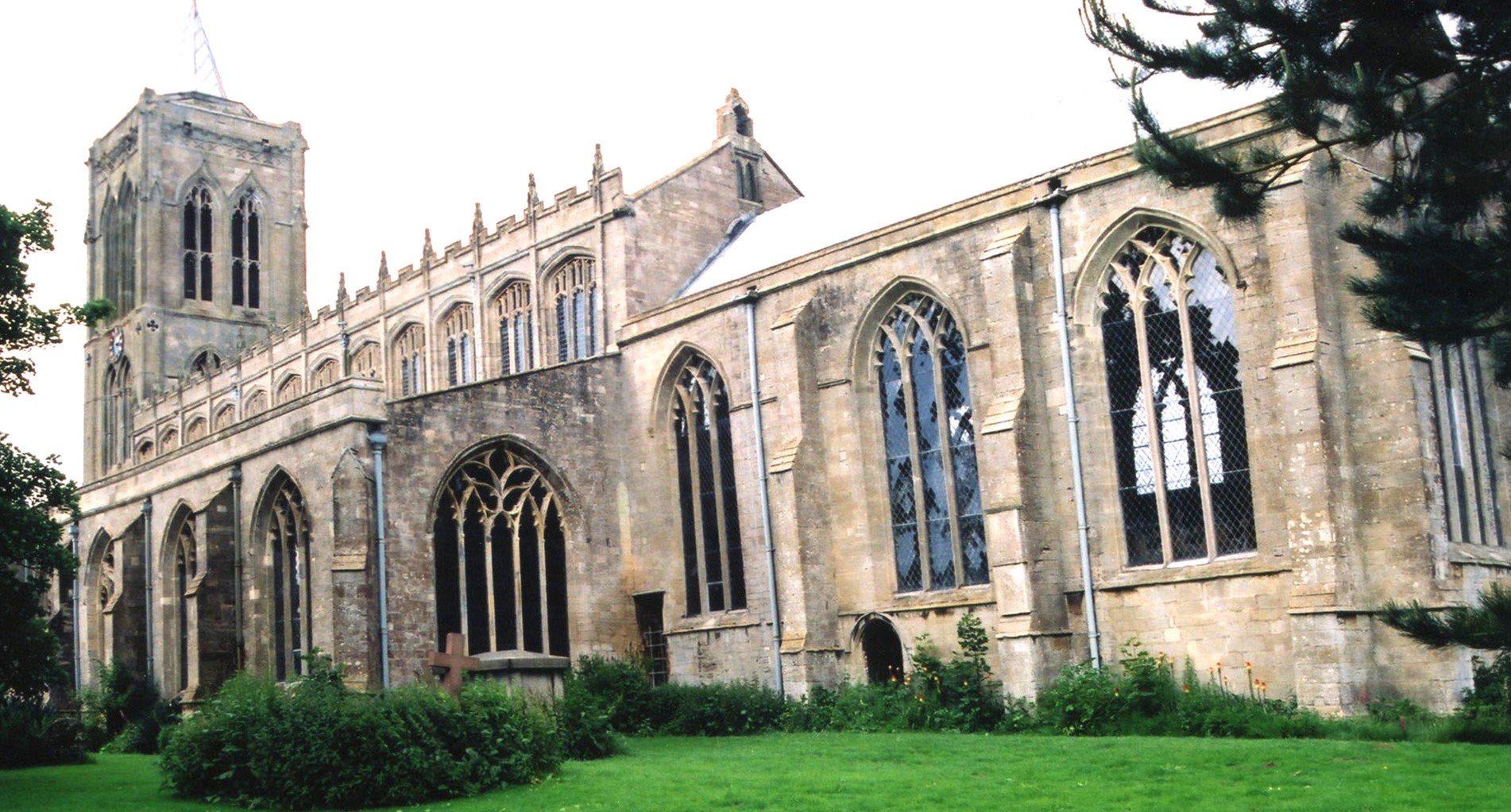
- The Anglican parish church is dedicated to St. Mary Magdalen.
- Some portions of the parish church have been dated back to 1280. Inside is a font with a date of 1664. The pulpit was made and carved around 1700. Some of the tombs and brasses date back to 1400.
- The church was restored in 1896 thru 1898.
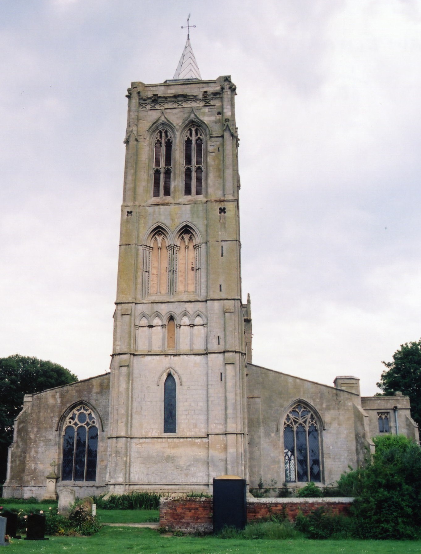
- The church tower is 86 feet in height.
- The church seats 240.
- A photograph of St. Mary Magdalen church is at the Wendy PARKINSON English Church Photographs site.
- Here are two photographs of St. Mary Magdalen Church, taken by Ron COLE (who retains the copyright):


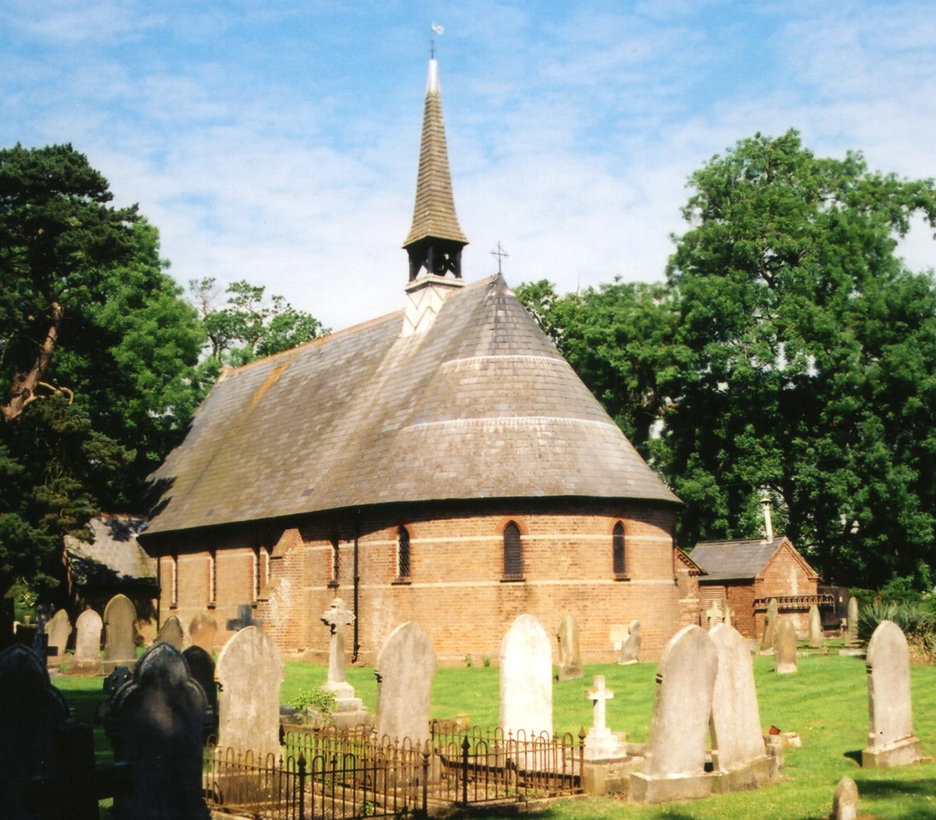
- Gedney Dawsmere has a church, Christ Church, which was erected in 1869.
- Here is a photograph of Christ Church, taken by Ron COLE (who retains the copyright):

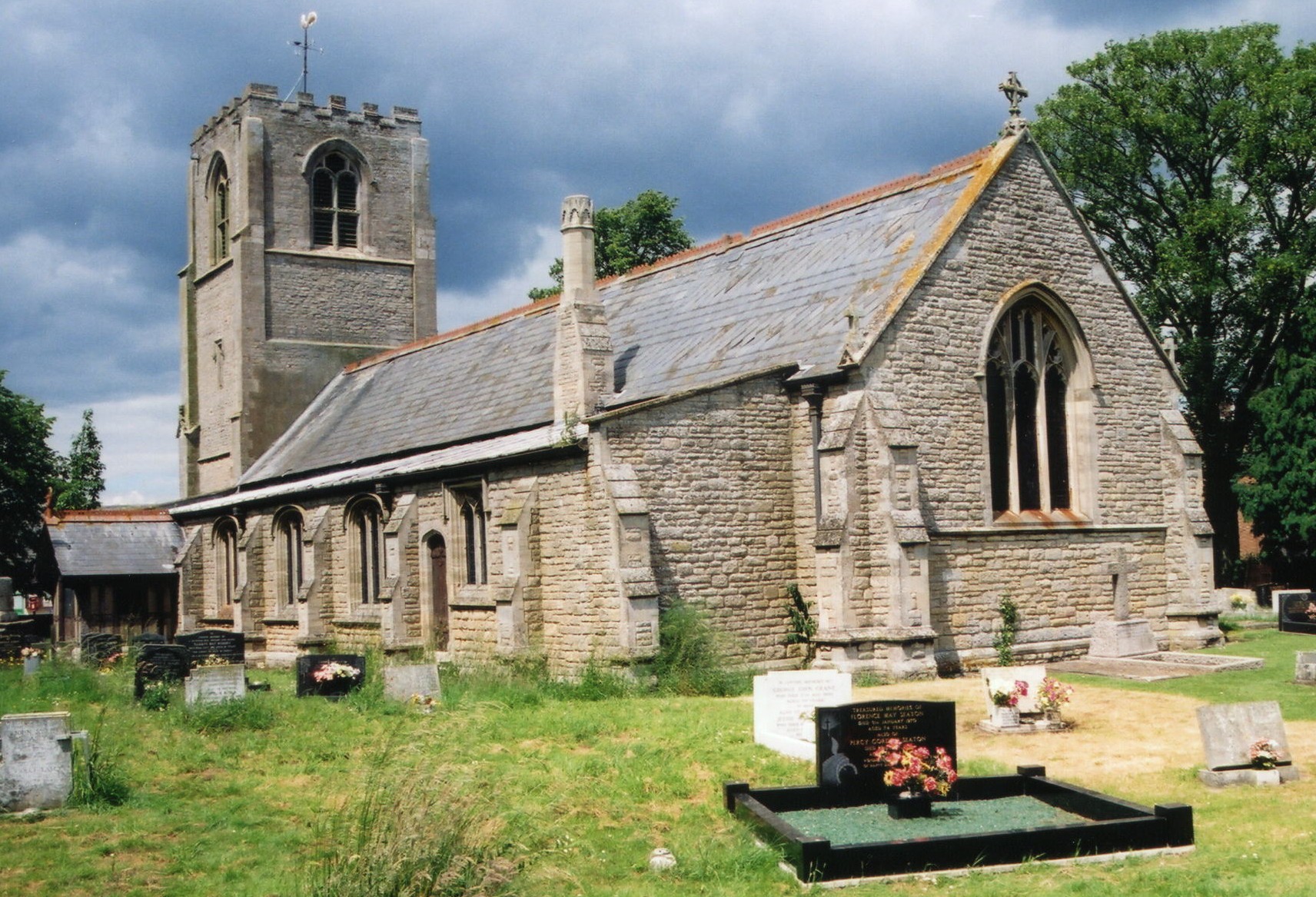
- Originally the parish included the area to the south known as Gedney Hill, but that area became its own parish centuries ago. The church there, Holy Trinity, dates to about 1400, but was rebuilt around 1870.
- Here is a photograph of Holy Trinity Church, taken by Ron COLE (who retains the copyright):

- The Anglican parish church registers exist from 1558.
- We have the beginnings of a Parish Register extract in a text file for your use. Your additions and corrections are welcome.
- The Lincolnshire FHS provides several indexes of the East Elloe Deanery to make your search easier.
- A lot of the parish registers for Gedney have been transcribed onto FreeREG and can be seached onlione. These include: Marriages 1754-1812; Baptisms 1753-1846; and Burials 1754-1921.
- J. THOMAS has a photograph of the Kingdom Hall of Jehovah's Witnesses, Chapelgate at Geo-graph, taken in October, 2015.
- The Weslyean Methodists had a chapel at Gedney and another at Gedney Dyke, and the Baptists one at Gedney Broadgate. For information and assistance in researching these chapels, see our non-conformist religions page.
- Check our Church Records page for county-wide resources.
- The parish was in the was in Long Sutton sub-district of the Holbeach Registration District.
- Check our Civil Registration page for sources and background on Civil Registration which began in July, 1837.
Gedney is both a village and parish about 100 miles north of London, 3 miles east of Holbeach, about nine miles east of Spalding and nine miles north of Wisbech. Holbeach parish and Fleet parish lie to the west. The parish is a long, narrow affair running roughly north and south and originally extended to the border of Cambridgeshire. It includes the hamlets of Gedney Broadgate, Gedney Drove End and Gedney Dyke. The A17 trunk road runs through the parish. The area is marshy, drained by many small canals and the South Holland Main Drain.
Traces of old trenches and embankments hint to ancient fortifications, probably Roman, in the parish. It is a popular area for bicyclists in the warmer months, perhaps due to the flatness of the area. David F. Lane, serious bicyclist, tells us (Spring of 2001):
A full Gedney is what you can claim to have achieved if you have visited the six settlements in the South Holland district of Lincolnshire, with Gedney in their name. These are Gedney Hill, Gedney Broadgate, Gedney, Gedney Dyke, Gedney Drove End and Gedney Dawsmere. You are also required to have visited Gedney Fen in order to claim a full Gedney. You also need to have visited Gedney Marsh but this is synonymous with visiting Gedney Drove End or Gedney Dawsmere and therefore gains no extra credit. Suprisingly few people can claim to have a Full Gedney, even many who live in one of the Gedneys cannot claim it, as it is 13 miles from Gedney Hill to Gedney Dawsmere. Note that you are not required to visit Gedeney Road in Tottenham, London.
Coming into Gedney Dyke there is a large barn being constructed and a large amount of pallets stacked up which are marked AAC. Surveillance cameras are in operation at The Chequers Pub in Gedney Dyke. There is a house in Gedney Dyke called Pooh Corner. On the way out of Gedney Dyke there is a bit of a mound like rise within a field which could almost be described as a hill in Fenland terms. H C Goose and Son have White House Farm between Gedney Dyke and Gedney Drove End. JEPCO (J.E. Piccaver & Co) have a circular mirror opposite their entrance near Gedney Drove End. The General Store in Gedney Drove End is called the Old Wheat Sheaf. The pub opposite the Old Wheat Sheaf Store is called The New Inn.
The Rising Sun in Gedney Drove End offers Real Ales, hot and cold food and children are welcome. The Methodist Chapel in Gedney Drove End is dated 1885. Onslow House retirement home is situated in Gedney Drove End. There's actually six Gedneys as when you get to Gedney Drove End there's a sign saying Gedney Dawsmere 1.5 mile. At Gedney Dawsmere there is a cemetery which is nowhere near full.
Passenger rail service came to Gedney in 1862 and ceased in March, 1959.
The National Gazetteer of Great Britain and Ireland - 1868
"GEDNEY HILL, (or Gedney-fen), a parochial chapelry in the parish of Gedney in the wapentake of Elloe, parts of Holland, county Lincoln. It is situated near the borders of the county of Cambridge, about 10 miles S. of Holbeach, and 7 E. of Crowland. Wisbeach is its post town. It was separated from the parish of Gedney, and formed into a separate ecclesiastical district in the last century. The land is almost wholly pasture and meadow. The living is a perpetual curacy* in the diocese of Lincoln, value £100. The church is an old edifice, dedicated to the Holy Trinity. The parochial endowments realise about £350 per annum, partly from lands given by one of the abbots of Croyland. This estate is now applied to the support of the free school, the repair of the church, the payment of the stipend of the curate, and other uses, as determined by a decree in Chancery. The Baptists have a chapel. In the neighbourhood Roman coins have been found, chiefly of the reign of Antoninus. A fair is held on the second Monday in June.
- Ask for a calculation of the distance from Gedney to another place.
- Much of the parish area once included a large number of salterns for reclaiming salt from seawater.
Three Manors are mentioned in the old directories for Fleet:
- Fleet Dominorum.
- Fleet Fitzwalter.
- Fleet Harrington.
An older Manor, called Blanches or Branches, where Captain J. H. BARKER was lord, was extinct by 1872. Although White's 1872 Directory lists an Edward MILLINGTON, land agent, as the resident at Branches Manor House, so the house itself may have been standing at that time.
Jonathan THACKER has a photograph of the Gedney Manor House on Geo-graph, taken in June, 2020.
- See our Maps page for additional resources.
You can see maps centred on OS grid reference TF404243 (Lat/Lon: 52.798143, 0.081539), Gedney which are provided by:
- OpenStreetMap
- Google Maps
- StreetMap (Current Ordnance Survey maps)
- Bing (was Multimap)
- Old Maps Online
- National Library of Scotland (Old Ordnance Survey maps)
- Vision of Britain (Click "Historical units & statistics" for administrative areas.)
- English Jurisdictions in 1851 (Unfortunately the LDS have removed the facility to enable us to specify a starting location, you will need to search yourself on their map.)
- Magic (Geographic information) (Click + on map if it doesn't show)
- GeoHack (Links to on-line maps and location specific services.)
- All places within the same township/parish shown on an Openstreetmap map.
- Nearby townships/parishes shown on an Openstreetmap map.
- Nearby places shown on an Openstreetmap map.
Inside the churchyard at Dawsmere is a tall, slim monument. To see it and the names on it, see the Roll of Honour site.
There is also this list from Gedney Dyke.
- The name Gedney is from the Old English gaeda+eg, or "island of Gaeda".
[A. D. Mills, "A Dictionary of English Place-Names," Oxford University Press, 1991]
- The parish was in the ancient Elloe Wapentake in the South Holland district in the parts of Holland.
- In August, 1882, Gedney was enlarged by gaining the "Gedney Marsh" portion of Gedney Hill Civil Parish.
- In April, 1932, Gedney swapped a 4 acre parcel with Lutton Civil Parish for a 10 acre parcel in that parish.
- You may contact the Gedney Parish Council regarding civic or political issues. They are NOT staffed to assist you with family history questions.
- For today's district governance, visit the South Holland District Council site.
- Bastardy cases would be heard in the Elloe (Spalding) petty session hearings.
- The WELBY family left land and houses for the relief of the poor, as did the reverend FISH. The proceeds were distributed yearly on St. Thomas's day (December 21st) and Good Friday.
- After the 1834 Poor Law Amendment Act reforms, the parish became part of the Holbeach Poor Law Union.
- Anne COLE tells us there are no Poorlaw records in the Lincolnshire Archives for Gedney July 2011.
Year Inhabitants 1801 1,042 1831 1,491 1851 1,982 1871 2,017 1891 1,862 1901 1,668 1911 1,834 1921 1,985 1931 2,189
- A school was built here in 1864 to hold 150 children.
- A school was built in Dyke in 1875 to hold 40 children. It was enlarged in 1896 to hold 60 children.
- For more on researching school records, see our Schools Research page.
