Hide
Great Gonerby
hide
Hide
hide
Hide
hide
Hide
Hide
"GONERBY MAGNA, a parish in the soke of Grantham, parts of Kesteven, county Lincoln, 2 miles N.W. of Grantham, its post town, and 12 S.E. of Newark. The village, which is large, is situated on the main road between the above towns. The Great Northern railway passes in the vicinity, the nearest station being at Grantham. The hamlet of Middle Gonerby is in the S. of the parish. The living is a vicarage* in the diocese of Lincoln, value £100, in the patronage of the Vicar of Grantham. The church is a fine structure with embattled tower, surmounted by a crocketed spire. It is dedicated to St. Sebastian, and has a handsome monument to one Robert Tyling, bearing date 1500. The charities consist of £12 school endowment and £10 for the poor. The Wesleyans, Independents, and Primitive Methodists, have each a chapel, and there is a National school. Earl Brownlow is lord of the manor."
[Transcribed from The National Gazetteer of Great Britain and Ireland 1868]
by Colin Hinson ©2020
Hide
The Library at Grantham will prove useful in your research.
Timothy HEATON has a photograph of the Hill Top Cemetery on Geo-graph, taken on a cold and wet December, 2017.
- The parish was in the Grantham sub-district of the Grantham Registration District.
- An 1890 re-organization placed the parish was in the "Grantham North" sub-district of the Grantham Registration District.
- Check our Census Resource page for county-wide resources.
- The table below gives census piece numbers, where known:
| Census Year | Piece No. |
|---|---|
| 1841 | H.O. 107 / 618 |
| 1851 | H.O. 107 / 2103 |
| 1861 | R.G. 9 / 2353 |
| 1871 | R.G. 10 / 3362 & 3363 |
| 1891 | R.G. 12 / 2585 |
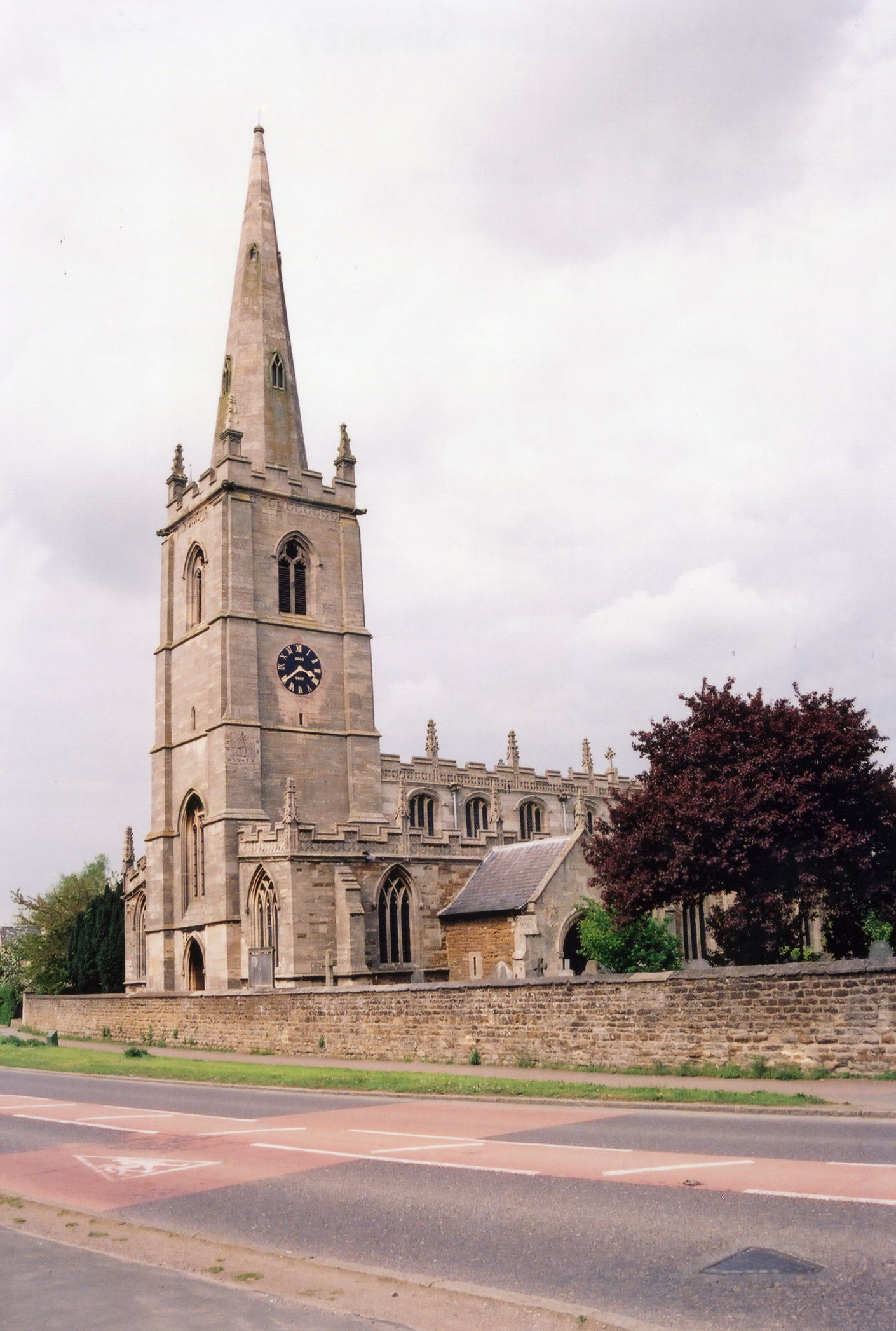
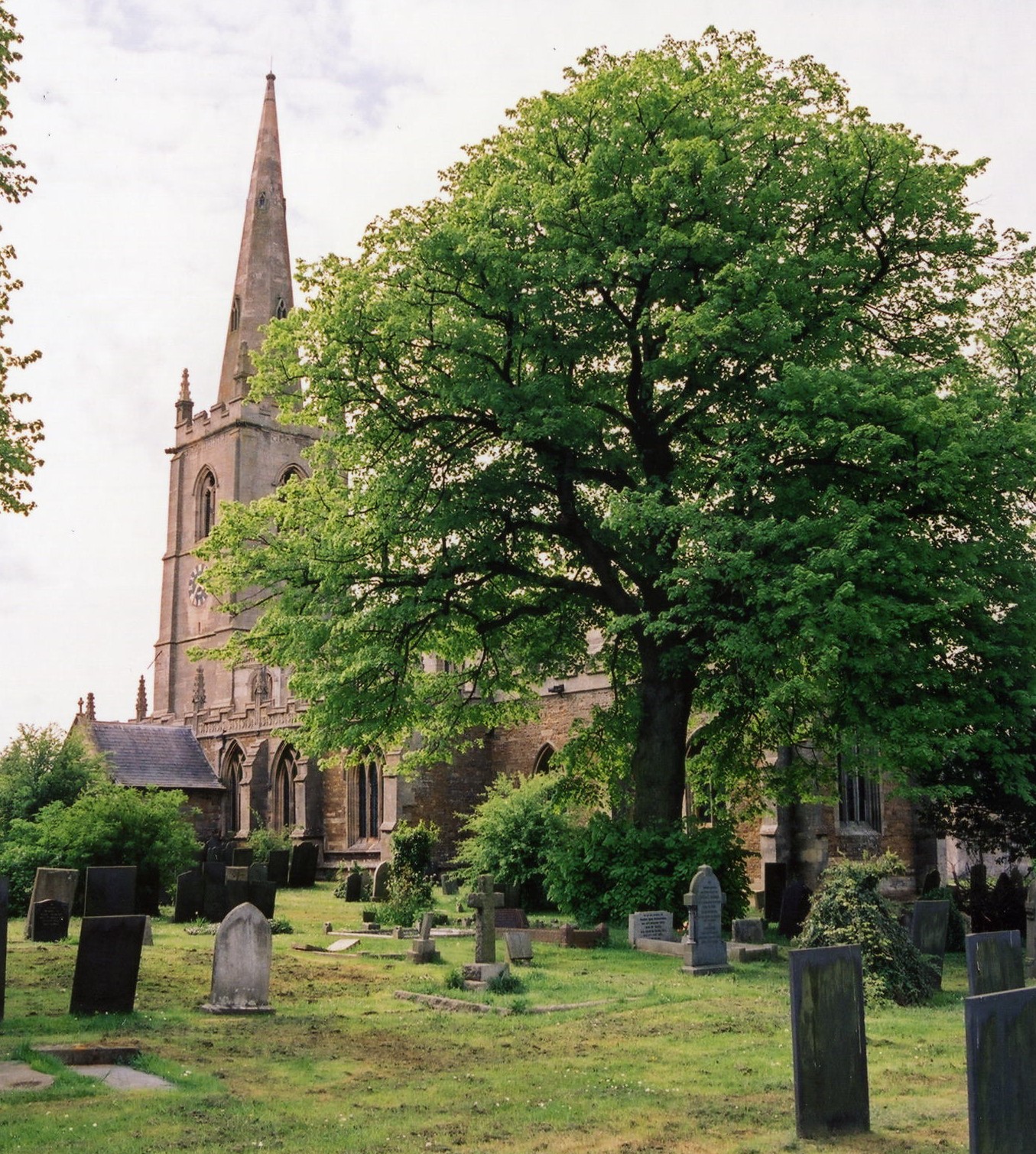
- The Anglican parish church is dedicated to Saint Sebastian and sits on a steep hill overlooking the village.
- The church was contructed circa 1200.
- The church was renovated in 1874 - 75.
- A new organ was added in 1890.
- The church is a Grade I listed structure with British Heritage.
- The church seats 155 (Thank you, Judith Jones, 2015).
- A photograph of St. Sebastian's can be found at the Wendy PARKINSON Church Photograph site.
- Anthony VOSPER has a photograph of St. Sebastian's Church on Geo-graph, taken in October, 2011.
- Here are two photographs of St. Sebastian's Church, taken by Ron COLE (who retains the copyright):


- A Church of England Mission Room was established in Gonerby Hill Foot.
- Parish registers exist from 1560.
- Parish marriages from 1651-1750 are covered in Boyd's Marriage Index, and from 1790-1837 in Pallot's Marriage Index.
- Parish registers are on file at the Society of Genealogists, covering 1560 - 1837.
- If searching the I.G.I., you can use the batch numbers C028692 and M028692.
- The LFHS has published several marriage and burial indexes for the Grantham Deanery to make your search easier. In the early 1900's, the parish was in the North Grantham Deanery. It is now back in the Grantham Deanery as part of the Barrowby and Great Gonerby group.
- John Wesley, the founder of Methodism, regularly preached in a Chapel in Gonerby which is now the Post Office. The village became a Methodist stronghold resulting in a Gonerby group introducing Methodism to Grantham and Lincoln. The Wesleyan Methodists and Primitive Methodists both had small chapels here, as for a while did the Independents (all built prior to 1841). Check our Non-Conformist Church Records page for additional resources.
- Anthony VOSPER has a photograph of the Primitive Methodist Church on Geo-graph, taken in October, 2009.
- Check our Church Records page for county-wide resources.
- The parish was in the Grantham sub-district of the Grantham Registration District.
- An 1890 re-organization placed the parish was in the "Grantham North" sub-district of the Grantham Registration District.
- Check our Civil Registration page for sources and background on Civil Registration which began in July, 1837.
Great Gonerby is both a village and a parish. The parish is about 108 miles north of London and only about 2 miles north-west of Grantham on the old Newark road. The parish itself is bounded on the north by Marston parish, to the south-west by Barrowby, and on the south-east by Grantham. The parish covers about 2,940 acres.
The village of Great Gonerby lies astride the Newark Road about two miles outside of Grantham. "Little Gonerby" is now a portion of Grantham and is outside this parish's boundaries. "Middle Gonerby" is also known as "Gonerby Hill Foot" is a small hamlet in this parish that sits along the border with Grantham parish.
Gonerby "born and bred" are ofttimes refered to locally as "Clockpelters". Stories tell of villagers pelting the clock in the church tower, installed in 1897, with stones or snowballs. Mud and stones would be gathered from a nearby pond, now dried up, to pelt the clock. Perhaps this was a rite of passage or a hope to suspend time for some reason. If you are planning a visit:
- Take the old Newark Road northwest out of Grantham for about two miles.
- Take some time to walk the Lincolnshire Heritage village trail.
- Visit our touring page for more sources.
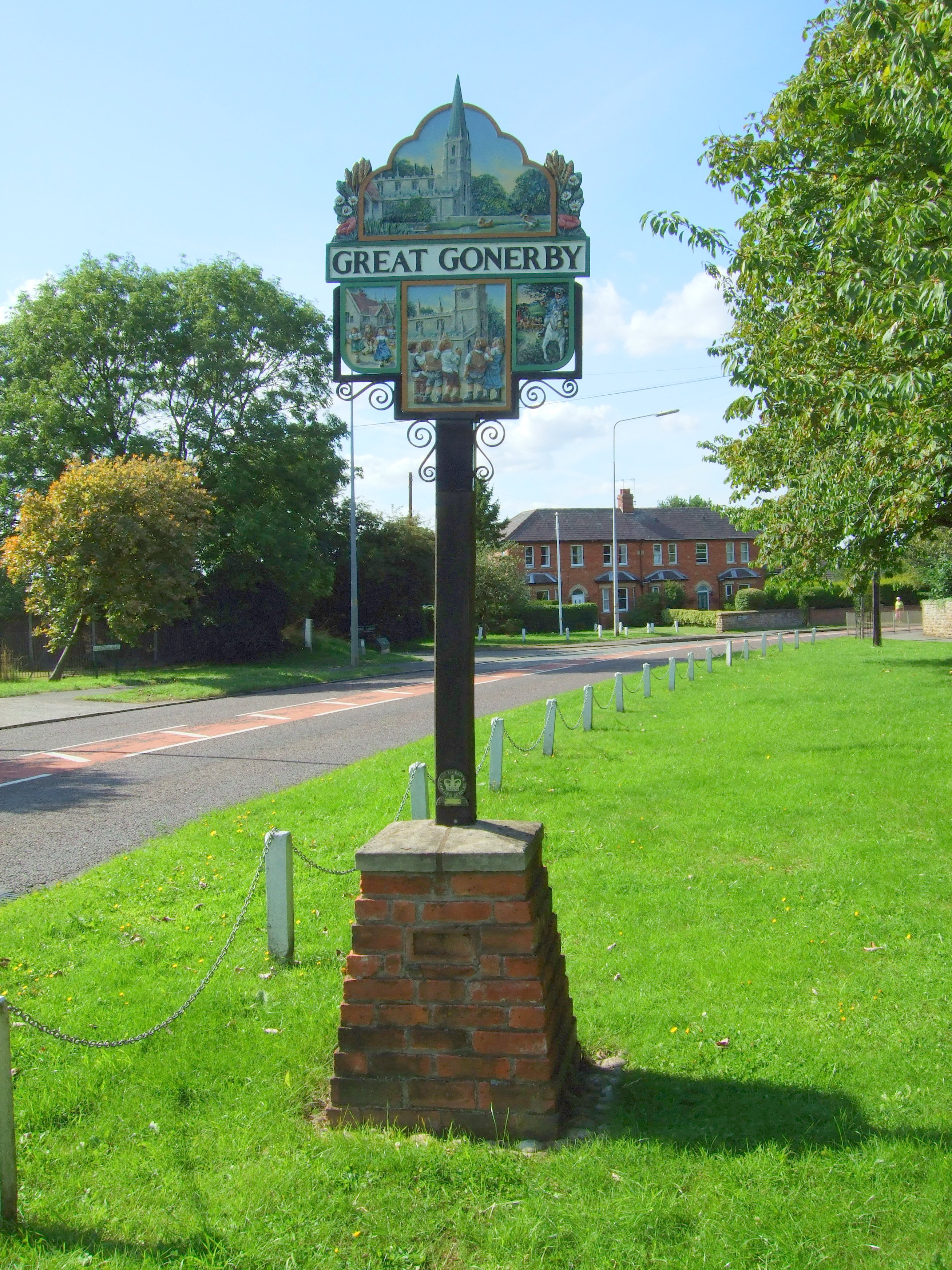
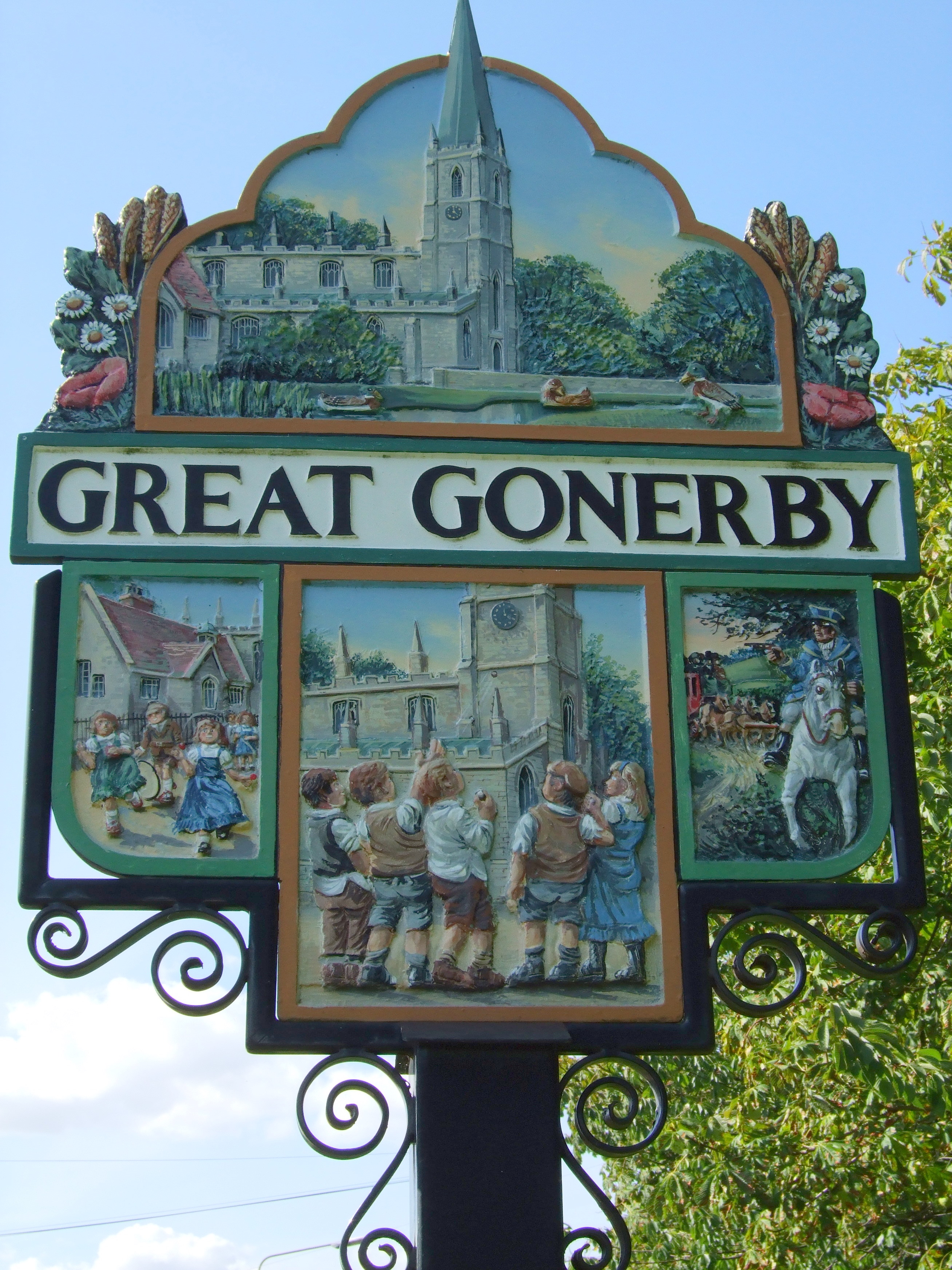
- Brian GREEN has a photograph of the Village Sign on Geo-graph, taken in November, 2006.
- Watch for this village sign as you enter the parish, taken by Patricia McCRORY (who retains the copyright):


The National Gazetteer of Great Britain and Ireland - 1868
- Ask for a calculation of the distance from Great Gonerby to another place.
- There is evidence of a Roman encampment to the North as well as a recently excavated Saxon settlement to the East of the present village.
- Oliver CROMWELL lodged in a house in Pond Street and planned his campaign against Grantham from there.
- The Great North Road ran through the village, situated between the steep Gonerby hill to the south and Newark hill to the North. The hills were mentioned in Sir Walter Scott's "Heart of Midlothian". The resulting slow stage coach traffic (passage was impossible in bad weather) proved irresistible to highwaymen. Their deeds were so numerous that Great Gonerby had its own court and gallows, and in a Newark inn was displayed a notice warning would-be travellers to remain until the next day if they could not "traverse the Gonerby hills by nightfall."
- Check the history of the Wapentake at the Loveden Wapentake website.
- J. THOMAS has a photograph of the Recruiting Sergeant Pub on Geo-graph, taken in May, 2012.
- In 1841, Earl BROWNLOW is lord of the manor and owner of about half the soil, followed by The Earl of Dysart and the TREADGOLD, EMINSON, GREEN and other families.
- In 1871, Earl BROWNLOW is lord of the manor and owner of about half the soil, followed by The Earl of Dysart and Robert KELHAM, and the EMINSON, TREADGOLD and other families.
- In 1913, Col. Earl BROWNLOW, PC, lord of the manor, was the principal landowner, followed by The Earl Dysart and Hebert V. L. KELHAM of Tangley Croft, Epsom, SURREY.
- See our Maps page for additional resources.
You can see maps centred on OS grid reference SK897392 (Lat/Lon: 52.942704, -0.666616), Great Gonerby which are provided by:
- OpenStreetMap
- Google Maps
- StreetMap (Current Ordnance Survey maps)
- Bing (was Multimap)
- Old Maps Online
- National Library of Scotland (Old Ordnance Survey maps)
- Vision of Britain (Click "Historical units & statistics" for administrative areas.)
- English Jurisdictions in 1851 (Unfortunately the LDS have removed the facility to enable us to specify a starting location, you will need to search yourself on their map.)
- Magic (Geographic information) (Click + on map if it doesn't show)
- GeoHack (Links to on-line maps and location specific services.)
- All places within the same township/parish shown on an Openstreetmap map.
- Nearby townships/parishes shown on an Openstreetmap map.
- Nearby places shown on an Openstreetmap map.
- The War Memorial stands in St. Sebastian's churchyard. It was erected in 1919 by public subscription.
- Additional names were added to the War Memorial after World War II.
- The War Memorial is a Grade II structure with British Heritage.
- In 1919, Lt.-Col. Algernon Fox Eric SMITH resided in Gonerby House. Some of his survey drawings are at the National Army Museum.
There are several war memorials at Great Gonerby. To see them and the names on them, see the Roll of Honour site.
- The name of Gonerby implies that the village was established by the Vikings circa 900 AD. Gunvar was a Viking tribal chief who had a settlement here.
- The name derives from the Old Scandinavian Gunnfrothr+by, meaning "farmstead or village of Gunnfrothr". It appears as Gunfordebi in the 1086 Domesday Book and has also appeared as Gunwarby.
A. D. Mills, "A Dictionary of English Place-Names," Oxford University Press, 1991.
- Locals pronounce the name as "Gunerby".
- For these Great Gonerby families, use e-mail to contact Ian WRIGHT in the UK: COOK (1891 onwards), SNEESBY (1900 onwards) and RAISBURY (1900 onwards).
- Taken from the Lincoln, Rutland and Stamford Mercury of 16 December 1842:
On Saturday last an inquest was held at Belton [Kesteven] by Mr. Kewney, coroner, on the body of Wm. BURROWS, of Great Gonerby, labourer, aged 35. The deceased was on Friday last employed with several others in Belton Park, in cutting the top boughs of a lime-tree, which had fallen across a walnut-tree, and could not be removed without having the tops taken off: he refused to use a patent ladder which had been provided for the purpose, and although repeatedly cautioned persisted in standing with one foot upon each tree: having separated a bough of the tree that was felled, it set at liberty a branch of the standing tree, which flew up, and striking the deceased, sent him to the ground, by which he received so much injury that he soon afterwards died. Verdict, accidental death.
- This place was an ancient parish in Lincoln county and became a modern Civil Parish when those were established.
- The parish was in the ancient Loveden Wapentake in the South Kesteven district in the parts of Kesteven.
- The parish is also within the eclessiastical boundaries of the Soke of Grantham.
- You can contact the local Great Gonerby Parish Council regarding civic or political issues. They are NOT staffed to assist you with family history questions.
- For today's district governance, contact the South Kesteven District Council.
- Bastardy cases would be heard in the Spittlegate (Grantham) petty session hearings.
- The parish enclosed the Common Lands in 1804.
- In 1817, Ann ROBERTS left a principal of £120, 6 shilling and 5 pence (which later grew to £165, 6 shilling and 5 pence). Of the annual interest, £1 was given to the school and the remainder distributed to the poor widows on the condition that they attend church.
- The parish set aside a little over three acres to generate revenue for the poor. In 1900, this allowed £6 and 8 shillings to be distributed.
- As a result of the 1834 Poor Law Amendment Act, the parish became part of the Grantham Poor Law Union.
Year Inhabitants 1801 559 1831 916 1841 1,049 1851 1,433 1861 1,145 1871 1,212 1891 1,053 1911 1,296 1991 1,630
- In 1808, Robert KELHAM left a principal of £333, 6 shillings and 8 pence. The annual interest was given to the school.
- A Public Elementary School was built in 1841 and enlarged in 1872 and again in 1896. It was attended by 166 students in 1913.
- Jonathan THACKER has a photograph of the above Primary School on Geo-graph, taken in November, 2019.
- A Public Elementary School was built at Gonerby Hill Foot in 1908 and was attended by 80 students in 1913.
- There are currently two schools in the parish: St. Sebastian's Church of England (Aided), the 1841 church, and Gonerby Hill Foot Church of England (Controlled), the 1908 church..
- For more on researching school records, see our Schools Research page.
