
Hide
Greetham
hide
Hide
hide
Hide
hide
Hide
Hide
hide
Hide
Hide
- The parish was in the Tetford sub-district of the Horncastle Registration District.
- Check our Census Resource page for county-wide resources.
- The table below gives census piece numbers, where known:
| Census Year | Piece No. |
|---|---|
| 1861 | R.G. 9 / 2369 |
| 1871 | R.G. 10 / 3383 |
| 1891 | R.G. 12 / 2599 |
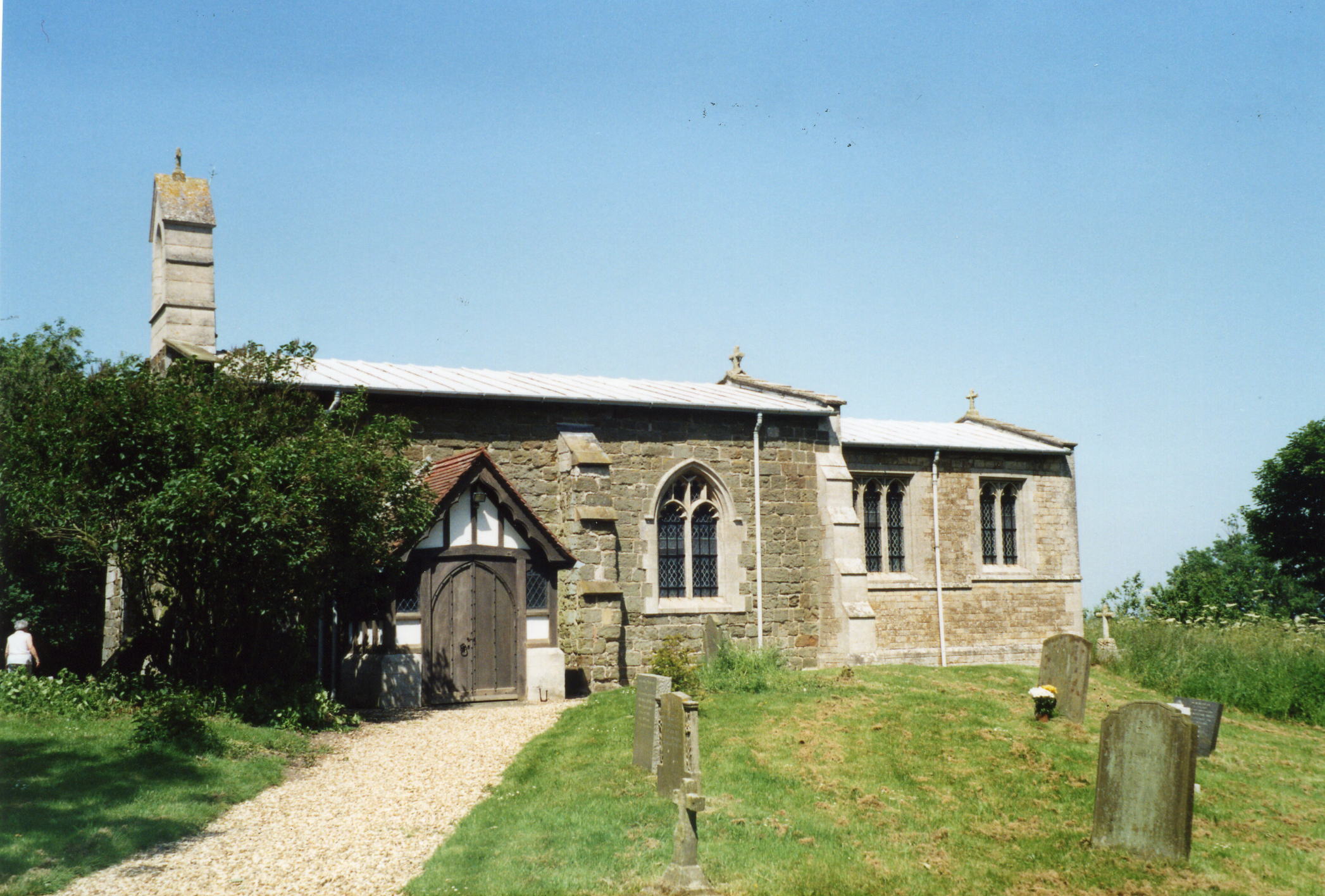
- The Anglican parish church is dedicated to All Saints.
- The church is very tiny, having seating for only 88.
- The belfry was restored in 1863.
- There is a photo of the church on Geograph.
- Here is a photo of All Saints Church, taken by Ron COLE (who retains the copyrights).
- The Anglican parish register dates from 1653.
- The LFHS has published several marriage and burial indexes for the Horncastle Deanery to make your search easier.
- Kelly's 1913 Directory of Lincolnshire places the parish in the rural deanery of Hill No. 1.
- Check our Church Records page for county-wide resources.
- The parish was in the Tetford sub-district of the Horncastle Registration District.
- Check our Civil Registration page for sources and background on Civil Registration which began in July, 1837.
Greetham is both a village and a parish in the Wold hills, 3.5 miles east of Horncastle and 7 miles north-west of Spilsby. Fulletby parish lies to the north and High Toynton parish to the west. The parish covers about 1,180 acres.
Greetham village sits on a hill overlooking Horncastle. It is one of the highest points in the county and commands extensive views of the countryside and parts of the North Sea. If you are planning a visit:
- Visit our touring page for more sources.
- Ask for a calculation of the distance from Greetham to another place.
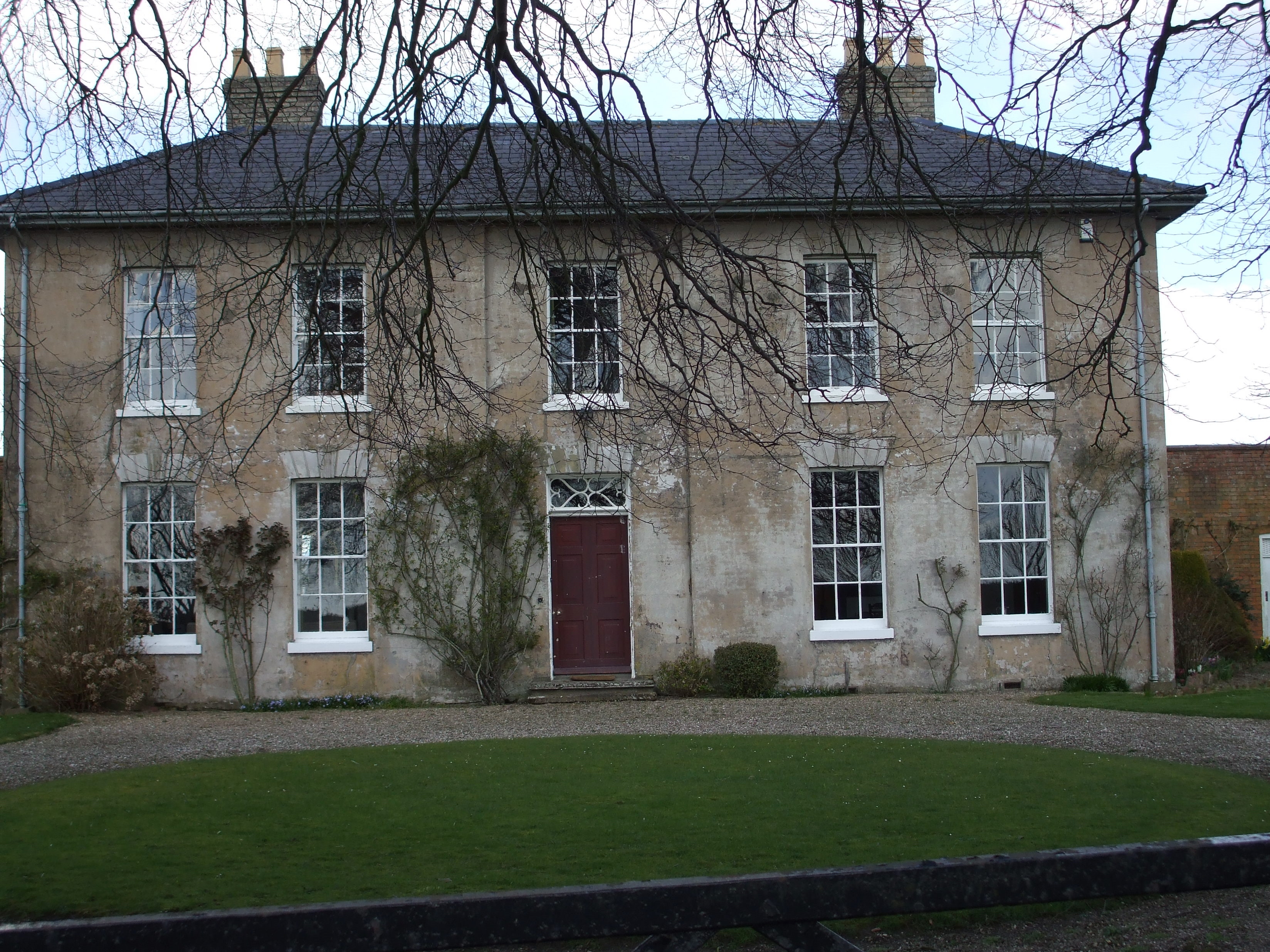
- In 1842, Greetham House was the property of Robert DENNIS, who had built it in 1832.
- In 1872, Greetham House was the residence of "The Misses DENNIS".
- Patricia McCRORY has a photograph of what she believes is Greetham Manor House, taken in 2008. She retains the copyright, but would like someone to veriofy that she is correct:
- See our Maps page for additional resources.
You can see maps centred on OS grid reference TF309705 (Lat/Lon: 53.215696, -0.041628), Greetham which are provided by:
- OpenStreetMap
- Google Maps
- StreetMap (Current Ordnance Survey maps)
- Bing (was Multimap)
- Old Maps Online
- National Library of Scotland (Old Ordnance Survey maps)
- Vision of Britain (Click "Historical units & statistics" for administrative areas.)
- English Jurisdictions in 1851 (Unfortunately the LDS have removed the facility to enable us to specify a starting location, you will need to search yourself on their map.)
- Magic (Geographic information) (Click + on map if it doesn't show)
- GeoHack (Links to on-line maps and location specific services.)
- All places within the same township/parish shown on an Openstreetmap map.
- Nearby townships/parishes shown on an Openstreetmap map.
- Nearby places shown on an Openstreetmap map.
- The parish has given its name to an inshore minsweeper. See the Dive Malta site for more information.
- The War Memorial plaques in All Saints Church were photographed by William Browning and are at Geo-graph.
- This place was an ancient parish in Lincoln county and became a modern Civil Parish when those were established.
- The parish was in the ancient Hill Wapentake (Hill Hundred) in the East Lindsey district and parts of Lindsey.
- Kelly's 1913 Directory of Lincolnshire places the parish, perhaps erroneously, in the South Lindsey division of the county.
- For today's district governance, see the East Lindsey District Council.
- Bastardy cases would be heard in the Horncastle petty session hearings every Saturday.
- The poor had income from Cross Closes, property left by Elizabeth SOMERSBY in 1733.
- The common fields were enclosed here in 1794.
- As a result of the 1834 Poor Law Amendment Act, the parish became part of the Horncastle Poor Law Union.
- Richard CROFT provides a photograph of The Terraces on Geo-graph, taken in 2007. These former almshouses are now Grade II structures with British Heritage.
- A day school was built here in 1870 by the Misses DENNIS and was attended then by 40 children.
- For more on researching school records, see our Schools Research page.