Hide
Hagworthingham
hide
Hide
hide
Hide
hide
Hide
Hide
hide
Hide
"HAGWORTHINGHAM, a parish in the hundred of Hill, parts of Lindsey, county Lincoln, 6 miles E. of Horncastle, and 4 N.W. of Spilsby, its post town. It is situated on the river Steeping. The land is chiefly arable. The tithes were commuted for corn-rents under an Enclosure Act in 1795. The living is a rectory* in the diocese of Lincoln, value £395, in the patronage of the bishop. The church, dedicated to the Holy Trinity, is an ancient edifice with a tower containing eight bells. Portions of the church have been rebuilt, and on the S. side is a handsome stained-glass window. The register dates from 1562. The parochial charities produce £45 per annum, chiefly the endowment of Whalley's free school. There are places of worship for Primitive and Wesleyan Methodists. Earl Manvers is lord of the manor."
[Transcribed from The National Gazetteer of Great Britain and Ireland 1868]
by Colin Hinson ©2020
Hide
- The parish was in the Tetford sub-district of the Horncastle Registration District.
- The North Lincolnshire Library holds a copy of the parish census returns for 1841 and 1881.
- We have a handful of 1901 census surnames in a text file. Your additions are welcome.
- Check our Census Resource page for county-wide resources.
- The table below gives census piece numbers, where known:
| Census Year | Piece No. |
|---|---|
| 1841 | H.O. 107 / 636 |
| 1851 | H.O. 107 / 2108 |
| 1861 | R.G. 9 / 2369 |
| 1871 | R.G. 10 / 3383 |
| 1881 | R.G. 11 / 3250 |
| 1901 | R.G. 13 / 3071 |
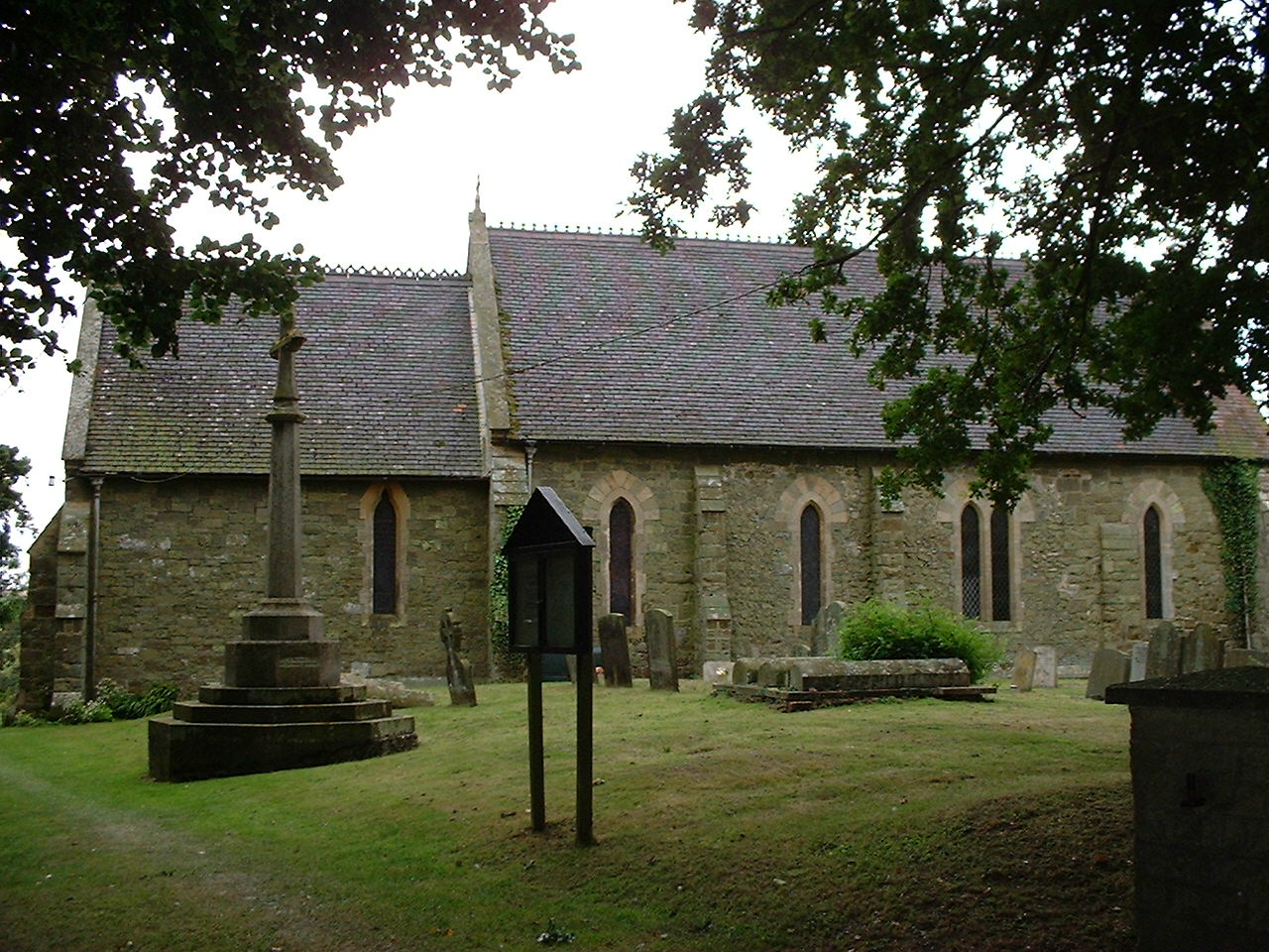
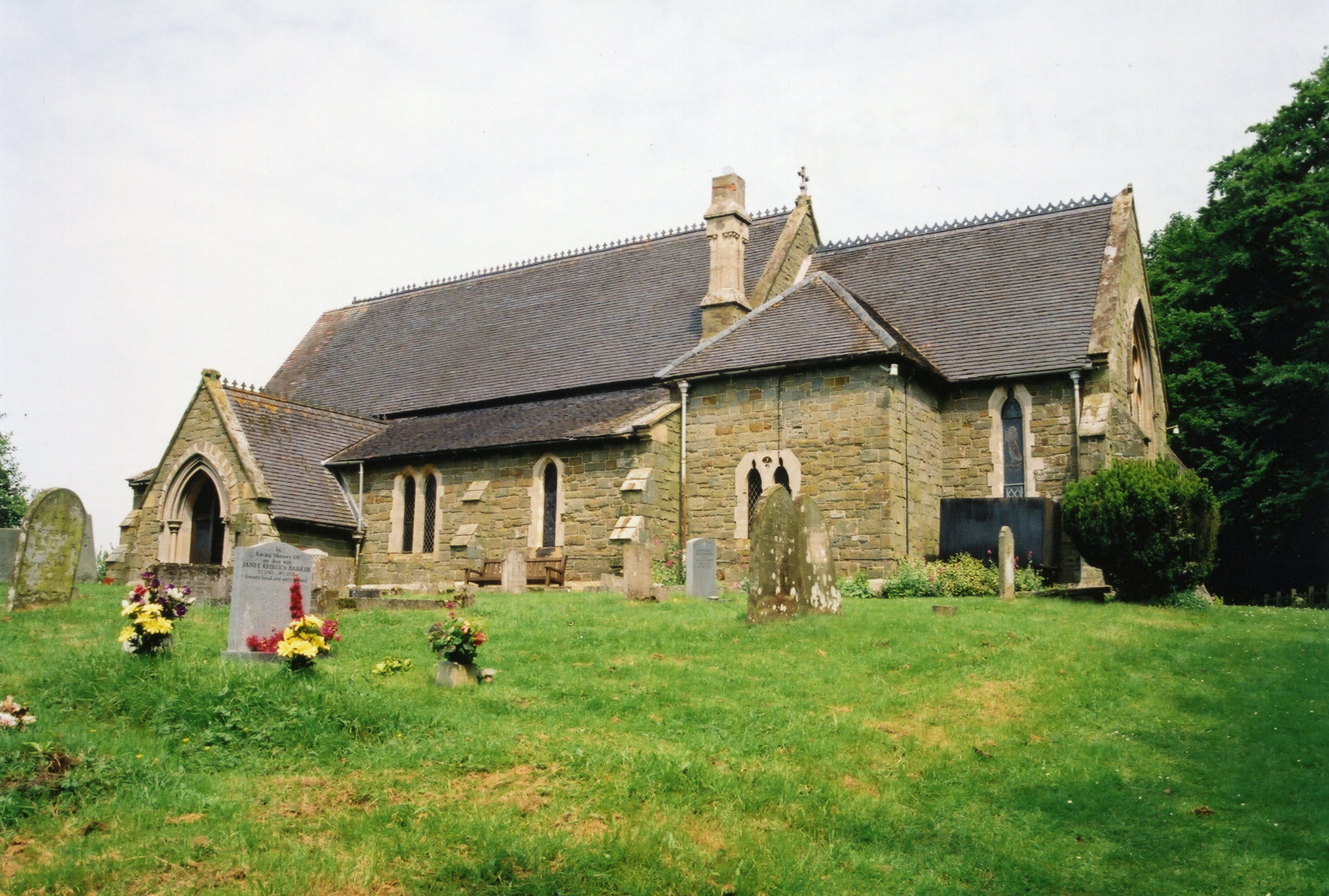
- The Anglican parish church is dedicated to the Holy Trinity.
- The Church of Holy Trinity is an ancient building with a low tower.
- The church was restored in 1859.
- Here is view of the church interior taken by Dave HITCHBORNE.
- Here is a photo of the church, taken by (and copyright of) Norma CLARE.

- Here is another photo of Holy Trinity church, taken by Ron COLE (who retains the copyright):

- The Anglican parish register dates from 1562.
- The Anglican parish register for baptisms, 1700-1861, Marriages 1700-1837 and burials 1700-1907 are on the FreeREG site.
- The LFHS has published several marriage and burial indexes for the Bolingbroke Deanery to make your search easier.
- The Wesleyan and Primitive Methodists each had a chapel in the village. For information and assistance in researching these chapels, see our non-conformist religions page.
- Check our Church Records page for county-wide resources.
- The parish was in the Tetford sub-district of the Horncastle Registration District.
- Check our Civil Registration page for sources and background on Civil Registration which started in July, 1837.
Six miles east of Horncastle and 5 miles north-west of Spilsby, Hagworthingham is a large village and parish in the Wold hills. Bag Enderby parish is to the north and Lusby parish to the south. The parish covers just over 2,400 acres.
The village is on the south side of the A158 between Horncastle and Skegness. If you are planning a visit:
- Watch for the SIGN!.
- The grassland area known as Furze Hill (TF 3569) is a nature preserve.
- Stop and relax at the Stockwith Mill Tearooms & Craft Shop on Harrington Road.
- See our touring page for visitor services.
The National Gazetteer of Great Britain and Ireland - 1868
"HAGWORTHINGHAM, a parish in the hundred of Hill, parts of Lindsey, county Lincoln, 6 miles E. of Horncastle, and 4 N.W. of Spilsby, its post town. It is situated on the river Steeping. The land is chiefly arable. The tithes were commuted for corn-rents under an Enclosure Act in 1795. The living is a rectory* in the diocese of Lincoln, value £395, in the patronage of the bishop. The church, dedicated to the Holy Trinity, is an ancient edifice with a tower containing eight bells. Portions of the church have been rebuilt, and on the S. side is a handsome stained-glass window. The register dates from 1562. The parochial charities produce £45 per annum, chiefly the endowment of Whalley's free school. There are places of worship for Primitive and Wesleyan Methodists. Earl Manvers is lord of the manor."
- Ask for a calculation of the distance from Hagworthingham to another place.
- The George and Dragon Public House provided a place to catch up on local news. There is a photograph of the Inn at Geo-graph, taken by Peter CHURCH.
- Individuals' names associated with the Inn in various directories are:
| Year | Person |
|---|---|
| 1868 | Alfred MARCHAM |
| 1872 | John FLETCHER, vict. |
| 1882 | Absalom Hanson CAUNT, horse breaker |
| 1900 | Mrs. Mary A. SKEPPER |
| 1913 | Mrs. Annie FARROW |
| 1919 | Charles George LAMMIMAN |
| 1930 | Charles George LAMMIMAN |
Absalom H, CAUNT was born in Burton Pedwardine, LIN, circa 1840. Annie FARROW is possibly Annie Marie FARROW, born Boston, LIN, circa 1863.
- The Rising Sun also provided a local view on events, but it appears to be a post-WWI creation. Individuals' names associated with the Inn in various directories are:
| Year | Person |
|---|---|
| 1882 | -- not listed -- |
| 1900 | -- not listed -- |
| 1913 | -- not listed -- |
| 1919 | -- not listed -- |
| 1930 | Mrs. Rose RILEY |
- In 1842, The Earl Manvers was the principal landowner, and the Rev. Henry CHEALES, Robt. CRACROFT, Thos. DUNDAS and Wm. Rd. WINGATE were also landowners, along with several smaller owners.
- In 1872, The Earl Manvers was the principal landowner, and the Rev. Henry CHEALES, the Rev. Henry J. INGILBY, the Rev. W. A. BATHURST and Mrs. WINGATE were also landowners, along with several smaller owners.
- In 1881, The Earl Manvers was the principal landowner, and the Rev. Henry CHEALES, the Rev. Henry J. INGILBY, the Rev. W. A. BATHURST and Mrs. WINGATE were also landowners, along with several smaller owners.
- In 1900, The Earl Manvers was the principal landowner.
- In 1913, Capt. Charles Arthur STANILAND, James Allan Carnegie CHEALES and Sir William INGILBY, Baronet, were the principal landowners.
- See our Maps page for additional resources.
You can see maps centred on OS grid reference TF344696 (Lat/Lon: 53.206855, 0.010214), Hagworthingham which are provided by:
- OpenStreetMap
- Google Maps
- StreetMap (Current Ordnance Survey maps)
- Bing (was Multimap)
- Old Maps Online
- National Library of Scotland (Old Ordnance Survey maps)
- Vision of Britain (Click "Historical units & statistics" for administrative areas.)
- English Jurisdictions in 1851 (Unfortunately the LDS have removed the facility to enable us to specify a starting location, you will need to search yourself on their map.)
- Magic (Geographic information) (Click + on map if it doesn't show)
- GeoHack (Links to on-line maps and location specific services.)
- All places within the same township/parish shown on an Openstreetmap map.
- Nearby townships/parishes shown on an Openstreetmap map.
- Nearby places shown on an Openstreetmap map.
- An obelisk in the churchyard is the War Memorial to the men from the parish who perished in the Great War. The photograph is by Richard CROFT.
- This place was an ancient parish in Lincolnshire and became a modern Civil Parish when those were established.
- The parish was in the ancient Hill Wapentake (Hill Hundred) in the East Lindsey district and in the parts of Lindsey.
- For today's district governance, see the East Lindsey District Council.
- Bastardy cases would be heard in the Horncastle petty session hearings every Saturday.
- The Common Lands were enclosed here in 1796.
- As a result of the 1834 Poor Law Amendment Act, the parish became part of the Horncastle Poor Law Union.
- A Free School was built here in 1704 and supported by subscription. It was rebuilt on a new site in 1823, but that building was taken down about 1873 and rebuilt yet again.
- Dr. Thomas Sedgwick WHALLEY, who died in 1828, left £300 to generate interest to support a Sunday School here, but the money was never paid from his estate. See Chris STEVENS note concerning T. S. WHALLEY.
- For more on researching school records, see our Schools Research page.
