Hide
Haltham
hide
Hide
hide
Hide
hide
Hide
Hide
[Transcribed from The National Gazetteer of Great Britain and Ireland 1868]
by Colin Hinson ©2020
Hide
- The parish was in the Tattershall sub-district of the Horncastle Registration District.
- Check our Census Resource page for county-wide resources.
- The table below gives census piece numbers, where known:
| Census Year | Piece No. |
|---|---|
| 1841 | H.O. 107 / 636 |
| 1851 | H.O. 107 / 2108 |
| 1861 | R.G. 9 / 2370 |
| 1871 | R.G. 10 / 3384 |
| 1891 | R.G. 12 / 2600 |
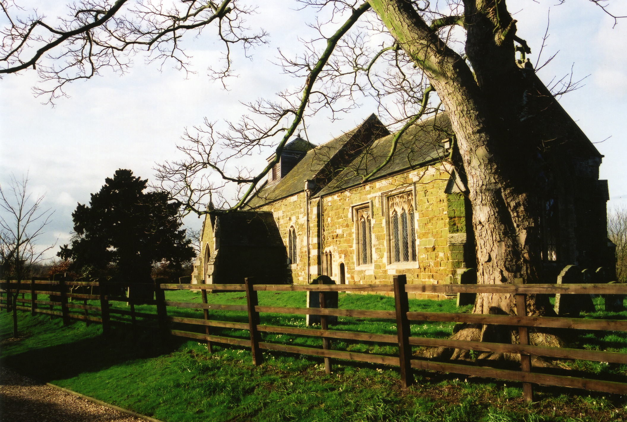
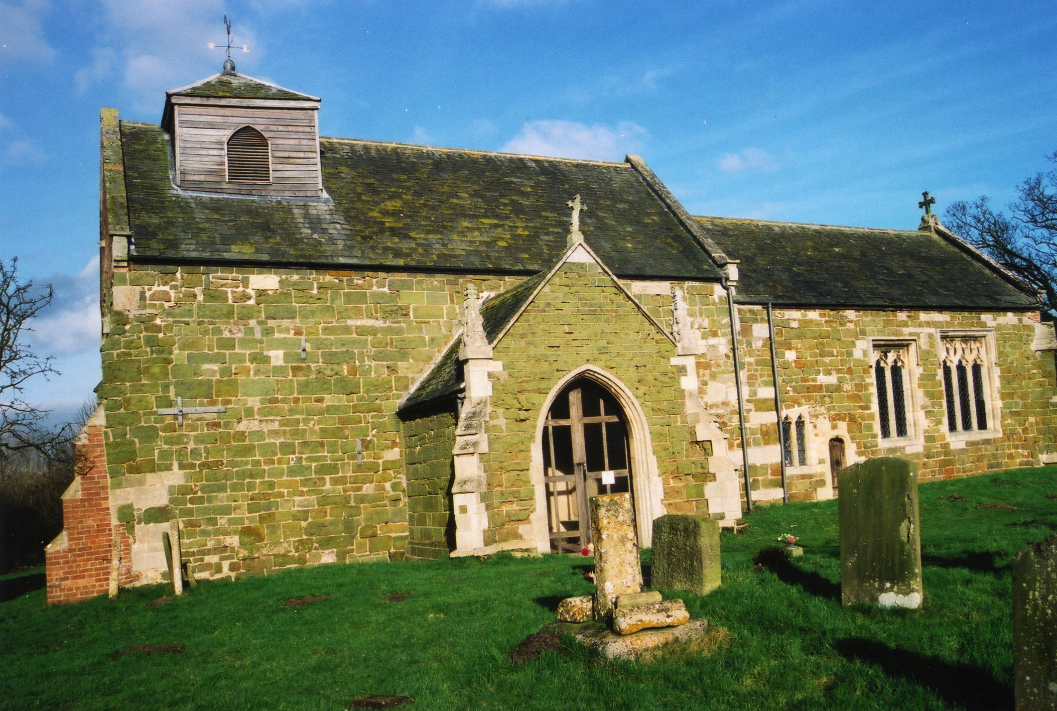
- The Anglican parish church is dedicated to Saint Benedict.
- The church appears to be of early Norman construction.
- The church in 1842 was described as "an ancient structure, which has suffered much from the hand of time...".
- The church could seat 67.
- The church was partially restored in 1880 and again in 1891, allowing seating to increase to 140.
- The Diocese of Lincoln declared this church redundant in October, 1977.
- J. HANNAH-BRIGGS has a photograph of the church interior at Geo-graph, taken in January, 2012.
- Here are two photographs of Saint Benedict's Church, taken by Ron Cole (who retains the copyright):


- Parish register entries start in 1561.
- The LFHS has published several marriage and burial indexes for the Horncastle Deanery to make your search easier.
- The Wesleyan Methodists had a small chapel here, built in 1853 and rebuilt in 1880. For information and assistance in researching these chapels, see our non-conformist religions page.
- Check our Church Records page for county-wide resources.
- The parish was in the Tattershall sub-district of the Horncastle Registration District.
- Check our Civil Registration page for sources and background on Civil Registration which began in July, 1837.
Haltham is both a village and a parish in the Wold hills, four and a helf miles south of Horncastle. Roughton parish lies to the northwest, Scrivelsby parish to the northeast and Tumby Township to the south. The parish covered about 2,610 acres in 1815, reduced by boundary realignments to 1,234 acres by 1913.
Haltham village is on the east bank of the River Bain as it travels south from Horncastle. The village is often called "Haltham on Bain". The Haltham Beck (stream) is on the east side of the village. If you are planning a visit:
- Take the A153 south out of Horncastle or north out of Coningsby.
- See our touring page for visitor services.
The National Gazetteer of Great Britain and Ireland - 1868
- Ask for a calculation of the distance from Haltham to another place.
- The Marmion Arms Public House was a popular conversation spot. At last report this 16th century inn was closed and shuttered.
- Richard CROFT has a photograph of the Marmion Arms on Geo-graph, taken in November, 2005.
- These are the names associated with the Marmion Arms in various directories:
| Year | Person |
|---|---|
| 1842 | Jas. DALE, vict. |
| 1856 | Charles WANT, vict. |
| 1868 | Charles WEST, farmer |
| 1872 | Alfred GOODYEAR, vict. |
| 1882 | Alfred GOODYEAR, vict. |
| 1900 | Sidney GOODYEAR |
| 1913 | Sidney GOODYEAR |
| 1930 | Sidney GOODYEAR |
- In 1842, Henry DYMOKE was lord of the manor, but a great part of the parish belonged to Sir J. H. HAWLEY.
- In 1872, John DYMOKE was lord of the manor and principal property owner.
- See our Maps page for additional resources.
You can see maps centred on OS grid reference TF246638 (Lat/Lon: 53.156761, -0.138019), Haltham which are provided by:
- OpenStreetMap
- Google Maps
- StreetMap (Current Ordnance Survey maps)
- Bing (was Multimap)
- Old Maps Online
- National Library of Scotland (Old Ordnance Survey maps)
- Vision of Britain (Click "Historical units & statistics" for administrative areas.)
- English Jurisdictions in 1851 (Unfortunately the LDS have removed the facility to enable us to specify a starting location, you will need to search yourself on their map.)
- Magic (Geographic information) (Click + on map if it doesn't show)
- GeoHack (Links to on-line maps and location specific services.)
- All places within the same township/parish shown on an Openstreetmap map.
- Nearby townships/parishes shown on an Openstreetmap map.
- Nearby places shown on an Openstreetmap map.
- David HITCHBORNE has a photograph of the Roll of Honour In St. Benedict's church on Geo-graph, taken in July, 2004. Unfortunately, one cannot make out the names.
- The name derives from the Old English holt+ham, meaning "homestead in a wood". It appeared in the 1086 Domesday Book as Holtham.
[A. D. Mills, "A Dictionary of English Place-Names," Oxford University Press, 1991]. - The locals pronounce the name as "Hawtum".
- White's 1842 Directory lists the following names in the parish: Wm. BLYTHE, Jas. DALE, Thos. DIXON, Ann FREEMAN, John GAUNT, Wm. HALL, James HOGG, Thos. JOBSON, Christopher KENT, Elizabeth LINCOLN, Mary LINCOLN, Chas. OLDERSHAW, Rev. John OVERTON, Wm. PROCTOR, Wm. RICHARDSON, Fras. SIMPER, James VEAR, Wm. WESTERBY and Saml. WHITE.
- White's 1872 Directory lists the following names in the parish: Charles BLYTHE, Joseph DAWSON, William DICKENSON, Mrs. Elizabeth DOWSE, Hubbert DUNHAM, Thomas GAUNT, William GAUNT, Alfred GOODYEAR, Curtis HOLDERSHAW, George HOLDERSHAW, William HURTON, John JEFFERY, John KNOWLES, Wright LEGGETT, Frederick MOTLEY, William PERKINS, Joseph PRIESTLEY, George PRITCHARD, William SINCLAIR, William SMITH, George VEAR and Thomas WOOD.
- This place was an ancient parish in Lincolnshire and became a modern Civil Parish when those were established.
- The parish was in the ancient Horncastle Soke in the East Lindsey district in the parts of Lindsey.
- Kelly's 1900 Directory of Lincolnshire places the parish, perhaps erroneously, in the South Lindsey division of the county.
- For today's district governance, see the East Lindsey District Council.
- Bastardy cases would be heard in the Horncastle petty session hearings every Saturday.
- Prior to 1842, John DYMOKE left the interest off of £5 to the parish poor.
- As a result of the 1834 Poor Law Amendment Act, the parish became part of the Horncastle Poor Law Union.
- The chilren of the parish attended school in Roughton.
- For more on researching school records, see our Schools Research page.
