
Hide
Irby on Humber
hide
Hide
hide
Hide
hide
Hide
Hide
hide
Hide
[Transcribed from The National Gazetteer of Great Britain and Ireland 1868]
by Colin Hinson ©2020
Hide
The Grimsby Library is an excellent resource with both a Local History section and a Family History section.
Ian S. has a photograph of the Churchyard cemetery on Geo-graph, taken in April, 2019.
- The parish was in the Grimsby sub-district of the Caistor Registration District.
- In 1890, the Caistor Registration District was split in two and this parish became part of the Grimsby Registration District.
- Check our Census Resource page for county-wide resources.
- The table below gives census piece numbers, where known:
| Census Year | Piece No. |
|---|---|
| 1851 | H.O. 107 / 2113 |
| 1861 | R.G. 9 / 2391 |
| 1871 | R.G. 10 / 3416 |
| 1891 | R.G. 12 / 2620 |
- There was a church here at the time of the Domesday Survey in 1086.
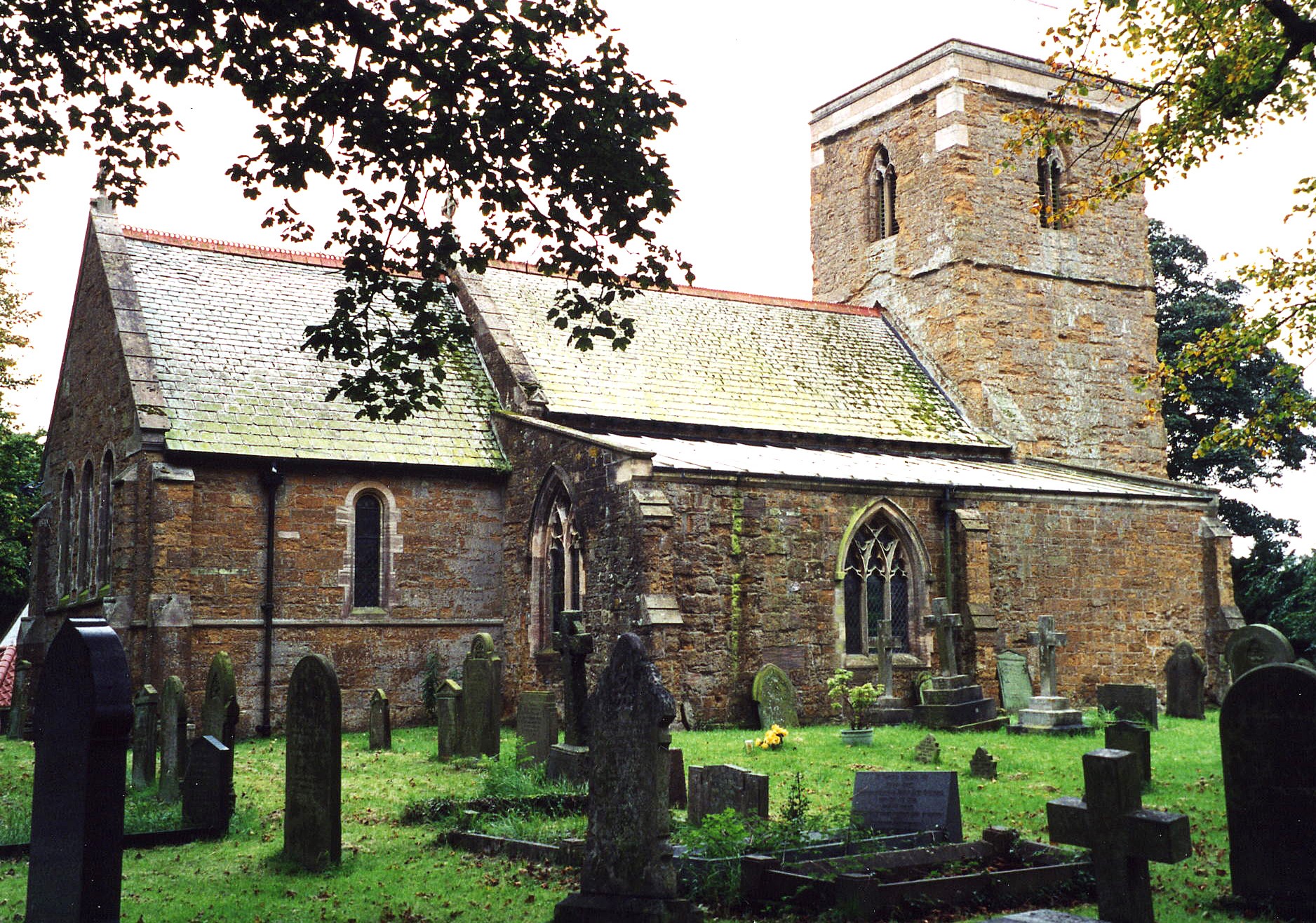
- The Anglican parish church is dedicated to Saint Andrew.
- The church was built in Norman times, with monuments dating to 1493.
- The church was restored in 1883.
- The church seats 120.
- John BEAL has a photograph of St. Andrew's Church on Geo-graph, taken in April, 2007.
- Richard CROFT also has a photograph of St. Andrew's Church on Geo-graph, taken in March, 2011.
- Here is a photo of St. Andrew's Church (Ron COLE retains the copyright):
- The Anglican parish register dates from 1558.
- The 1742 marriages were lost because a servant accidently burned them.
- The Lincolnshire FHS has published several marriage indexes and a 1641/2 Protestation Return for the Haverstoe Deanery to make your search easier.
- The Wesleyan Methodists had a chapel built here in 1884.
- For information and assistance in researching this chapel, see our non-conformist religions page.
- Check our Church Records page for county-wide resources.
- The parish was in the Grimsby sub-district of the Caistor Registration District.
- In 1890, the Caistor Registration District was split in two and this parish became part of the Grimsby Registration District.
- Check our Civil Registration page for sources and background on Civil Registration beginning in July 1837.
Irby upon Humber is both a parish and a village in northern Lincolnshire. Perhaps misnamed, the parish does not sit on the banks of the Humber. The parish lies 6 miles inland of Grimsby and is 6 miles northeast of Caistor. The parish covers about 1,800 acres.
If you are planning a visit:
- Ian S. has a photograph of the Village Sign on Geo-graph, taken in April, 2019. It appeares that they could use your artistic and marketing skills to make the sign more impactful and attractive.
- See our touring page for visitor services.
The National Gazetteer of Great Britain and Ireland - 1868
- Ask for a calculation of the distance from Irby on Humber to another place.
- At the east end of the village there are remains of an earthwork structure known to locals as "the Moat".
- See our Maps page for additional resources.
You can see maps centred on OS grid reference TA206042 (Lat/Lon: 53.520498, -0.182207), Irby on Humber which are provided by:
- OpenStreetMap
- Google Maps
- StreetMap (Current Ordnance Survey maps)
- Bing (was Multimap)
- Old Maps Online
- National Library of Scotland (Old Ordnance Survey maps)
- Vision of Britain (Click "Historical units & statistics" for administrative areas.)
- English Jurisdictions in 1851 (Unfortunately the LDS have removed the facility to enable us to specify a starting location, you will need to search yourself on their map.)
- Magic (Geographic information) (Click + on map if it doesn't show)
- GeoHack (Links to on-line maps and location specific services.)
- All places within the same township/parish shown on an Openstreetmap map.
- Nearby townships/parishes shown on an Openstreetmap map.
- Nearby places shown on an Openstreetmap map.
There is a War Memorial Cross of Red Granite on a three-stepped plinth in the churchyard. Ian S. has a photograph of the W. M. Cross on Geo-graph, taken in April, 2019. The Memorial was unveiled in September 1919.
There are 4 names on the War Memorial, all from World War One:
- Dyas, Richard, pte. in 9th Bn. Sherwood Foresters, died 10 Nov 1917.
- Lusby, George, (George Ernest Lusby) pte. in 1st Bn. Lincolnshire Regt., died 21 Sep 1915.
- Lusby, Robert, (Robert’s actual name appears to have been Walter Lusby), pte. 2nd/5th Bn. South Staffs. Regt., died 28th Sep 1917.
- Plaskitt, Robert James, pte. in 11th Bn. Royal Sussex Regt. Died 25 Sep 1917.
- This place was an ancient parish in Lincoln county and it became a modern Civil Parish when those were established.
- The parish was in the ancient Bradley Haverstoe Wapentake in the Central Lindsey district and parts of Lindsey.
- Kelly's 1913 Directory of Lincolnshire places the parish in the North Lindsey district of the county.
- District governance is provided by the North-East Lincolnshire Council.
- Bastardy cases would be heard in the Grimsby petty session hearings.
- As a result of the 1834 Poor Law Amendment Act, this parish became part of the Caistor Poor Law Union.
- In 1890, this parish was transferred to the new Grimsby Poor Law Union.
- A Public Elementary School was built here in 1867.
- See our Schools page for more information on researching school records.