Hide
Langton by Wragby
hide
Hide
hide
Hide
hide
Hide
Hide
hide
Hide
"LANGTON-BY-WRAGBY, a parish in the E. division of the wapentake of Wraggoe, parts of Lindsey, county Lincoln, 1 mile S.E. of Wragby, its post town, and 6 miles N. of the Bardney railway station. The village, which is small, is wholly agricultural. The tithes have been commuted for a rent-charge of £331 12s. ed. The living is a vicarage in the diocese of Lincoln, value £319. The church, dedicated to St. Giles, was rebuilt in 1766, with the exception of its tower. The register dates from 1653. The parochial charities produce about £5 per annum. Earl Manvers is lord of the manor."
[Transcribed from The National Gazetteer of Great Britain and Ireland 1868]
by Colin Hinson ©2020
Hide
- The parish was in the Wragby sub-district of the Horncastle Registration District.
- Check our Census Resource page for county-wide resources.
- The table below gives census piece numbers, where known:
| Census Year | Piece No. |
|---|---|
| 1861 | R.G. 9 / 2365 |
| 1871 | R.G. 10 / 3378 |
| 1891 | R.G. 12 / 2597 |
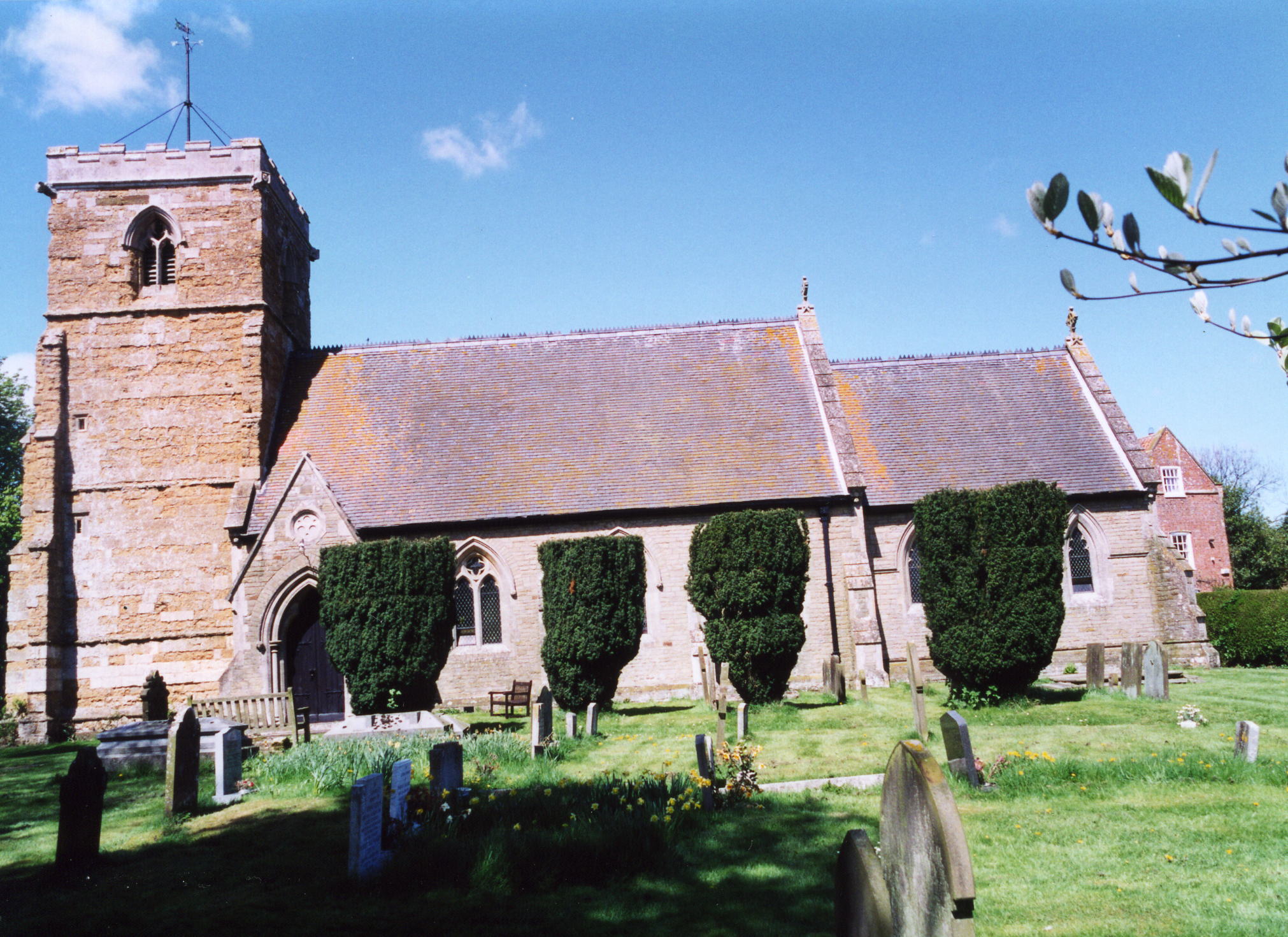
- The Anglican parish church is dedicated to Saint Giles.
- The church was rebuilt in 1766, then again in 1866.
- The church seats 170.
- Richard CROFT has a photograph of St. Giles' Church on Geo-graph, taken in December, 2005.
- Here is a photo of St. Giles Church, taken by Ron COLE (who retains the copyright):

- The Anglican parish register dates from 1653.
- The Bishop's Transcripts start in 1561.
- The LFHS has published several marriage indexes for the Horncastle Deanery to make your search easier.
- The Lincolnshire Archives holds copies of the overseers of the poor accounts, 1773 - 1817.
- Check our Church Records page for county-wide resources.
- The parish was in the Wragby sub-district of the Horncastle Registration District.
- Check our Civil Registration page for sources and background on Civil Registration which began in July, 1837.
Langton by Wragby is both a village and a parish in the Wolds, one mile southeast of Wragby. Hatton parish lies to the east and Apley parish to the southwest. The parish covers about 2,550 acres and includes the hamlets of Low Langton, Langton Hill and Strubby.
Langton village lies astride the old Horncastle Road (now the A158 trunk road). If you are planning a visit:
- Visit the Lincolnshire Trust George Leachman Memorial Reserve at grid co-ordinates TF 1475. The reserve is situated on the north side of the minor road known as Hoop Lane, which joins the B1202 Wragby to Bardney road with the A158 Lincoln to Skegness road. Access is across a grass field on the west side of Hoop Lane Farm.
- Visit our touring page for more sources.
The National Gazetteer of Great Britain and Ireland - 1868
"LANGTON-BY-WRAGBY, a parish in the E. division of the wapentake of Wraggoe, parts of Lindsey, county Lincoln, 1 mile S.E. of Wragby, its post town, and 6 miles N. of the Bardney railway station. The village, which is small, is wholly agricultural. The tithes have been commuted for a rent-charge of £331 12s. ed. The living is a vicarage in the diocese of Lincoln, value £319. The church, dedicated to St. Giles, was rebuilt in 1766, with the exception of its tower. The register dates from 1653. The parochial charities produce about £5 per annum. Earl Manvers is lord of the manor."
- Ask for a calculation of the distance from Langton by Wragby to another place.
- Neil THEASBY has a photograph of the Manor House on Geo-graph, taken in March, 2015.
- See our Maps page for additional resources.
You can see maps centred on OS grid reference TF149769 (Lat/Lon: 53.276641, -0.278298), Langton by Wragby which are provided by:
- OpenStreetMap
- Google Maps
- StreetMap (Current Ordnance Survey maps)
- Bing (was Multimap)
- Old Maps Online
- National Library of Scotland (Old Ordnance Survey maps)
- Vision of Britain (Click "Historical units & statistics" for administrative areas.)
- English Jurisdictions in 1851 (Unfortunately the LDS have removed the facility to enable us to specify a starting location, you will need to search yourself on their map.)
- Magic (Geographic information) (Click + on map if it doesn't show)
- GeoHack (Links to on-line maps and location specific services.)
- All places within the same township/parish shown on an Openstreetmap map.
- Nearby townships/parishes shown on an Openstreetmap map.
- Nearby places shown on an Openstreetmap map.
- Richard CROFT has a photograph of the memorial window in St. Giles' Church for both Stephen Langton and the eight men who perished in World War I, taken in September, 2007.
- This place was an ancient parish in Lincoln county and became a modern Civil Parish when those were established.
- The parish was in the ancient Wraggoe Wapentake in the East Lindsey district in the parts of Lindsey.
- Langton Wood, formerly an "extra-parochial" area, is included in this parish.
- For today's district governance, see the East Lindsey District Council.
- Bastardy cases would be heard in the Wragby petty session hearings on the first Thursday of every month.
- As a result of the 1834 Poor Law Amendment Act, the parish became part of the Horncastle Poor Law Union.
Year Inhabitants 1801 144 1811 173 1821 193 1831 206 1841 262 1851 287 1871 351 1881 296 1891 250 1901 203 1911 188 1931 152 1951 138 1971 105
- A National School was built here in 1871 to handle 58 children.
- For more on researching school records, see our Schools Research page.
