Hide
Londonthorpe
hide
Hide
hide
Hide
hide
Hide
Hide
[Transcribed from The National Gazetteer of Great Britain and Ireland 1868]
by Colin Hinson ©2020
Hide
The Library at Grantham will prove useful in your research.
The churchyard at St. John's contains the graves of 31 soldiers from many regiments who lost their lives during the 1914-18 war, after coming for treatment in the military hospital in Cherry Orchard, Grantham.
- The parish was in the Grantham sub-district of the Grantham Registration District.
- An 1890 re-organization placed the parish in the "Grantham North" sub-district of the Grantham Registration District.
- Check our Census Resource page for county-wide resources.
- The table below gives census piece numbers, where known:
| Census Year | Piece No. |
|---|---|
| 1841 | H.O. 107 / 620 |
| 1861 | R.G. 9 / 2352 |
| 1871 | R.G. 10 / 3363 |
| 1891 | R.G. 12 / 2586 |
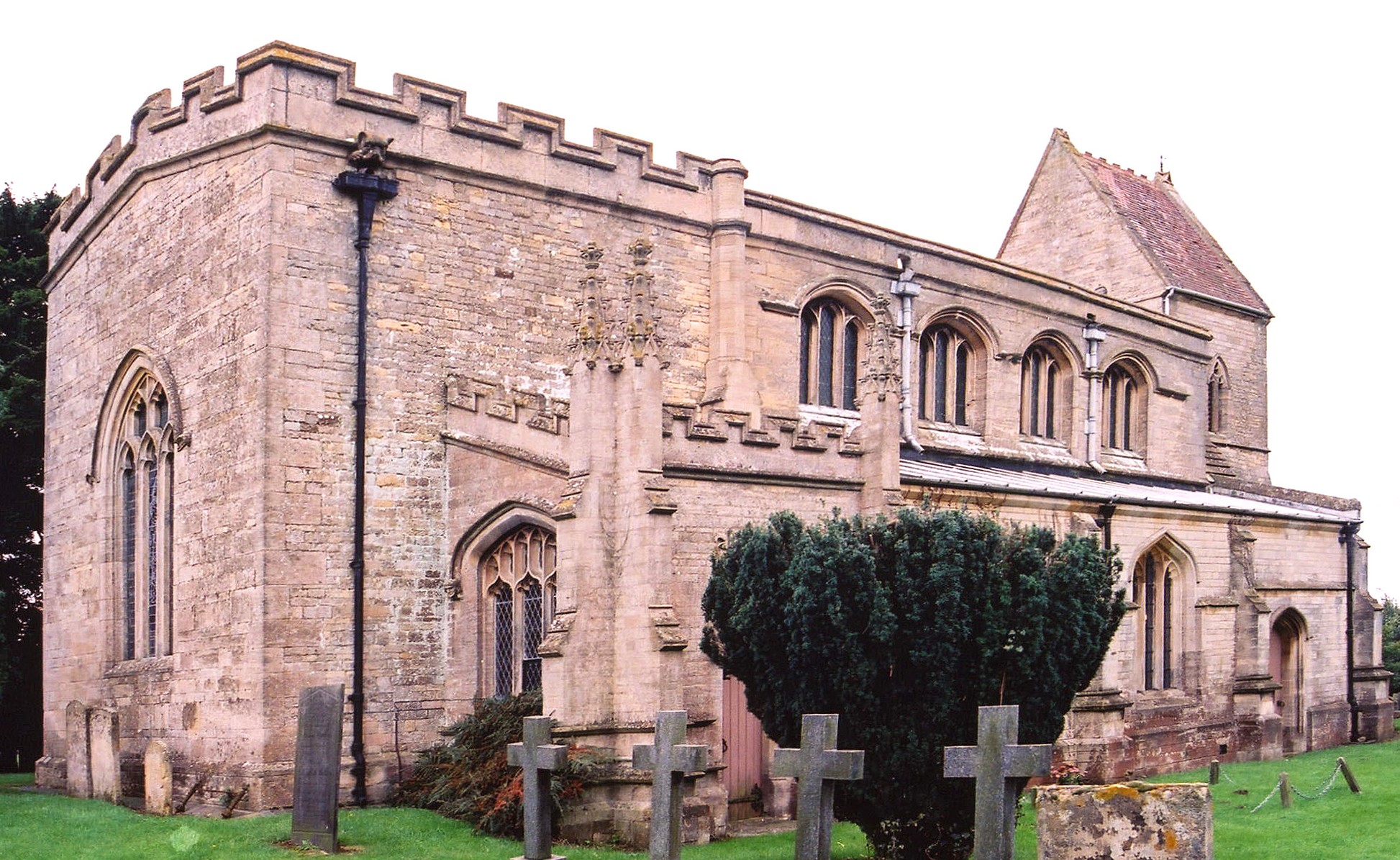
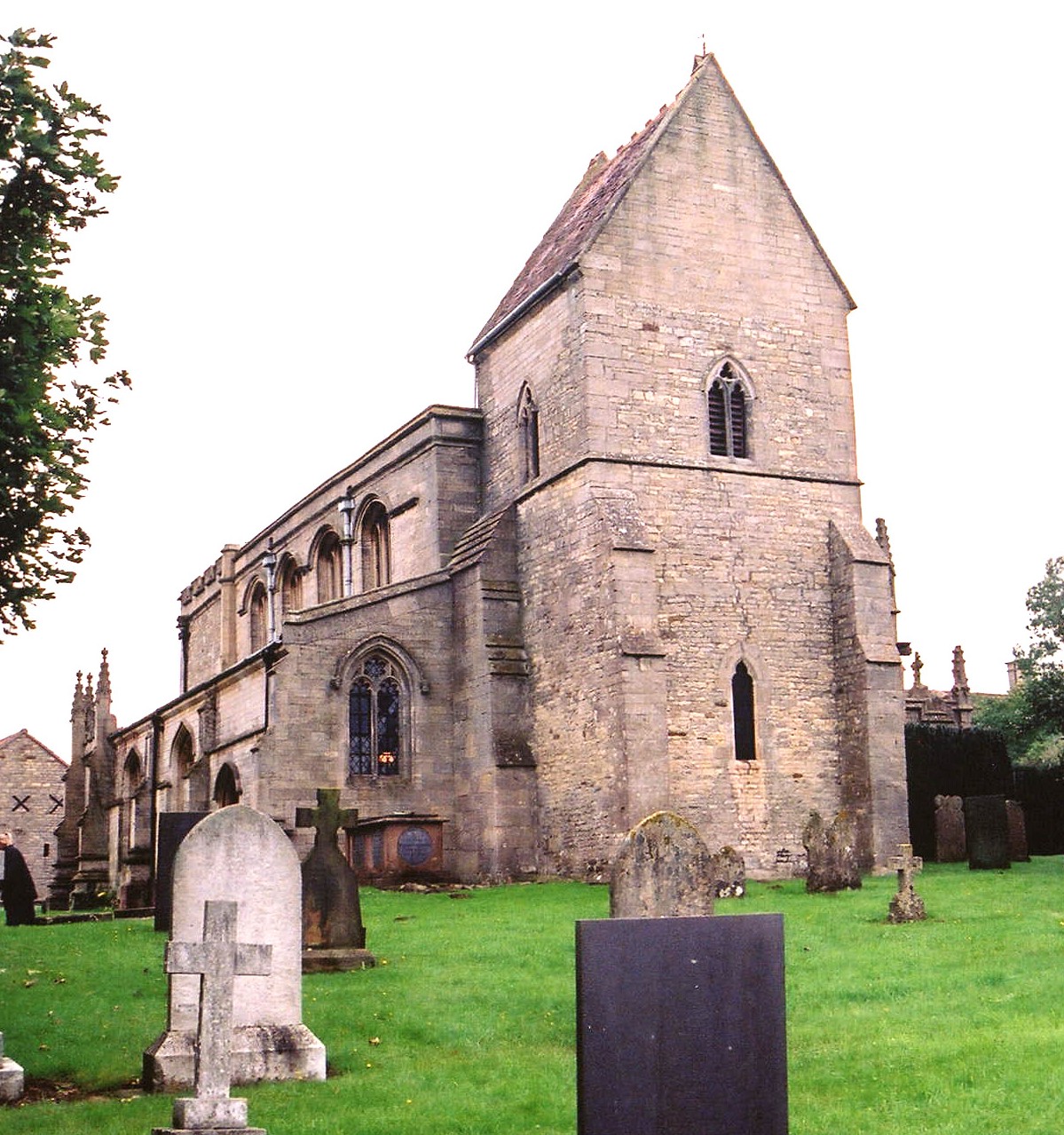
- The Anglican parish church is dedicated to Saint John the Baptist and is built of stone.
- Estimates are that the church was built at around the time of the Norman Conqest, circa 1100.
- The church once had a spire which was destroyed in Cromwell’s time.
- Robert HARVEY has a photograph of the Churchyard Yew Tree on Geo-graph, taken in December, 2020.
- The interior was restored and reseated in 1879.
- The church seats 162.
- Here are two photographs of St. John's church, taken by Ron COLE (who retains the copyright):


- Parish registers reportedly exist from 1539. Bishop's Transcripts exist from 1562 through 1813.
- The LFHS has published several marriage and burial indexes for the Grantham Deanery to make your search easier.
- The Wesleyan Methodists had a small chapel built here in 1838 and enlarged in 1889. Check our Non-Conformist Church Records page for additional resources.
- Check our Church Records page for county-wide resources.
- The parish was in the Grantham sub-district of the Grantham Registration District.
- An 1890 re-organization placed the parish in the "Grantham North" sub-district of the Grantham Registration District.
- Check our Civil Registration page for sources and background on Civil Registration which began in July, 1837.
Londonthorpe is both a small village and a large parish. The parish is about 110 miles north of London and lies about three miles east of Grantham along the old Ermine Street (now the B6403). The parish itself is bounded on the north by Belton parish, to the east by Welby parish, west by Grantham, and to the south by Somerby parish. The parish covers about 1,710 acres.
The village of Londonthorpe is about three miles northeast of Grantham's center and just east of Belton House. If you are planning a visit:
- It is probably easiest to take the A52 east out of Grantham, then north on the B6403 about three miles brings you to Londonthorpe on the west side of the road.
- Visit our touring page for more sources.
The National Gazetteer of Great Britain and Ireland - 1868
- Ask for a calculation of the distance from Londonthorpe to another place.
- Check the history of the Wapentake at the Loveden Wapentake website.
- In 1871, nearly all of the parish was held by Earl BROWNLOW.
- In 1913, the greater part of the parish was held by Earl BROWNLOW.
- See our Maps page for additional resources.
You can see maps centred on OS grid reference SK954380 (Lat/Lon: 52.930585, -0.582447), Londonthorpe which are provided by:
- OpenStreetMap
- Google Maps
- StreetMap (Current Ordnance Survey maps)
- Bing (was Multimap)
- Old Maps Online
- National Library of Scotland (Old Ordnance Survey maps)
- Vision of Britain (Click "Historical units & statistics" for administrative areas.)
- English Jurisdictions in 1851 (Unfortunately the LDS have removed the facility to enable us to specify a starting location, you will need to search yourself on their map.)
- Magic (Geographic information) (Click + on map if it doesn't show)
- GeoHack (Links to on-line maps and location specific services.)
- All places within the same township/parish shown on an Openstreetmap map.
- Nearby townships/parishes shown on an Openstreetmap map.
- Nearby places shown on an Openstreetmap map.
For a photograph of the Londonthorpe War Memorial and the names on it, see the Roll of Honour site.
- The name derives from the Old Scandinavian lundr+thorp, meaning "outlying farmstead or hamlet by a grove". It appears as Lundertorp in the 1086 Domesday Book. You will find more recent spellings both with and without the final "e", and also split into "London Thorpe," etc.
A. D. Mills, "A Dictionary of English Place-Names," Oxford University Press, 1991.
- White's 1872 Directory lists the following surnames in the parish: BRAKENBURY, BRETT, GIBSON, GOODSON, HARVEY, NIXON, PALMER, ROSS, WATSON and WHITE.
- Kelley's 1900 Directory lists the following surnames in the parish: BAXTER, BRETT, BURTON, CLARK, FARBON, HARVEY, LLYOD, ROSS, WATSON and WHITE.
- Kelley's 1913 Directory lists the following surnames in the parish: BAKER, BAXTER, BURTON, CHAMBERS, FARBON, LYNN, PAWLETT, POOLE, WADSLEY and WILSON.
- This place was an ancient parish in Lincoln county and became a modern Civil Parish when those were established.
- The parish was in the ancient Loveden Wapentake in the South Kesteven district in the parts of Kesteven.
- The parish was also within the Soke of Grantham.
- In April, 1931, this Civil Parish was abolished and merged with Harrowby Without Civil parish.
- The local parish governance is handled by the Londonthorpe and Harrowby Without Council. Note: They are NOT staffed to answer family history questions.
- For today's district governance, contact the South Kesteven District Council.
- Bastardy cases would be heard in the Spittlegate (Grantham) petty session hearings.
- As a result of the 1834 Poor Law Amendment Act, the parish became part of the Grantham Poor Law Union in 1837.
- A Public Elementary School was built here in 1851 and enlarged in 1876. In 1913 it was attended by 35 children.
- For more on researching school records, see our Schools Research page.
