
Hide
Market Stainton
hide
Hide
hide
Hide
hide
Hide
Hide
"STAINTON MARKET, a parish in the wapentake of North Gartree, county Lincoln, 6 miles N.W. of Horncastle. It is now a small agricultural village, situated near the river Bain, but was formerly a market town. In the centre of the village is a green, once the market-place. The living is a donative curacy in the diocese of Lincoln, value £100. The church is an ancient structure dedicated to St. Michael, and was repaired at the commencement of the present century."
[Transcribed from The National Gazetteer of Great Britain and Ireland 1868]
by Colin Hinson ©2020
Hide
- The parish was in the Wragby sub-district of the Horncastle Registration District.
- Check our Census Resource page for county-wide resources.
- The table below gives census piece numbers, where known:
| Census Year | Piece No. |
|---|---|
| 1841 | H.O. 107 / 645 |
| 1861 | R.G. 9 / 2365 |
| 1871 | R.G. 10 / 3379 |
| 1891 | R.G. 12 / 2597 |
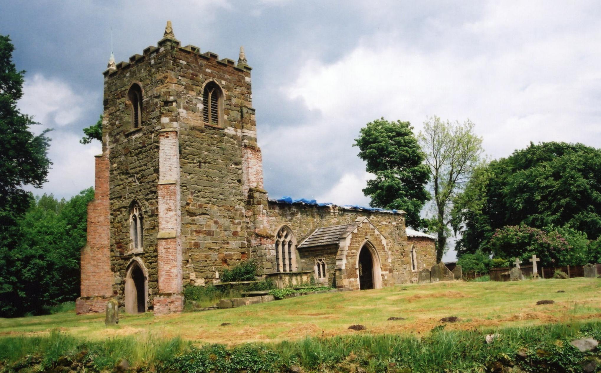
- The Anglican parish church is dedicated to Saint Michael.
- The church was restored in 1886 and again in 1909-10.
- The church building is small, seating only 80.
- A photograph of St. Michael's Church is at the Wendy PARKINSON English Church Photographs site.
- Another good photograph of St. Michael's Church, taken on a sunny day, is at the Flickr Photographs site (Under Description and Travel)
- J. HANNAH-BRIGGS has a photograph of St. Michael's Church on Geo-graph, taken in June, 2012.
- Here is a photo of Saint Michael's Church, taken by Ron COLE (who retains the copyright):
- The Anglican parish register dates from 1689 for baptisms and burials, 1690 for marriages.
- The LFHS has published several marriage indexes for the Horncastle Deanery to make your search easier.
- Check our Church Records page for county-wide resources.
- The Wesleyan Methodists had a chapel in this parish before 1871.
- The parish was in the Wragby sub-district of the Horncastle Registration District.
- Check our Civil Registration page for sources and background on Civil Registration which began in July, 1837.
Market Stainton is both a village and a parish, 7 miles north of Horncastle. Ranby parish lies to the south. The parish covers about 1,200 acres.
The village stands on a rise overlooking the River Bain. If you are planning a visit:
- Visit our touring page for more sources.
The National Gazetteer of Great Britain and Ireland - 1868
"STAINTON MARKET, a parish in the wapentake of North Gartree, county Lincoln, 6 miles N.W. of Horncastle. It is now a small agricultural village, situated near the river Bain, but was formerly a market town. In the centre of the village is a green, once the market-place. The living is a donative curacy in the diocese of Lincoln, value £100. The church is an ancient structure dedicated to St. Michael, and was repaired at the commencement of the present century."
- Ask for a calculation of the distance from Market Stainton to another place.
- See our Maps page for additional resources.
You can see maps centred on OS grid reference TF228799 (Lat/Lon: 53.301824, -0.158728), Market Stainton which are provided by:
- OpenStreetMap
- Google Maps
- StreetMap (Current Ordnance Survey maps)
- Bing (was Multimap)
- Old Maps Online
- National Library of Scotland (Old Ordnance Survey maps)
- Vision of Britain (Click "Historical units & statistics" for administrative areas.)
- English Jurisdictions in 1851 (Unfortunately the LDS have removed the facility to enable us to specify a starting location, you will need to search yourself on their map.)
- Magic (Geographic information) (Click + on map if it doesn't show)
- GeoHack (Links to on-line maps and location specific services.)
- All places within the same township/parish shown on an Openstreetmap map.
- Nearby townships/parishes shown on an Openstreetmap map.
- Nearby places shown on an Openstreetmap map.
- The RAF opened a station here in January, 1943. It was primarily a storage facility for ammunition, but ammo was stored on the roadside verges when space ran out. It used the rail station at Brocklesby to supply the eastern stations in Lincolnshire and had a satellite storage facility at Orby.
- The Market Stainton facility was closed in 1948.
- This place was an ancient parish in Lincoln county and became a modern Civil Parish when those were established.
- The parish was in the north division of the ancient Gartree Wapentake in the East Lindsey district in the parts of Lindsey.
- For today's district governance, see the East Lindsey District Council.
- Bastardy cases would be heard at the Horncastle petty session hearings.
- As a result of the 1834 Poor Law Amendment Act, the parish became part of the Horncastle Poor Law Union.
Year Inhabitants 1801 93 1811 130 1821 131 1831 132 1841 184 1851 142 1871 100 1881 97 1891 123 1901 84 1911 104
- The children of this parish attend the school at Ranby.
- For more on researching school records, see our Schools Research page.