Hide
Raithby cum Maltby
hide
Hide
hide
Hide
hide
Hide
Hide
hide
Hide
[Transcribed from The National Gazetteer of Great Britain and Ireland 1868]
by Colin Hinson ©2020
Hide
The Library at Louth will prove useful in your research.
- The parish was in the Louth sub-district of the Louth Registration District.
- Check our Census Resource page for county-wide resources.
- The table below gives census piece numbers, where known:
| Census Year | Piece No. |
|---|---|
| 1851 | H.O. 107 / 2111 |
| 1861 | R.G. 9 / 2381 |
| 1871 | R.G. 10 / 3404 |
| 1891 | R.G. 12 / 2608 |
| 1901 | R.G. 13 / 3084 |
- The Knights Templar had a preceptory here in Maltby, later taken over by the Knights Hospitallers.
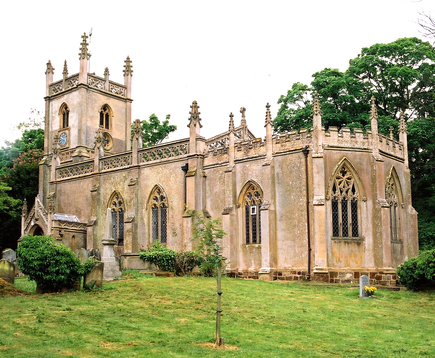
- The Anglican parish church is dedicated to Saint Peter.
- Portions of the church foundation indicate an original structure was built during the Norman period in the 13th century.
- The church was rebuilt in 1839.
- The church chancel was restored in 1883.
- The church is a Grade II listed building with British Heritage.
- A photograph of the Anglican parish church is at the Wendy PARKINSON English Church Photographs site, taken by Paul Fenwick.
- Here is a photo of St. Peter's church, taken by Ron COLE (who retains the copyright):

- The Anglican parish register dates from 1557.
- The Lincolnshire FHS has published several Marriage indexes and a Burial index for the Louthesk Deanery to make your search easier.
- The Wesleyan Methodists had a chapel here before 1900. For information and assistance in researching these chapels, see our non-conformist religions page.
- Check our Church Records page for county-wide resources.
- The parish was in the Louth sub-district of the Louth Registration District.
- Check our Civil Registration page for sources and background on Civil Registration which began in July, 1837.
Raithby, actually Raithby-cum-Maltby, is a village and a parish about 2 miles south-west of Louth. The parish borders Louth parish on the north and Tathwell parish to the south. The parish covers about 1,900 acres and includes the hamlet of Maltby, just to the south of Raithby.
A stream from Tathwell runs right through the hamlet of Maltby and the village of Raithby. Raithby Springs add to the flow and the stream travels on toward Louth. If you are planning a visit:
- David WRIGHT has a photograph of the stream at Raithby on Geo-graph, taken in 2006.
- By automobile, take the A153 arterial road north from Horncastle or south from Louth. The village is about a mile outside the town of Louth.
- Visit our touring page for more sources.
The National Gazetteer of Great Britain and Ireland - 1868
- Ask for a calculation of the distance from Raithby cum Maltby to another place.
- Raithby Hall, built of red brick with stone facings in 1776 near the church, was the residence of Rev. Edward RAWNSLEY in 1900.
- See our Maps page for additional resources.
You can see maps centred on OS grid reference TF310844 (Lat/Lon: 53.340406, -0.033302), Raithby cum Maltby which are provided by:
- OpenStreetMap
- Google Maps
- StreetMap (Current Ordnance Survey maps)
- Bing (was Multimap)
- Old Maps Online
- National Library of Scotland (Old Ordnance Survey maps)
- Vision of Britain (Click "Historical units & statistics" for administrative areas.)
- English Jurisdictions in 1851 (Unfortunately the LDS have removed the facility to enable us to specify a starting location, you will need to search yourself on their map.)
- Magic (Geographic information) (Click + on map if it doesn't show)
- GeoHack (Links to on-line maps and location specific services.)
- All places within the same township/parish shown on an Openstreetmap map.
- Nearby townships/parishes shown on an Openstreetmap map.
- Nearby places shown on an Openstreetmap map.
- This place was an ancient parish in county Lincoln and became a modern Civil Parish when those were established.
- the parish was in the Wold Division of the ancient Louth Eske Wapentake in the East Lindsey district in the parts of Lindsey.
- For today's district governance, see the East Lindsey Disctrict Council.
- Bastardy cases would be heard in the Louth petty session hearings.
- After the 1834 Poor Law Amendment Act reforms, the parish became part of the Louth Poorlaw Union.
- An Endowed School was founded here in 1668 by Thomas LAWFORD. The school was rebuilt in 1866 for 45 children.
- The children of this parish attended school in Tathwell parish.
- For more on researching school records, see our Schools Research page.
