Hide
Scotter
hide
Hide
hide
Hide
hide
Hide
Hide
"SCOTTER, a parish in the wapentake of Corringham, parts of Lindsey, county Lincoln, 4 miles N.W. of Kirton-in-Lindsey, its post town, 9 N.E. of Gainsborough and 34 from Northorpe railway station. The parish, which is extensive, is situated on the river Eau, here joined by the Trent, which forms its north-western boundary. A charter for a market on Thursday was granted by Richard I., but has long been discontinued. The parish includes the hamlets of Cotehouses, Scotterthorpe, and Susworth. The surface is generally level, with some alternation of hilly ground. The soil is various, consisting of clay, loam, sand, and gravel, according to the locality. Some years ago a canoe and other relics were found imbedded in the gravel." (There is more of this description).
"COURTHOUSES, a hamlet in the parish of Scotter, in the county of Lincoln, 9 miles N. of Gainsborough."
"SUSWORTH, a hamlet in the parish of Scotter, county Lincoln, 8 miles N.E. of Gainsborough."
[Transcribed from The National Gazetteer of Great Britain and Ireland 1868]
by Colin Hinson ©2020
Hide
The two Libraries at Scunthorpe would be a good resource.
Alternatively, the Library at Gainsborough has a local history and a Family Hisory section.
- The Scotter Cemetery on Scotton Road is a lawn-style, non-denominational cemetery. Requests for information on burial records can be made to the clerk of the parish council.
- Jonathan BILLINGER has a photograph of the Entrance to Scotter churchyard on the Geo-graph website, taken in March, 2010.
- David WRIGHT also has a photograph of the Scotter Village Green on Geo-graph, taken in March, 2006. I believe that is the War Memorial in the center distance.
| St Peter, Scotter, Church of England |
- The parish was in the Scotter sub-district of the Gainsborough Registration District.
- We have a list of surnames extracted from a small portion of the 1901 census for Scotter.
- Check our Census Resource page for county-wide resources.
- The table below gives census piece numbers, where known:
| Census Year | Piece No. |
|---|---|
| 1841 | H.O. 107 / 643 |
| 1851 | H.O. 107 / 2119 |
| 1861 | R.G. 9 / 2406 |
| 1871 | R.G. 10 / 3441 |
| 1891 | R.G. 12 / 2632 |
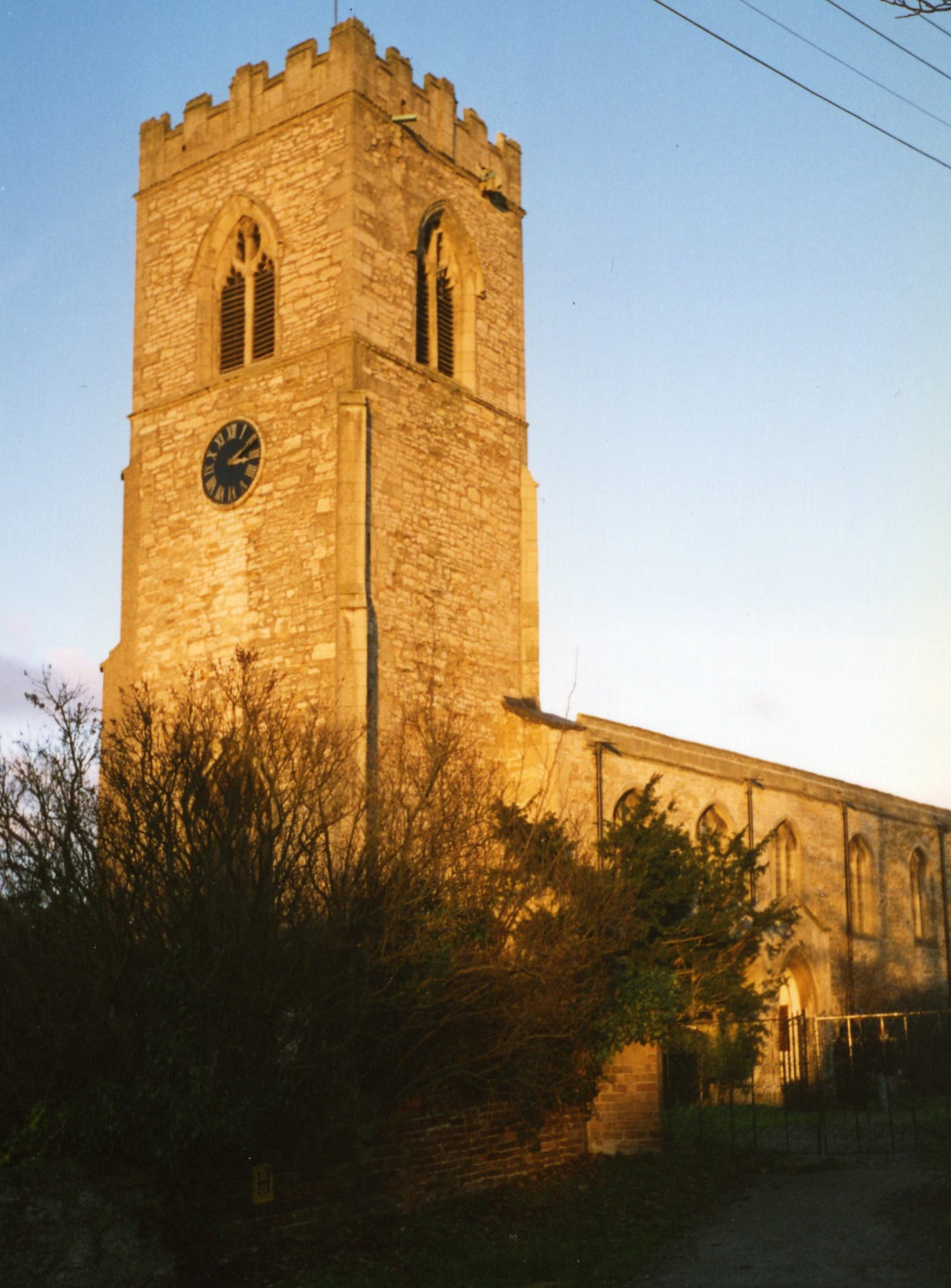
- The Anglican parish church is dedicated to St. Peter.
- The church is built of stone.
- Some portions of the church date from the early Norman period.
- The church was extensively repaired in 1820.
- The church seats 400.
- There is a photograph of St. Peter's Church on the Wendy Parkinson Church Photos web site.
- Here is a photo of St. Peter's Church, taken by Ron Cole (who retains the copyright):

- Ian S. has a photograph of St. Peter's Interior on Geo-graph, taken in May, 2018.
- The Anglican parish registers exist from 1561.
- We have a handful of entries in our Parish Register Extract text file. Your additions are welcome.
- The Lincolnshire FHS publishes indexes of marriages and a burial index for the Manlake Deanery to make your search easier.
- Susworth had its own Weleyan Methodist chapel in the 1800's. Scotter had chapels for the Wesleyan, New Connexion and Primitive Methodists. The one for the Wesleyan Methodists is still in use.
- For information and assistance in researching Methodist chapels, see our non-conformist religions page.
- Check our Church Records page for county-wide resources.
- The parish was in the Scotter sub-district of the Gainsborough Registration District.
- Check our Civil Registration page for sources and background on Civil Registration which began in July, 1837.
Scotter is a parish due south of the conurbation of Scunthorpe and which sits nine miles northeast of Gainsborough. The parish of Messingham lies to the north, Scotton parish to the south. The parish covers about 5,400 acres and includes the hamlets of Scotterthorpe, Susworth (on the Trent River), Cotehouses (now virtually gone) and Woodhouse.
The picturesque village lies south of the the M180 motorway. The A159 trunk road cuts through the heart of the village. The small river Eau passes through the village and just north of Scotterthorpe.
The hamlets of Susworth and Cotehouses (also given as "Gotchouses") are on the River Trent west-northwest of the village of Scotter.
Ideas for a visit to Scotter:
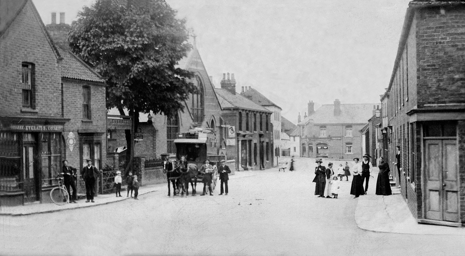
- Here's a street scene from bygone Scotter days. It is a Paddy and Yankee carrier cart:

- Modern day visitors to Scotter might enjoy a picnic in the wooded grounds in the southwestern part of the parish or fishing at Morton's Pond. But watch out for the hundreds of ducks that roam the village (residents of the River Eau).
- And visit our touring page for Lincolnshire.
The National Gazetteer of Great Britain and Ireland - 1868
"COURTHOUSES, a hamlet in the parish of Scotter, in the county of Lincoln, 9 miles N. of Gainsborough."
"SUSWORTH, a hamlet in the parish of Scotter, county Lincoln, 8 miles N.E. of Gainsborough."
- Ask for a calculation of the distance from Scotter to another place.
- Diggings around the village indicate that the Anglo-Saxons lived here for some centuries.
- In 1190 King Richard I granted the right to hold a market and fairs here.
- In 1216 King John visited the parish.
In recent centuries, a cattle fair was held at Scotter on July 10
thof each year.
- See our Maps page for additional resources.
You can see maps centred on OS grid reference SE885011 (Lat/Lon: 53.499228, -0.667677), Scotter which are provided by:
- OpenStreetMap
- Google Maps
- StreetMap (Current Ordnance Survey maps)
- Bing (was Multimap)
- Old Maps Online
- National Library of Scotland (Old Ordnance Survey maps)
- Vision of Britain (Click "Historical units & statistics" for administrative areas.)
- English Jurisdictions in 1851 (Unfortunately the LDS have removed the facility to enable us to specify a starting location, you will need to search yourself on their map.)
- Magic (Geographic information) (Click + on map if it doesn't show)
- GeoHack (Links to on-line maps and location specific services.)
- All places within the same township/parish shown on an Openstreetmap map.
- Nearby townships/parishes shown on an Openstreetmap map.
- Nearby places shown on an Openstreetmap map.
- The War Memorial, built of Portland stone, sits at the junction of two roads as they diverge to enclose the village green.
- There is a good photograph of the War Memorial at the Roll of Honour website.
For a list of the names on the War Memorial, see the Roll of Honour site.
- The meaning of the name Scotter is uncertain, possibly from the Old English Scot+treow, for "tree of the Scots". In the 1086 Domesday Book it appeared as Scotere. Scotterthorpe apparently has a different derivation, coming from Old Scandinavian Skalli+thorp, for "hamlet of a man called Skalli". In the 1086 Domesday Book it appeared as Scaltorp. Susworth appears to mean only "southern settlement".
A. D. Mills, "A Dictionary of English Place-Names," Oxford University Press, 1991.
- This place was an ancient parish in Lincoln county and became a modern Civil Parish when those were established.
- The parish was in the ancient Corringham Wapentake in the West Lindsey district in the parts of Lindsey.
- The parish boundaries were changed slightly in 1885 when a detached portion of Scotton parish was transfered to Scotter.
- On 1 April, 1936, this parish gained 4 acres from East Ferry Civil Parish.
- You can contact the Scotter Parish Council regarding civic or political issues, but they are NOT staffed to assist you with family history searches.
- J. THOMAS has a photograph of the Village Hall on Geo-graph, taken in September, 2014. You can stop in when the Hall is open and ask to see the schedule of forth-coming events.
- Today's district governance is provided by the West Lindsey District Council.
- Bastardy cases would be held in the Gainsborough petty session hearings every Tuesday.
- The Common Lands were enclosed here in 1812.
- As a result of the 1834 Poor Law Amendment Act, this parish became part of the Gainsborough Poorlaw Union.
Year Inhabitants 1801 666 1831 1,043 1851 1,158 1861 1,167 1871 1,094 1881 1,070 1891 1,078 1901 1,073 1911 1,083 1921 1,043
- A National School was built here in 1834 and by the 1870's was schooling about 100 children. An Infants school was added in 1877. This school closed in July, 1932. Scotter Primary School, which opened in Aug, 1932, now resides on High Street.
- The Minute Books for Scotter Primary School are deposited for 1932-55 and 1955-69 at the Lincoln Archives. No admission registers were deposited.
- A Public Elementary School was built is Susworth hamlet in 1904 to hold upto 52 students.
- See our Schools page for more information on researching school records.
