Hide
Skidbrooke
hide
Hide
hide
Hide
hide
Hide
Hide
hide
Hide
"SALTFLEET-HAVEN, a hamlet in the parish of Skidbrooke, Marsh division of Louth-Eske hundred, parts of Lindsey, county Lincoln, 9 miles N.E. of Louth, and 38 N.E. of Lincoln. It is situated on the seacoast, and is a sub-port to Boston. At a short distance is an oyster bed. The hamlet is much frequented for sea bathing. A small trade is done in coals and fish. In the vicinity are numerous springs of water. The Wesleyans and Free Methodists have each a place of worship. A fair is held on 3rd October."
[Transcribed from The National Gazetteer of Great Britain and Ireland 1868]
by Colin Hinson ©2020
Hide
The Library at Louth will prove useful in your research.
- The parish was in the Saltfleet sub-district of the Louth Registration District.
- Check our Census Resource page for county-wide resources.
- The table below gives census piece numbers, where known:
| Census Year | Piece No. |
|---|---|
| 1841 | H.O. 107 / 644 |
| 1851 | H.O. 107 / 2112 |
| 1861 | R.G. 9 / 2385 |
| 1871 | R.G. 10 / 3408 |
| 1891 | R.G. 12 / 2610 |
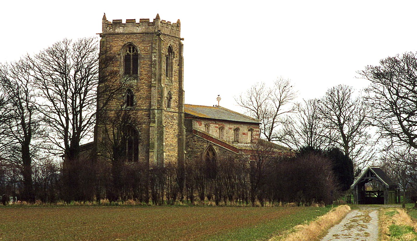
- The Anglican parish church is dedicated to Saint Botolph.
- The chancel arch dates from around 1200 A.D.
- The church seats 300.
- The Diocese of Lincoln declared this church redundant in November, 1973.
- The church ownership was vested in the Churches Conservation Trust in 1975.
- There is a photograph of St. Botolph's Church on the Wendy PARKINSON Church Photos web site.
- Here is a photograph of Saint Botolph Church taken by Ron COLE (who retains the copyright):

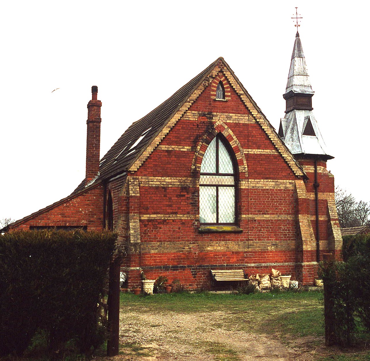
- In Saltfleet Haven, divine services were held in the public school.
- Here is a photograph of the Saltfleet Haven church taken by Ron COLE (who retains the copyright):

- The Anglican parish register dates from 1558.
- We have a handful of entries from a Parish Register Extract in a text file for your use. Your additions and corrections are welcome.
- The Lincolnshire FHS has published several Marriage indexes and a Burial index for the Louthesk Deanery to make your search easier.
- The United Methodists (Originally the Free Methodists) had a small chapel built here in 1870.
- Saltfleet Haven had a Methodist chapel that was enlarged in 1857.
- For information and assistance in researching these chapels, see our non-conformist religions page.
- Check our Church Records page for county-wide resources.
- The parish was in the Saltfleet sub-district of the Louth Registration District.
- Check our Civil Registration page for sources and background on Civil Registration which began in July, 1837.
Skidbrooke is a village and parish near the North Sea, 10 miles ENE from Louth and 10 miles north of Alford. The parish covers over 2,400 acres and includes the hamlet of Saltfleet Haven on the North Sea coast.
Saltfleet Haven (sometimes just recorded as "Saltfleetby") was mentioned in the 1086 Domesday Book as a significant port. In the days of Edward I it was a considerable market town as well. If you are planning a visit:
- Roger GILBERTSON provides a prospective of the flatlands in this area with his photograph at Geo-graph of Draining the Marshes, taken in December, 2006.
- By automobile, take the A1031 between Mablethorpe and Grimsby. The village is about a mile north of the junction with the B1200 arterial road to Louth.
- See our touring page for visitor services.
The National Gazetteer of Great Britain and Ireland - 1868
"SALTFLEET-HAVEN, a hamlet in the parish of Skidbrooke, Marsh division of Louth-Eske hundred, parts of Lindsey, county Lincoln, 9 miles N.E. of Louth, and 38 N.E. of Lincoln. It is situated on the seacoast, and is a sub-port to Boston. At a short distance is an oyster bed. The hamlet is much frequented for sea bathing. A small trade is done in coals and fish. In the vicinity are numerous springs of water. The Wesleyans and Free Methodists have each a place of worship. A fair is held on 3rd October."
- Ask for a calculation of the distance from Skidbrooke to another place.
- A fair for stock (cheifly cart foals) was held each year on the 3rd of October.
- There was a Coastguard Station at Saltfleet Haven.
- Oysters were harvested here in the flats of the North Sea.
- J. THOMAS has a photograph of the Crown Inn on Geo-graph, taken in March, 2015.
- Chris ? has a photograph of the New Inn on Geo-graph, taken in January, 2010. The Inn was built in the 17th century.
- Wendy PARKINSON has a photograph of the 1953 Flood Plaques on Geo-graph, taken in June, 2005.
- There was a Manor House here, name unknown. One of the windows is engraved with a lover's knot and a date of marriage.
- Wendy PARKINSON has a photograph of the Manor House at Saltfleetby on Geo-graph, taken in April, 2007.
- See our Maps page for additional resources.
You can see maps centred on OS grid reference TF440932 (Lat/Lon: 53.415773, 0.165052), Skidbrooke which are provided by:
- OpenStreetMap
- Google Maps
- StreetMap (Current Ordnance Survey maps)
- Bing (was Multimap)
- Old Maps Online
- National Library of Scotland (Old Ordnance Survey maps)
- Vision of Britain (Click "Historical units & statistics" for administrative areas.)
- English Jurisdictions in 1851 (Unfortunately the LDS have removed the facility to enable us to specify a starting location, you will need to search yourself on their map.)
- Magic (Geographic information) (Click + on map if it doesn't show)
- GeoHack (Links to on-line maps and location specific services.)
- All places within the same township/parish shown on an Openstreetmap map.
- Nearby townships/parishes shown on an Openstreetmap map.
- Nearby places shown on an Openstreetmap map.
- In the middle of the village there is a stone pump which is a memorial to Frederick Allen FRESHNEY of South Somercotes, who died here in May, 1906, from wounds received in the South African War.
- This place was an ancient parish in Lincoln county and became a modern Civil Parish when those were established.
- The parish was in the Marsh division of the ancient Louth Eske Wapentake in the East Lindsey district in the parts of Lindsey.
- For today's district governance, see the East Lindsey District Council.
- Bastardy cases would be heard in the Louth petty session hearings every other Wednesday.
- After the Poor Law Amendment Act reforms of 1834, this parish became part of the Louth Poor Law Union.
- A Public Elementary School was built here in Saltfleet Haven in 1861 for up to 100 children.
- See our Schools page for more information on researching school records.
