Hide
South Elkington
hide
Hide
hide
Hide
hide
Hide
Hide
hide
Hide
"ACKTHORPE, a hamlet in the parish of South Elkington and hundred of South Eske, in the county of Lincoln. It is situated on the Wolds, 2 miles to the W. of Louth."
"COACH-GRANGE, a hamlet in the parish of South Elkington, in the county of Lincoln, 2 miles W. of Louth."
[Transcribed from The National Gazetteer of Great Britain and Ireland 1868]
by Colin Hinson ©2020
Hide
A Reading Room and Institute was opened in the village in 1905.
The Library at Louth will prove useful in your research.
Colin PARK has a photograph of All Saints churchyard on Geo-graph, taken in September, 2013.
- The parish was in the Louth sub-district of the Louth Registration District.
- Check our Census Resource page for county-wide resources.
- The table below gives census piece numbers, where known:
Census
YearPiece No. 1841 H.O. 107 / 632 1851 H.O. 107 / 2111 1861 R.G. 9 / 2383 1871 R.G. 10 / 3404 1891 R.G. 12 / 2608 1901 R.G. 13 / 3084
- The Anglican parish church is dedicated to All Saints.
- The church is built of stone and chalk.
- The church was rebuilt in 1843 and underwent alteration and repair in 1871.
- The church seats 220.
- There is a nice photograph of All Saints Church on the Flickr website. (Under Description and Travel)
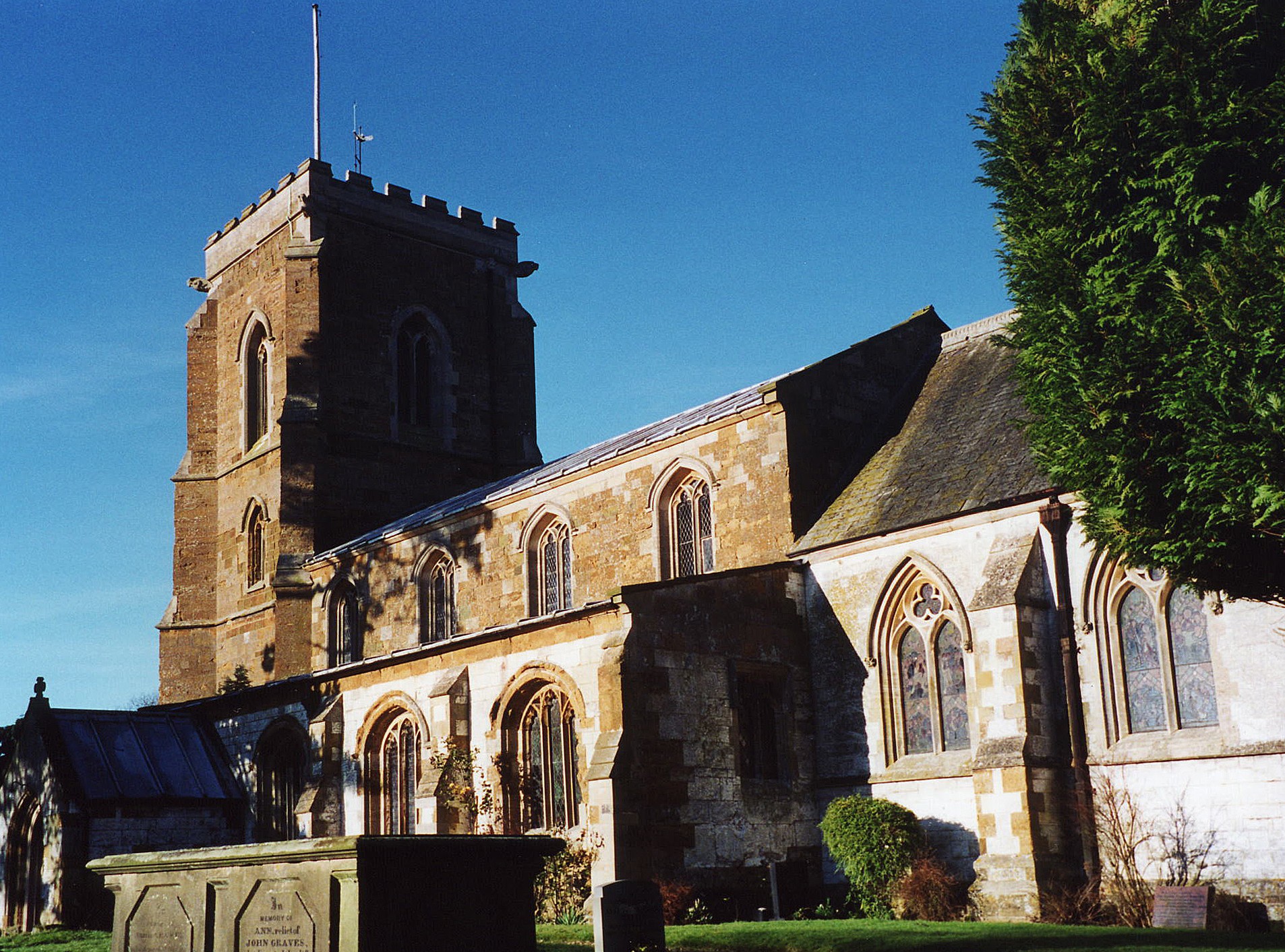
- Here is a photo of All Saints Church, taken by Ron COLE (who retains the copyright):
- The Anglican parish register dates from 1701 for baptisms and burials, and has marriages from 1755.
- The Lincolnshire FHS has published several Marriage indexes and a Burial index for the Louthesk Deanery to make your search easier.
- Kelly's 1913 Directory of Lincolnshire places the parish in the rural Ludborough Deanery.
- Check our Church Records page for county-wide resources.
- The parish was in the Louth sub-district of the Louth Registration District.
- Check our Civil Registration page for sources and background on Civil Registration which began in July, 1837.
South Elkington is a village and a parish 2.5 miles north-west of Louth, on the road to Market Rasen. Welton-le-Wold parish is to the south-west and Brackenborough parish to the north-east. The parish covers 2,660 acres (3,085 in 1912) and contains the hamlets of Ackthorpe and Coach Grange.
Locals refer to both North Elkington and South Elkington as "Elkington". If you are planning a visit:
- By automobile, take the A631 arterial road west out of Louth.
- Jonathan BILLINGER has a photograph of South Elkington on Geo-graph, taken in 2007.
- See our touring page for visitor services.
The National Gazetteer of Great Britain and Ireland - 1868
"ACKTHORPE, a hamlet in the parish of South Elkington and hundred of South Eske, in the county of Lincoln. It is situated on the Wolds, 2 miles to the W. of Louth."
"COACH-GRANGE, a hamlet in the parish of South Elkington, in the county of Lincoln, 2 miles W. of Louth."
- Ask for a calculation of the distance from South Elkington to another place.
- Elkington Hall, was the seat of the Rev. William SMYTH in 1871. The Hall was built of brick in 1842 in the Italian style.
- Thorpe Hall, originally built in 1584 by Sir John BOLLE, was once owned by James BIRCH, who mortgaged the hall in 1759. The mortgage was purchased by the Rev. William CHAPLIN, who bought the house in 1825. It was restored in the 1980s and still stands.
- A good book which details Thorpe Hall: "Lincolnshire County Houses & Their Families", by Terrence R. LEACH, 1980.
- See our Maps page for additional resources.
You can see maps centred on OS grid reference TF297884 (Lat/Lon: 53.37657, -0.051584), South Elkington which are provided by:
- OpenStreetMap
- Google Maps
- StreetMap (Current Ordnance Survey maps)
- Bing (was Multimap)
- Old Maps Online
- National Library of Scotland (Old Ordnance Survey maps)
- Vision of Britain (Click "Historical units & statistics" for administrative areas.)
- English Jurisdictions in 1851 (Unfortunately the LDS have removed the facility to enable us to specify a starting location, you will need to search yourself on their map.)
- Magic (Geographic information) (Click + on map if it doesn't show)
- GeoHack (Links to on-line maps and location specific services.)
- All places within the same township/parish shown on an Openstreetmap map.
- Nearby townships/parishes shown on an Openstreetmap map.
- Nearby places shown on an Openstreetmap map.
RAF South Elkington was a wireless telegraphy station in World War II. There was no airfield.
J. THOMAS has a photograph of the War Memorial on Geo-graph, taken in May, 2020.
Kate JEWELL has a photograph of the War Memorial on Geo-graph, taken in 2006.
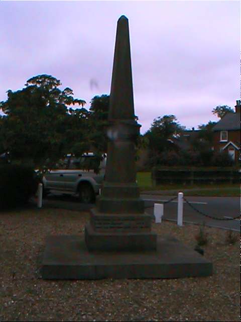
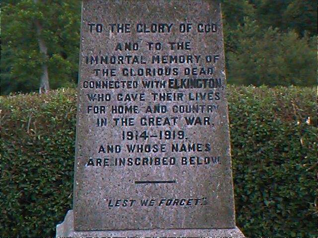
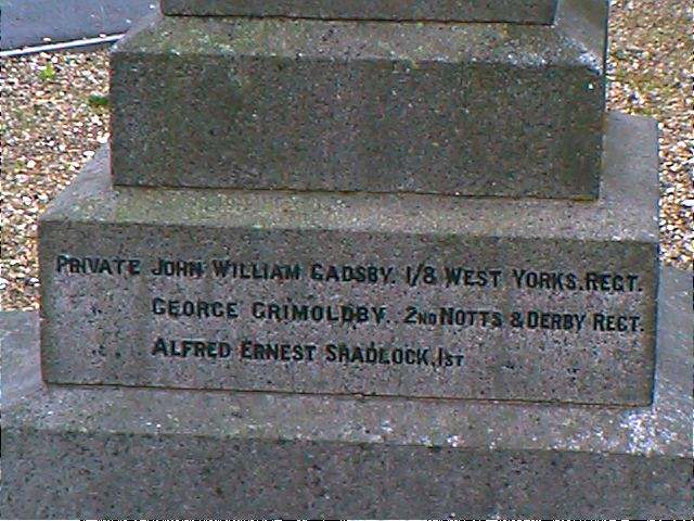
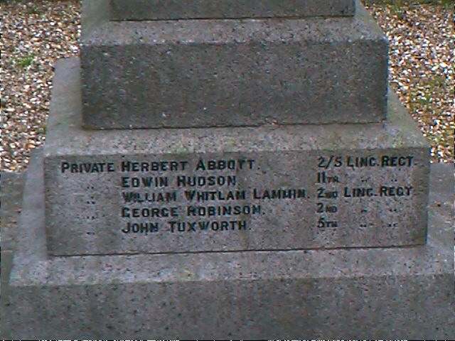
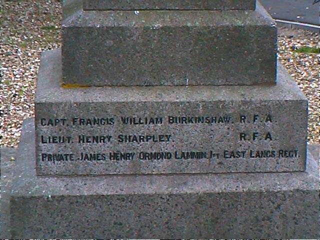
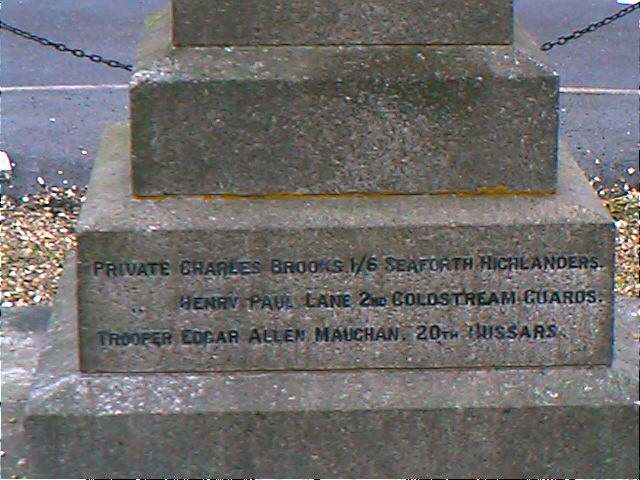
John EMERSON, who retains the copyright, provides these photographs of the war memorial at South Elkington:
Chris ? has a photograph of a Memorial Bench (to Capt. David Jones QLR) on Geo-graph, taken in November, 2012.
John EMERSON also supplies this list of names off of the memorial:
To the glory of God and to the immortal memory of the glorious dead connected with Elkington who gave their lives for home and country in the Great War 1914-1919 and whose names are inscribed below. Lest we forget.
| Rank | Name | Unit | Died | Notes |
|---|---|---|---|---|
| Capt | Francis William BURKINSHAW | R. F. A. | 30 Mar 1916 | |
| Lieut | Henry SHARPLEY | R. F. A. | 24 Mar 1918 | |
| Private | James Henry Ormond LAMMIN | 1st East Lancs Regt | 22 Mar 1918 | |
| Private | Charles BROOKS | 1/6 Seaforth Highlanders | 31 Mar 1918 | |
| Private | Henry Paul LANE | 2nd Coldstream Guards | 17 Dec 1916 | b |
| Trooper | Edgar Allen MAUGHAM | 20th Hussars | 21 Feb 1918 | |
| Private | John William GADSBY | 1/8 West Yorks Regt | 9 Oct 1917 | |
| Private | George GRIMOLDBY | 2nd Notts & Derby Regt | 1 Jul 1917 | |
| Private | Alfred Ernest SRADLOCK | 1st Notts & Derby Regt | 14 Apr 1917 | |
| Private | Herbert ABBOTT | 2/S Linc Regt | 21 Aug 1918 | |
| Private | Edwin HUDSON | 7 btln. Linc Regt | 12 Aug 1917 | |
| Private | William Whitlam LAMMIN | 2nd Linc Regt | 13 Mar 1915 | a |
| Private | George ROBINSON | 2nd Linc Regt | 16 Aug 1917 | |
| Private | John TUXWORTH | 5th Linc Regt | 29 Sep 1918 |
- Last name probably LAMMING
- Name should be Edward Paul LANE
- Ekwall's "Concise Oxford Dictionary of English Place-Names" (4th Edition, 1977), tells us that Elkington is mentioned in the 1086 Domesday Book: "Alchinton", and the name is cited in c1115 "Helchingtuna", 1205 "Northalkinton" and 1209 "Sudhelkinton".
- Acthorpe Top, a hamlet in the parish, is always pronounced "Agthorpe" by the locals.
- This place was an ancient parish in Lincolnshire and became a modern Civil Parish when those were established.
- You may contact the joint Elkington Parish Council regarding civic or political issues, but they can NOT do family history searches for you.
- The parish was in the Wold division (later: Marsh division) of the ancient Louth Eske Wapentake in the East Lindsey district in the parts of Lindsey.
- For today's district governance, see the East Lindsey District Council.
- Bastardy cases would be heard in the Louth petty session hearings every other Wednesday.
- After the Poor Law Amendment Act of 1834, this parish became part of the Louth Poor Law Union.
- A Public Elementary School (mixed) was built here in 1877 to serve both North and South Elkington. It could hold 128 children.
- See our Schools page for more information on researching school records.
