Hide
South Kyme
hide
Hide
hide
Hide
hide
Hide
Hide
[Transcribed from The National Gazetteer of Great Britain and Ireland 1868]
by Colin Hinson ©2020
Hide
- The parish was in the Heckington sub-district of the Sleaford Registration District.
- In an 1891 re-organization of the district, the parish was now allocated to the Billinghay sub-district of the Sleaford Registration District.
- Check our Census Resource page for county-wide resources.
- The table below gives census piece numbers, where known:
| Census Year | Piece No. |
|---|---|
| 1841 | H.O. 107 / 620 |
| 1861 | R.G. 9 / 2341 & 2345 |
| 1871 | R.G. 10 / 3347 & 3352 |
| 1891 | R.G. 12 / 2577 |
- In the 12th Century, around 1167, Philip de Kyme, Sheriff of Lincolnshire, founded a priory in South Kyme for Augustine Canons. It was dedicated to St. Mary.
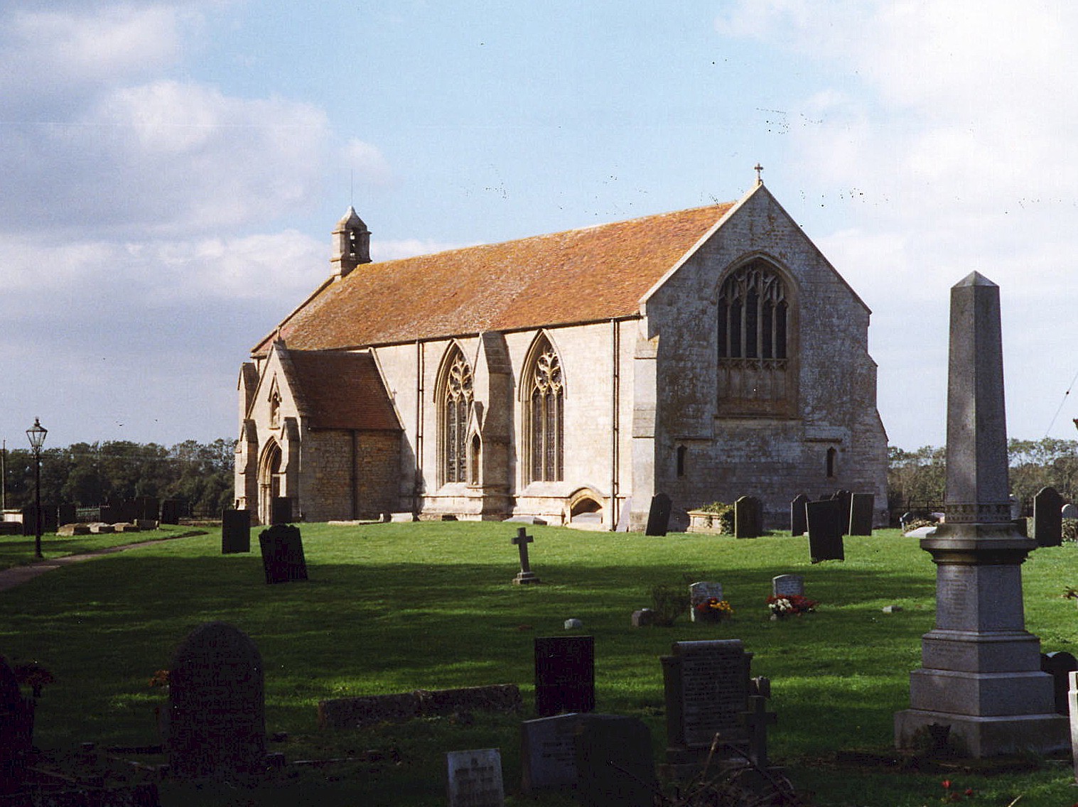
- The Anglican parish church in South Kyme is dedicated to St. Mary and All Saints and dates back to Norman times. It abuts the former priory. It was considerably rebuilt in 1805 and restored in 1890.
- Some sources give the parish church dedication as "St. Mary and All Angels."
- The church seats about 300.
- Here is a photo of St. Mary's Church, taken by Ron Cole (who retains the copyright):
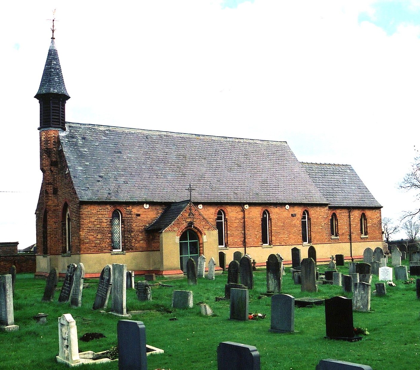
- The old church of North Kyme was pulled down at the Reformation. The new church, dedicated to St. Luke, was built in 1877 and seats about 250.
- There is a photograph of St. Luke's Church on the Wendy Parkinson Church Photos web site.
- Here is a photo of St. Luke's Church, taken by Ron Cole (who retains the copyright):
- South Kyme parish registers exist from 1654.
- North Kyme parish registers exist from 1877.
- The Lincolnshire FHS has a Loan Library service which has the parish registers on microfiche for Baptisms from 1654 to 1812 and Marriages from 1654 to 1812.
- The LFHS has published several marriage and burial indexes for the Lafford Deanery to make your search easier.
- Check our Church Records page for county-wide resources.
- The Wesleyan Methodists had a chapel at South Kyme, built in 1886. There was one also in North Kyme. Check our Non-Conformist Church Records page for additional resources.
- The parish was in the Heckington sub-district (until 1891) of the Sleaford Registration District.
- In an 1891 re-organization of the district, the parish was now allocated to the Billinghay sub-district of the Sleaford Registration District.
- Check our Civil Registration page for sources and background on Civil Registration which began in July 1837.
South Kyme is both a village and a parish. South Kyme is a parish consisting of the townships of North Kyme and South Kyme. The parish is about 10 miles east-northeast of Sleaford on the B1395 that runs south from Billinghay. It covers about 4,900 acres. The River Kyme, also called the Kyme Eau, flows through the parish to join the River Slea.
The village of South Kyme sits on both sides of the River Slea. North Kyme village is at the juntion of the A153 trunk road and the B1395, about 1.5 miles south of Billinghay. The Car Dyke passes through North Kyme. If you are planning a visit:
- See our touring page for more sources.
The National Gazetteer of Great Britain and Ireland - 1868
- Ask for a calculation of the distance from South Kyme to another place.
- The castle here, probably built by Robert de UMFRAVILLE around 1320, was torn down between 1720 and 1725.
- The last Baron KYME died in 1338 and the barony fell into abeyance. The manor and estates descended by marriage to the TALBOYS family.
- Smallpox is known to have visited the village in 1790 leaving several villagers deceased.
- A little hard to find, but useful, is the book: "South Kyme - The History of a Fenland Village," by Margaret Newton & Village Project Group, 1995, 200 pages. Published by Kyme Publications, The Old Rectory, South Kyme, Nr. Lincoln, LN4 4AB, UNITED KINGDOM. Cost was about £6 originally.
- See our "Maps" page for additional resources.
You can see maps centred on OS grid reference TF174497 (Lat/Lon: 53.031975, -0.250626), South Kyme which are provided by:
- OpenStreetMap
- Google Maps
- StreetMap (Current Ordnance Survey maps)
- Bing (was Multimap)
- Old Maps Online
- National Library of Scotland (Old Ordnance Survey maps)
- Vision of Britain (Click "Historical units & statistics" for administrative areas.)
- English Jurisdictions in 1851 (Unfortunately the LDS have removed the facility to enable us to specify a starting location, you will need to search yourself on their map.)
- Magic (Geographic information) (Click + on map if it doesn't show)
- GeoHack (Links to on-line maps and location specific services.)
- All places within the same township/parish shown on an Openstreetmap map.
- Nearby townships/parishes shown on an Openstreetmap map.
- Nearby places shown on an Openstreetmap map.
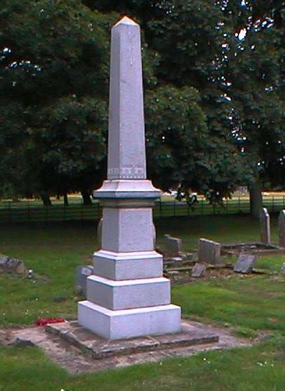
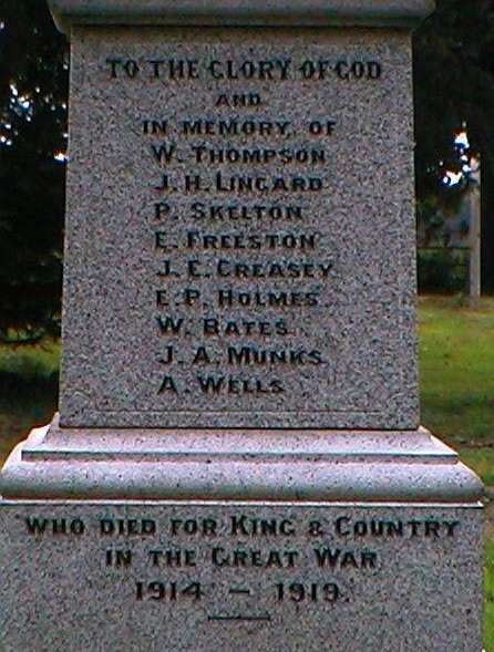
John Emerson, who retains the copyright, provides these photographs of the war memorial at South Kyme:
John Emerson, who retains the copyright, provides these photographs of the war memorial at North Kyme:
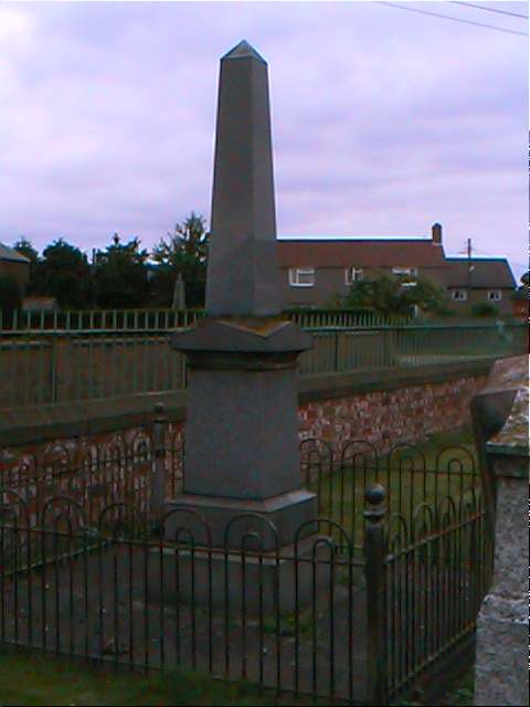
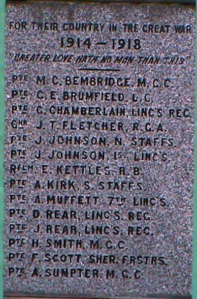
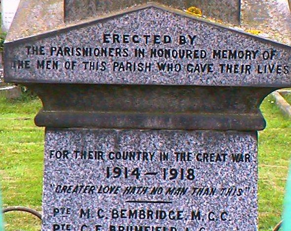
From the South Kyme War Memorial by John Emerson:
To the Glory of God and in memory of
| W. THOMPSON | E. FREESTON | W. BATES |
| J. H. LINGARD | J. E. CREASEY | J. A. MUNKS |
| P. SKELTON | E. P. HOLMES | A. WELLS |
Who died for King & Country in the Great War 1914-1919
We have a list of men, the rank and unit for North Kyme in a pop-up text file.
- The name derives from the Old English cymbe, meaning "(place at) the hollow". It appears as Chime in the 1086 Domesday Book.
[A. D. Mills, "A Dictionary of English Place-Names," Oxford University Press, 1991.]
- This place was an ancient parish in Lincoln county and became a modern Civil Parish when those were established.
- The parish was in the ancient Flaxwell Wapentake in the North Kesteven district in the parts of Kesteven.
- Due to boundary changes, South Kyme was also for a while in the ancient Aswardhurn Wapentake and North Kyme in the Langoe Wapentake.
- On 1 April, 1935, South Kyme Civil Parish transfered a 39 acre parcel in the Fens to Amber Hill Civil Parish.
- For today's district governance, see the North Kesteven District Council.
- Bastardy cases would be heard in the Sleaford petty session hearings every Monday.
- After the Poor Law Amendment Act reforms of 1834, the parish became part of the Sleaford Poor Law Union.
Year South
KymeNorth
Kyme1801 292 215 1841 581 361 1871 520 734 1881 530 ? 1891 456 636 1901 432 ? 1911 444 549 1921 424 ?
Chris ANDREW provides a transcript of the will of Joel ANDREW of South Kyme.
- A school was erected in South Kyme in 1843 to hold 100 children. Average attendance in 1911 was 84.
- A school was erected in North Kyme in 1866 to hold 110 children. Average attendance in 1911 was 60.
- For more on researching school records, see our Schools Research page.
