Hide
Usselby
hide
Hide
hide
Hide
hide
Hide
Hide
hide
Hide
[Transcribed from The National Gazetteer of Great Britain and Ireland 1868]
by Colin Hinson ©2020
Hide
The Caistor Library is an excellent resource with a Local History section and a Family History section.
Alternatively, you can use the Market Rasen Library as a resource, also.
- The parish was in the Market Rasen sub-district of the Caistor Registration District.
- Check our Census Resource page for county-wide resources.
- We have a partial 1901 Census extract for you to search and to add to with your own findings.
- The table below gives census piece numbers, where known:
| Census Year | Piece No. |
|---|---|
| 1841 | H.O. 107 / 647 |
| 1851 | H.O. 107 / 2115 |
| 1861 | R.G. 9 / 2395 |
| 1871 | R.G. 10 / 3425 |
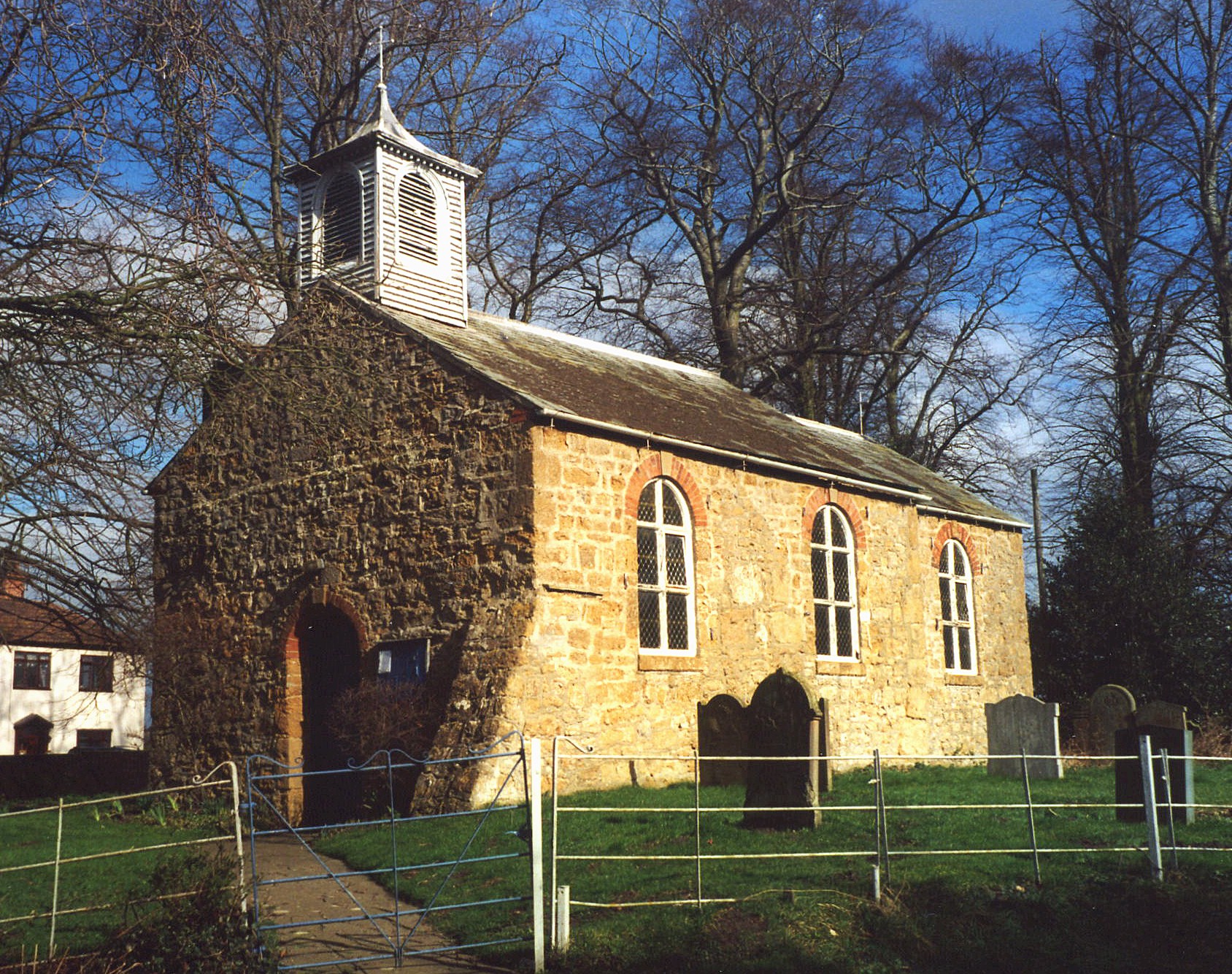
- The Anglican parish church is a small, stone structure dedicated to Saint Margaret.
- The church was originally built in the 14th century.
- The church was rebuilt in 1749.
- The church was restored in 1889.
- The church has a sundial on the south side.
- The church seats only 48.
- The church is a Grde II listed building with British Heritage.
- There is a photograph of St. Margaret's Church on the Wendy PARKINSON Church Photos web site.
- Richard CROFT has a photograph of St. Margaret's Church on Geo-graph, taken in February, 2006.
- Here is a photo of St. Margaret's Church, taken by Ron COLE (who retains the copyright):

- The Anglican parish register dates from 1564.
- The Family History Centre in London has the parish register from 1556 through 1742. These films are also held by the Lincolnshire Archives Office.
- The Family History Centre in London also has the Bishop's Transcripts from 1561 through 1831. These films are also held by the Lincolnshire Archives Office.
- The Lincolnshire FHS has published several marriage indexes and a burial index for the Westwold Deanery to make your search easier.
- Check our Church Records page for county-wide resources.
- The parish was in the Market Rasen sub-district of the Caistor Registration District.
- Check our Civil Registration page for sources and background on Civil Registration which began in July, 1837.
This village and parish in the south of Lincolnshire, 153 miles north of London, 5 miles south of Caistor and 3 miles north of Market Rasen, covers only about 850 acres.
If you are planning a visit:
- Railway service to the village ceased in 1960.
- Visit our touring page for more sources.
The National Gazetteer of Great Britain and Ireland - 1868
- Ask for a calculation of the distance from Usselby to another place.
- Usselby Hall was owned and lived in by Lord Tennyson's grandfather.
- Usselby Hall was occupied by Wm. BRACKENBURY in 1841.
- Usselby Hall now covers most of the site of Usselby deserted medieval village (DMV).
- You might like the 1906 inch-to-the-mile map of North East Lincolnshire.
- See our Maps page for additional resources.
You can see maps centred on OS grid reference TF094937 (Lat/Lon: 53.42856, -0.355167), Usselby which are provided by:
- OpenStreetMap
- Google Maps
- StreetMap (Current Ordnance Survey maps)
- Bing (was Multimap)
- Old Maps Online
- National Library of Scotland (Old Ordnance Survey maps)
- Vision of Britain (Click "Historical units & statistics" for administrative areas.)
- English Jurisdictions in 1851 (Unfortunately the LDS have removed the facility to enable us to specify a starting location, you will need to search yourself on their map.)
- Magic (Geographic information) (Click + on map if it doesn't show)
- GeoHack (Links to on-line maps and location specific services.)
- All places within the same township/parish shown on an Openstreetmap map.
- Nearby townships/parishes shown on an Openstreetmap map.
- Nearby places shown on an Openstreetmap map.
During the Second World War Usselby Hall was used as a German Officer Prisoner of War Camp (Camp 407).
There are earthworks of a former Second World War training camp at Usselby, visible on aerial photographs examined as part of the National Mapping Programme. The earthworks include the remains of what were thought to be gun emplacements, a firing range, and slit trenches.
Lieut. Commander John Lee MACHIN, Royal Navy, was killed in action on 24 May 1941 while serving on HMS Hood. He was born in Worksop, NTT, in 1902. His estate was probated in Nottingham, NTT, in May 1942. Margaet SIUDECK in the UK tells us that the family is listed in Retford. NTT, in 9121 where JOHN is listed as a Midshipman in the Rayal Navy.
.p/dai ein wuotes the "Yorkshire Post and Leeds Intelligencer" of 09 June 1941 p2: "MACHIN, john Lee- Killed in action in HMS Hood, May 24, 1941, aged 38 years, elder son of the late Mr. & Mrs. George Vessey V, Usselby Hall, Lincs., and beloved brother of Dollie & David V, and Kathleen CARTWRIGHT and Mary BREAY"
kathleen eliabeth MACHIN married thomas weeks CARTWRIGHT on 17 FEb 1930 in Usselby LIN. The CARTWIGHTS settled in Ragnall, DBY.
- This place was an ancient Chapelry for centuries in Lincoln county and became a modern Civil Parish shortly after those were established.
- The parish was in the ancient Walshcroft Wapentake in the West Lindsey district in the parts of Lindsey.
- Kelly's 1900 Direcoty of Lincolnshire places the parish in the East Lindsey district of the county.
- This Civil Parish was abolished in April, 1936, and all 853 acres amalgamated into Osgodby Civil Parish.
- Today's district governance is provided by the West Lindsey District Council.
- Bastardy cases would be heard on the 1st Tuesday each month at the Market Rasen petty session hearings.
- As a result of the 1834 Poor Law Amendment Act reforms, this parish became part of the Caistor Poor Law Union.
