Hide
Waltham
hide
Hide
hide
Hide
hide
Hide
Hide
hide
Hide
Waltham, small market town and par. with ry. sta., Lincolnshire, 4½ miles S. of Grimsby by rail and within its parliamentary limits, 2,464 ac., pop. 743; P.O., T.O. Market-day, Tuesday. Waltham Hall is a seat.
From: John BARTHOLOMEW's "Gazetteer of the British Isles (1887)"
Hide
Use the Grimsby Library as a resource.
- Brian CHESTER provides the All Saints Monument Index as a search aid.
- Mr. CHESTER also provides the Waltham Cemetery Index as a search aid.
| Ings Lane, Waltham, Cemetery |
- The parish was in the Great Grimsby sub-district of the Caistor Registration District.
- In 1890, with the restructuring of the Poor Law Unions, this parish became part of the Great Grimsby sub-district of the Grimsby Registration District.
- We have a handful of 1901 census surnames in a text file. Your additions are welcome.
- Check our Census Resource page for county-wide resources.
- The table below gives census piece numbers, where known:
| Census Year | Piece No. |
|---|---|
| 1841 | H.O. 107 / 648 |
| 1851 | H.O. 107 / 2113 |
| 1861 | R.G. 9 / 2390 |
| 1871 | R.G. 10 / 3416 |
| 1881 | R.G. 11 / 3274 |
| 1891 | R.G. 12 / 2620 |
| 1901 | R.G. 13 / 3097 |
- The Anglican parish church is dedicated to All Saints.
- The church dates back at least to 1420.
- The church was restored in 1867 and again in 1874.
- The church tower was rebuilt and restored in 1887.
- The church seats 300.
- There is a photograph of All Saints Church on the Wendy PARKINSON Church Photos web site.
- Allan CHAPMAN has a photograph of All Saints Church on Geo-graph, taken in March, 2008.
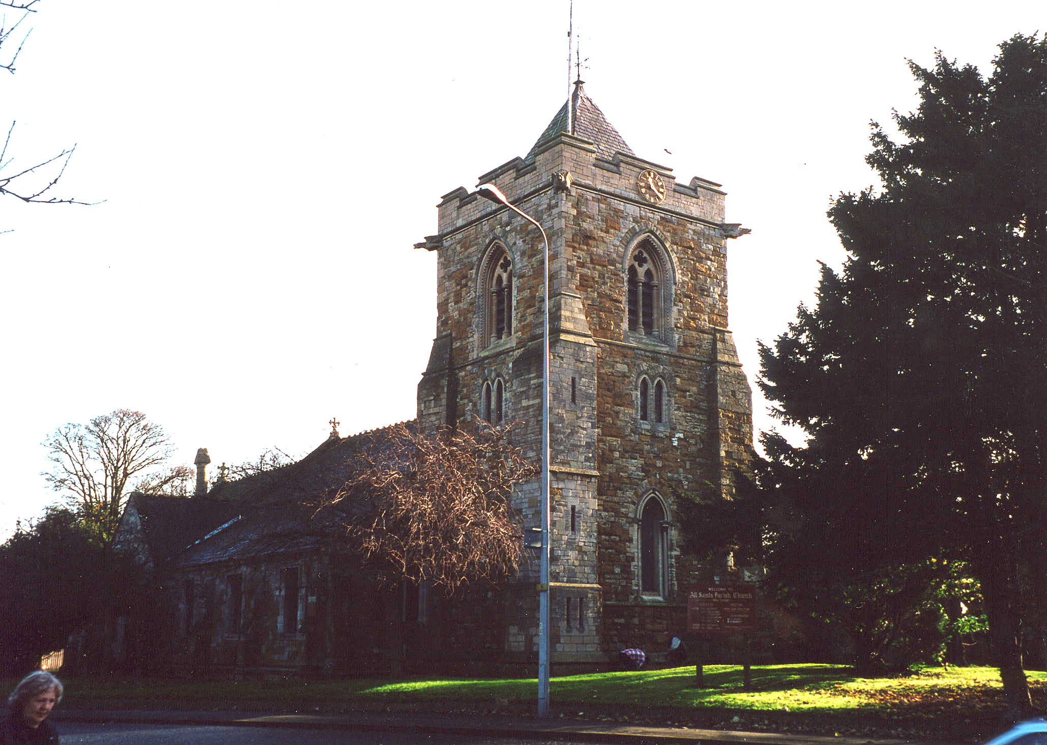
- Here is a photo of All Saints Church, taken by Ron COLE (who retains the copyright):

- Anglican parish registers date back to 1561.
- The Lincolnshire FHS has published several marriage indexes, a baptism and burial index and a 1641/2 Protestation Return for the Haverstoe Deanery to make your search easier.
- Kelly's 1900 Directory of Lincolnshire lists the parish, perhaps erroneously, as being in the rural deanery of Grimsby No. 2.
- The parish had non-conformist chapels. The Wesleyan Methodists and Primitive Methoodists had chapels prior to 1900. For information and assistance in researching these chapels, see our non-conformist religions page. (JB)
- Check our Church Records page for county-wide resources.
- The parish was in the Great Grimsby sub-district of the Caistor Registration District.
- In 1890, with the restructuring of the Poor Law Unions, this parish became part of the Great Grimsby sub-district of the Grimsby Registration District.
- Check our Civil Registration page for sources and background on Civil Registration which began in July, 1837.
Waltham is both a village and a parish located about 150 miles north of London and 3.5 miles south of Grimsby. Humberstone parish lies to the east and Scartho parish is to the north. The parish covers 1,709 acres.
If you are planning a visit:
- By automobile, take the A16 trunk road south from Grimsby. Turn off onto the B1203 arterial road and follow that about a mile into Waltham village.
- See our touring page for visitor services.
- Ask for a calculation of the distance from Waltham to another place.
- The Waltham Brick Company made bricks from local clay around 1900.
- By 1896, the village had a Temperance Hall that could hold 200 people.
- Alexander P. KAPP has a photograph of the King's Head Inn on Geo-graph, taken in June, 2008.
- The King's Head Public House was renovated in 2011 and modernized. Not everyone is happy with the loss of the old-style Pub, but it needed some work. These are the names associated with the place in various directories:
| Year | Proprietor |
|---|---|
| 1822 | Joseph HALL vict. |
| 1872 | George AUSTIN, vict. |
| 1882 | George AUSTIN, horse breaker & vict. |
| 1896 | William MOUNTAIN |
| 1900 | William MOUNTAIN |
| 1913 | William MOUNTAIN |
| 1930 | Charles MOUNTAIN |
William MOUNTAIN had been the Station Master in Waltham in the 1881 census. He was born in Laceby, LIN, around 1819. His wife Jane was with him in 1881.
- See our "Maps" page for additional resources.
You can see maps centred on OS grid reference TA262039 (Lat/Lon: 53.516583, -0.098276), Waltham which are provided by:
- OpenStreetMap
- Google Maps
- StreetMap (Current Ordnance Survey maps)
- Bing (was Multimap)
- Old Maps Online
- National Library of Scotland (Old Ordnance Survey maps)
- Vision of Britain (Click "Historical units & statistics" for administrative areas.)
- English Jurisdictions in 1851 (Unfortunately the LDS have removed the facility to enable us to specify a starting location, you will need to search yourself on their map.)
- Magic (Geographic information) (Click + on map if it doesn't show)
- GeoHack (Links to on-line maps and location specific services.)
- All places within the same township/parish shown on an Openstreetmap map.
- Nearby townships/parishes shown on an Openstreetmap map.
- Nearby places shown on an Openstreetmap map.
- In 1882, Major Peter Kerslake SEDDON of the 6th Lincolnshire Rifle Volunteers resided in Waltham grove. He was a British Subject, born in Lisbon, Portugal, circa 1836, and who was a timber merchant and farmer in his civilian life.
- There is a memorial window in the church to Lieut. Francis Cuthbert HORN. The window was added in 1920. Francis was born in Alford and went to school in Louth.
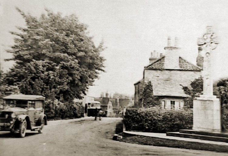
- Here is a photograph of the war memorial (on the right) that was erected in 1920 on Cheapside, at the crossroads of routes to Barnoldby-le-Beck, Brigsley, Holton-le-Clay and Waltham village, so it is visible to all who pass by. The Portland Stone, shining white in the sun, makes it difficult to miss. Contributed by John READMAN:

John Readman has also provided the names inscribed on the monument.
Joseph HILL, native of nearby Irby-on-Humber, died on HMS Sparrowhawk, a destroyer, at the Battle of Jutland in 1916. He is listed on the War Memorial above.
All the names on the War Memorial can be seen at the Roll-of-Honour website.
- This place was an ancient parish in Lincolnshire and became a modern Civil Parish when those were established.
- The parish was part of the ancient Bradley Haverstoe Wapentake in the Central Lindsey district in the parts of Lindsey.
- Kelly's 1900 Directory of Lincolnshire lists the parish, perhaps erroneously, as being in the North Lindsey division of the county.
- On 1 April, 1928, this parish was enlarged by 267 acres from the abolishment of Scartho Civil Parish.
- On 1 April, 1961, this parish was reduced in size by 724 acres to help create the New Waltham Civil Parish.
- District governance is provided by the North-East Lincolnshire Council.
- Bastardy cases would be heard in the Grimsby petty session hearings every other Thursday.
- After the 1834 Poor Law Amendment Act reforms the parish became part of the Caistor Poor Law Union.
- In April, 1897, this parish was transferred to the new Grimsby Poor Law Union.
- Waltham built a National public school here in 1868 on a site donated by Dr. PARKINSON of Ravendale. It had a clock tower and could hold 120 students, although average attendance in 1912 was only 50.
- The Wesleyan Methodists also built a school here in 1858 to hold 124 students, and average attendance in 1912 was 80.
- For more on researching school records, see our Schools Research page.
