
Hide
Welton le Wold
hide
Hide
hide
Hide
hide
Hide
Hide
hide
Hide
Hide
The Library at Louth will prove useful in your research.
- Richard CROFT has a photograph of St. Martin's Churchyard on Geo-graph, taken in September, 2019.
- The parish was in the Louth sub-district of the Louth Registration District.
- We have a 1901 census surname list for possible relatives. You are welcome to add your entries.
- Check our Census Resource page for county-wide resources.
- The table below gives census piece numbers where known.
Census
YearPiece No. 1851 H.O. 107 / 2111 1861 R.G. 9 / 2383 1871 R.G. 10 / 3404 1891 R.G. 12 / 2608 1901 R.G. 13 / 3084
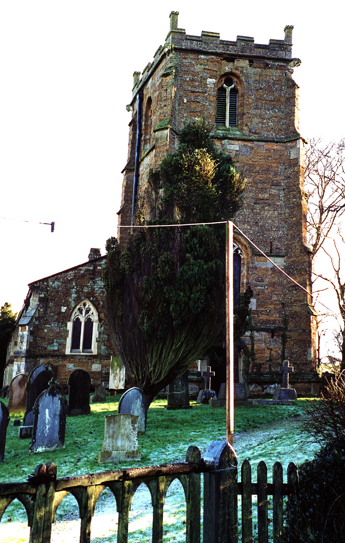
- The Anglican parish church is dedicated to St. Martin.
- The church appears to date from the 14th century.
- The church was repaired and enlarged in 1838.
- The church was rebuilt in 1850.
- The church seats 150 people.
- The church is a Grade II listed building with English Heritage.
- There is a photograph of St. Martin's church on the Wendy PARKINSON Church Photos web site.
- There is a photograph of the church interior at Geo-graph taken by Jonathan THACKER in April, 2011.
- Here is a photo of St. Martin's Church, taken by Ron COLE (who retains the copyright):
- The Anglican parish register dates from 1558.
- The Lincolnshire FHS has published several Marriage indexes and a Burial index for the Louthesk Deanery to make your search easier.
- The Wesleyan Methodists built a chapel here in 1835. The Primitive Methodists also had a chapel built some time later.
- For information and assistance in researching these chapels, see our non-conformist religions page.
- Check our Church Records page for county-wide resources.
- The parish was in the Louth sub-district of the Louth Registration District.
- Check our Civil Registration page for sources and background on Civil Registration which began in July, 1837.
Welton le Wold is a village and a parish just 3 miles west of Louth in Lincolnshire. The parish covers just over 2,600 acres.
The village is in the Lincolnshire Wolds. If you are planning a visit:
- By automobile, take the A157 trunk road west out of Louth for about 3 miles. The village is just to the north of the road.
- Colin PARK has a photograph of the Village Sign on Geo-graph, taken in September, 2013.
- The village is known for some fine springs nearby.
- Visit our touring page for more sources.
- Ask for a calculation of the distance from Welton le Wold to another place.
- Welton le Wold Quarry, just east of the village, has yeilded the bones of a straight-tusked elephant, red deer and horse, along with three flint handaxes, a worked flake. The handaxes appear to be from 424,000-374,000 years ago.
- Chris ? has a photograph of Fred WRIGHTS' old aerodrome hanger on Geo-graph, taken in January, 2013.
- In 1911, Captain William Henry SMYTH of Elkington Hall was one of the principal landowners in the parish. The other was the church rector.
- Welton Manor is a fairly modern mansion of white brick, built circa 1870.
- The Manor was unoccupied in 1913.
- See our Maps page for additional resources.
You can see maps centred on OS grid reference TF274875 (Lat/Lon: 53.368787, -0.087032), Welton le Wold which are provided by:
- OpenStreetMap
- Google Maps
- StreetMap (Current Ordnance Survey maps)
- Bing (was Multimap)
- Old Maps Online
- National Library of Scotland (Old Ordnance Survey maps)
- Vision of Britain (Click "Historical units & statistics" for administrative areas.)
- English Jurisdictions in 1851 (Unfortunately the LDS have removed the facility to enable us to specify a starting location, you will need to search yourself on their map.)
- Magic (Geographic information) (Click + on map if it doesn't show)
- GeoHack (Links to on-line maps and location specific services.)
- All places within the same township/parish shown on an Openstreetmap map.
- Nearby townships/parishes shown on an Openstreetmap map.
- Nearby places shown on an Openstreetmap map.
- This place was an ancient parish in Lincolnshire and became a modern Civil Parish when those were established.
- The parish was in the Wold Division of the ancient Louth Eske Wapentake in the East Lindsey district in the parts of Lindsey.
- You may contact the local Parish Council, but their website is under development (in 2021). They will NOT be able to assist you with family search questions.
- For today's district governance, see the East Lindsey District Council.
- Bastardy cases would be heard in the Louth petty session hearings every other Wednesday.
- After the Poor Law Amendment Act reforms of 1834, this parish became part of the Louth Poor Law Union.
- In 1860 a large National School was built by subscription, aided by government grants. This replaced the two schools built for boys and girls in 1839.
- There is a photograph of a former Boys' School at Geo-graph taken by Ian PATERSON in January, 2008.
- Chris ? has a photograph of the School on Geo-graph, taken in March, 2013.
- See our Schools page for more information on researching school records.