Hide
Worlaby
hide
Hide
hide
Hide
hide
Hide
Hide
hide
Hide
[Transcribed from The National Gazetteer of Great Britain and Ireland 1868]
by Colin Hinson ©2020
Hide
The Brigg Library is an excellent resource with a Local History section.
Neil THEASBY has a photograph of St. Clement's church graveyard on Geo-graph, taken in February, 2016.
- The parish was in the Brigg sub-district of the Glanford Brigg Registration District.
- We have a handful of 1901 census surnames in a text file. Your additions are welcome.
- Check our Census Resource page for county-wide resources.
| Census Year | Piece No. |
|---|---|
| 1841 | H.O. 107 / 650 |
| 1851 | H.O. 107 / 2116 |
| 1861 | R.G. 9 / 2399 |
| 1871 | R.G. 10 / 3430 |
| 1891 | R.G. 12 / 2626 |
| 1901 | R.G. 13 / 3101 |
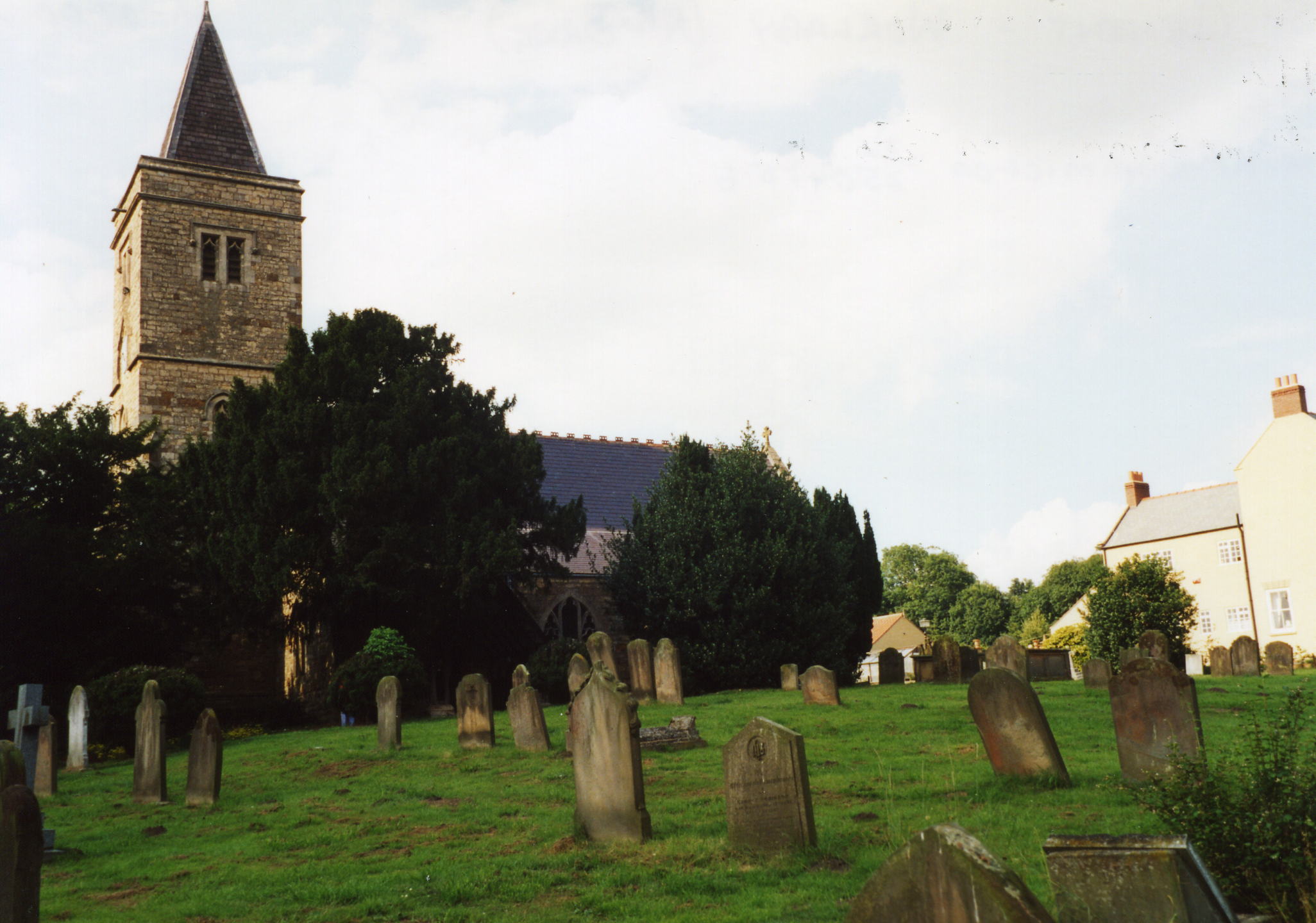
- The Anglican parish church is dedicated to Saint Clement.
- The church was rebuilt on the ancient site in 1873-77.
- The church appears to be of Saxon or early Norman origin.
- There is a photograph of the Anglican parish church on the Wendy PARKINSON Church Photos web site.
- Keith HAVERCROFT has a photograph of St. Clement's Church on Geo-graph, taken in February, 2006.
- Here is a photo of St. Clement's Church, taken by Ron COLE (who retains the copyright):

The Anglican parish register dates from 1559.
- The Lincolnshire FHS has published several marriage indexes and a burial index for the Yarborough Deanery to make your search easier.
- The Wesleyan Methodists built their chapel here in 1858.
- David WRIGHT provides a photograph of the Wesleyan Chapel on Geo-graph, taken in 2006.
- The Primitive Methodists built their chapel here in 1856. For information and assistance in researching these chapels, see our non-conformist religions page.
- Check our Church Records page for county-wide resources.
- The parish was in the Brigg sub-district of the Glanford Brigg Registration District.
- Check our Civil Registration page for sources and background on Civil Registration which began in July, 1837.
Worlaby is both a village and a parish in the far north of Lincolnshire, about 5 miles northeast of Glanford Brigg and 6 miles southwest of Barton. The parish covers about 3,300 acres.
If you are planning a visit:
- By automobile, take the B1204 Arterial Road north out of Elsham.
- David WRIGHT provides this photograph of Worlaby village on Geo-graph, taken in 2006.
- Check out our touring page.
The National Gazetteer of Great Britain and Ireland - 1868
"WORLABY-BY-ALFORD, (or Worlaby-nearlouth), a parish in the hundred of Hill, parts of Lindsey, county Lincoln, 7 miles N.E. of Horncastle, and 8 S. of Louth. It is situated on the Wolds, and comprises only one farm.
- Ask for a calculation of the distance from Worlaby to another place.
- In 1873 a drinking fountain was erected in the center of the village by Sir John Dugdale ASTLEY, baronet.
- Richard CROFT has a photograph of the drinking fountain on Geo-graph, taken in January, 2008.
- Paul GLAZZARD also has a photograph of the Drinking Fountain on Geo-graph, taken in May, 2008.
- In 1897 an oak tree was planted on the village green in commemoration of the Queen's Jubilee.
- Worlaby Hall was pulled down in 1807.
- David WRIGHT has a photograph of the new Worlaby Hall on Geo-graph, taken in June, 2010.
- See our Maps page for additional resources.
You can see maps centred on OS grid reference TA015140 (Lat/Lon: 53.612726, -0.467223), Worlaby which are provided by:
- OpenStreetMap
- Google Maps
- StreetMap (Current Ordnance Survey maps)
- Bing (was Multimap)
- Old Maps Online
- National Library of Scotland (Old Ordnance Survey maps)
- Vision of Britain (Click "Historical units & statistics" for administrative areas.)
- English Jurisdictions in 1851 (Unfortunately the LDS have removed the facility to enable us to specify a starting location, you will need to search yourself on their map.)
- Magic (Geographic information) (Click + on map if it doesn't show)
- GeoHack (Links to on-line maps and location specific services.)
- All places within the same township/parish shown on an Openstreetmap map.
- Nearby townships/parishes shown on an Openstreetmap map.
- Nearby places shown on an Openstreetmap map.
David WRIGHT has a photograph of the War Memorial at the Geo-graph site, taken in January, 2006.
Richard CROFT also has a photograph of the War Memorial on Geo-graph, taken in April, 2014.
There is a photograph of the memorial in Main Street and the names on it at the Roll of Honour site.
- This place was an ancient parish in Lincoln county and became a modern Civil Parish when those were established.
- The parish was in the ancient Yarborough Wapentake in the Glanford district in the parts of Lindsey.
- Kelly's 1900 Directory of Lincolnshire places the parish, perhaps erroneously, in the North Lindsey division of the county.
- You can contact the Worlaby Parish Council regarding civic or political issues, but they are NOT staffed or funded to help you with family history searches.
- District governance is provided by the North Lincolnshire Council.
- Bastardy cases would be heard in the Brigg petty session hearings.
- In 1663, John Lord Bellasye, Baron of Worlaby, built a hospital (almshouse) here for four poor women. The almshouse was still standing at last check.
- David WRIGHT provides this photograph of the Hospital on Geo-graph, taken in 2009.
- As a result of the 1834 Poor Law Amendment Act, the parish became part of the Glanford Brigg Poor Law Union.
- A Council School was erected in 1872 to hold 120 children. The school was enlarged in 1884.
- For more on researching school records, see our Schools Research page.
