
Hide
All Hallows Barking
hide
Hide
hide
Hide
Hide
Hide
"ALLHALLOWS, Barking, the church of, is situated at the east end of Tower-street, and the corner of Seething-lane. It receives its name as having been dedicated to all the Saints, formerly called All-Hallows, and from being before the Reformation a vicarage in the gift of the Abbess and Convent of Barking, in Essex. But on the dissolution of the monasteries the advowson was given to the Archbishop of Canterbury. It escaped the fire in 1666, and is of considerable extent, being one hundred and eighty feet long, sixty-seven broad and thirty-five high; it has a plain bell tower, with a well proportioned turret, about eighty feet in height from the ground. This church is of considerable antiquity, as appears from the circumstance of Richard the First having founded and endowed a chapel within its walls. Its present vicar is ihe Rev. S. J. Knight, who was instituted in 1783." [James Elmes. A Topographical Dictionary of London and its Environs (1831) - transcribed by Brian Randell]
Hide
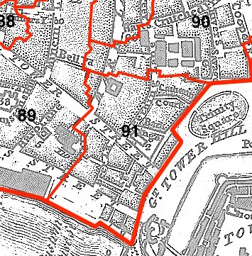
This parish - no. 91 in the above map - is located in Tower Ward.
The church was damaged in 1666, rebuilt in the 17thC, destroyed 1940, rebuilt 1948-1957.
Hide
London Metropolitan Archive holdings for All Hallows Barking.
The modern name of this parish is All Hallows by the Tower and All Hallows Barking by the Tower [according to LDS FamilySearch], hence the All Hallows by the Tower church website.
The "History and education" section on the church website provides information on the church's history..
The Lost City of London website has extensive material on the church.
Maskell, Joseph. All Hallows Barking ... London : A brief history. London : Parr, (c1888) 32pp.
Redstone, Lilian Jane. The Parish of All Hallows Barking, AMS Press (1971).
No non-Church of England denominations have been identified for All Hallows Barking [LDS FamilySearch Wiki].
Online Parish Register Images and Indexes for All Hallows Barking parish are provided by, or at various subscription sites via, the LDS FamilySearch wiki.
Wikipedia page on All Hallows Barking.
- Ask for a calculation of the distance from All Hallows Barking to another place.
Summary history of All Hallows Barking parish, from the Worshipful Company of Parish Clerks.
Public Houses, Inns & Taverns of the parish of All Hallows Barking - provides "information from census records, trade directories, etc."
1898 map of Allhallows Barking - illustration of the location covered, and of archive(s) holding a copy, provided by the Catalogue of British Town Maps.
You can see maps centred on OS grid reference TQ334807 (Lat/Lon: 51.509164, -0.07957), All Hallows Barking which are provided by:
- OpenStreetMap
- Google Maps
- StreetMap (Current Ordnance Survey maps)
- Bing (was Multimap)
- Old Maps Online
- National Library of Scotland (Old Ordnance Survey maps)
- Vision of Britain (Click "Historical units & statistics" for administrative areas.)
- English Jurisdictions in 1851 (Unfortunately the LDS have removed the facility to enable us to specify a starting location, you will need to search yourself on their map.)
- Magic (Geographic information) (Click + on map if it doesn't show)
- GeoHack (Links to on-line maps and location specific services.)
- All places within the same township/parish shown on an Openstreetmap map.
- Nearby townships/parishes shown on an Openstreetmap map.
- Nearby places shown on an Openstreetmap map.
Surnames from the 1881 census in the All Hallows Barking district.
Clerical career summaries for the parish of All Hallows Barking, from the Clergy of the Church of England Database website.
Sources for listings of taxpayer names for All Hallows Bread-street parish, listed on the LDS FamilySearch wiki.