
Hide
St Martin Vintry
hide
Hide
hide
Hide
Hide
Hide
"ST. MARTIN VINTRY, the church of, stood near the south corner of Queen-street, Upper Thames-street, and derived its addition from its situation in the Vintry the ancient mart of the vintners or wine-tunners, wine-merchants and coopers; but sharing the fate of the city in the dreadful fire of 1666, the parish was united to that of St. Michael Royal, College-hill, by act of parliament." [James Elmes. A Topographical Dictionary of London and its Environs (1831) - transcribed by Brian Randell]
Hide
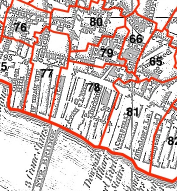
This parish - no. 78 in the above map - is located in Vintry Ward.
The church was destroyed in 1666 and not rebuilt.
The parish was later united with St Michael Paternoster Royal 1670.
Hide
London Metropolitan Archive holdings for St Martin Vintry.
Online Parish Register Images and Indexes for St Martin Vintry parish are provided by, or at various subscription sites via, the LDS FamilySearch wiki.
Independent/Congregational is the only identified non-Church of England denomination in St Michael Royal with St Martin Vintry [LDS FamilySearch Wiki].
Wikipedia page on St Martin Vintry.
- Ask for a calculation of the distance from St Martin Vintry to another place.
Summary history of St Martin Vintry parish, from the Worshipful Company of Parish Clerks.
Public Houses, Inns & Taverns of the parish of St Martin Vintry
Plan of the Parish of St Martin Vintry in 1818 from COLLAGE, the London Picture Archive.
You can see maps centred on OS grid reference TQ325808 (Lat/Lon: 51.51044, -0.092252), St Martin Vintry which are provided by:
- OpenStreetMap
- Google Maps
- StreetMap (Current Ordnance Survey maps)
- Bing (was Multimap)
- Old Maps Online
- National Library of Scotland (Old Ordnance Survey maps)
- Vision of Britain (Click "Historical units & statistics" for administrative areas.)
- English Jurisdictions in 1851 (Unfortunately the LDS have removed the facility to enable us to specify a starting location, you will need to search yourself on their map.)
- Magic (Geographic information) (Click + on map if it doesn't show)
- GeoHack (Links to on-line maps and location specific services.)
- All places within the same township/parish shown on an Openstreetmap map.
- Nearby townships/parishes shown on an Openstreetmap map.
- Nearby places shown on an Openstreetmap map.
Surnames from the 1881 census in the S t Martin Vintry and St Martin Vintry London districts.
Sources for listings of taxpayer names for St Martin Vintry parish, listed on the LDS FamilySearch wiki.