
Hide
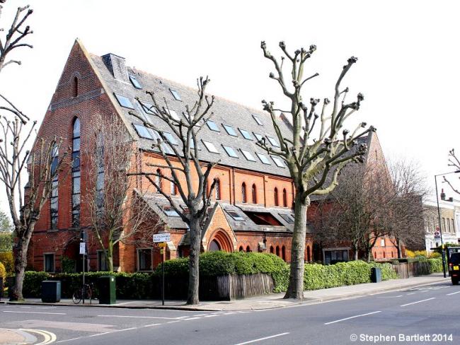
St Mary, Stamford Brook, Church of England
hide
Hide
Hide
St Mary,
Stamford Brook Road,
Stamford Brook
Stamford Brook Road,
Stamford Brook
Hide
It was founded in 1888. It closed in 1982.
Founded 1888. Closed 1982 and parish merged with St Saviour Stamford Brook. Converted into flats.
It was located near TQ218791 (Lat/Lon 51.497674, -0.246731). You can see this on maps provided by:
- OpenStreetMap
- Google Maps
- StreetMap (Current Ordnance Survey maps)
- Bing (was Multimap)
- Old Maps Online
- National Library of Scotland (Old Ordnance Survey maps)
- Vision of Britain (Click "Historical units & statistics" for administrative areas.)
- English Jurisdictions in 1851 (Unfortunately the LDS have removed the facility to enable us to specify a starting location, you will need to search yourself on their map.)
- Magic (Geographic information) (Click + on map if it doesn't show)
- GeoHack (Links to on-line maps and location specific services.)