
Hide
Outline map of parishes of Hampstead, Middlesex in 1903
hide
Hide
Click on a parish name for alphabetical list of parishes - a fuller description of the parish, with its grid reference and link to a modern street map will be added later. For clearer display or print, see map in pdf format.
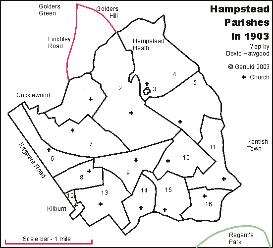
Parish boundaries traced from "A map of the Ecclesiastical Divisions within the County of London, 1903" published by Edward Stanford of London, reprinted as a facsimile by the London Topographical Society. List from that map is of parishes within the rural deanery of Hampstead in 1903; they were all sub-divisions of the historic parish of Hampstead. They were in the Archdeaconry of London, and Diocese of London. We have a list of other deaneries.
Map and list by David Hawgood. ©2003, page modified 15 Feb 2004