
Hide
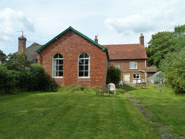
Wisborough Green Chapel (Zoar Chapel), Wisborough Green, Evangelical
hide
Hide
© Copyright Robin Webster and licensed for reuse under this Creative Commons Licence.
Hide
Wisborough Green Chapel (Zoar Chapel),
Petworth Road,
Wisborough Green
Petworth Road,
Wisborough Green
Hide
The present building dates from 1920. Originally built for the Baptists, the church is now used by an Evangelical congregation.
It is located at TQ0477325858 (Lat/Lon 51.022558, -0.507523). You can see this on maps provided by:
- OpenStreetMap
- Google Maps
- StreetMap (Current Ordnance Survey maps)
- Bing (was Multimap)
- Old Maps Online
- National Library of Scotland (Old Ordnance Survey maps)
- Vision of Britain (Click "Historical units & statistics" for administrative areas.)
- English Jurisdictions in 1851 (Unfortunately the LDS have removed the facility to enable us to specify a starting location, you will need to search yourself on their map.)
- Magic (Geographic information) (Click + on map if it doesn't show)
- GeoHack (Links to on-line maps and location specific services.)