Hide
Ambleside
hide
Hide
hide
Hide

Hide
Hide
"Ambleside, from the similitude of the name, is supposed by Camden to have been the Amboglana in the Itinerary. But anciently it was written Hamelside, which hath not so much resemblance to the word Amboglana, but may seem rather to have been derived from the name of the owner. Ambleside is all within the manor of Windermere, but only part of it within the parish. All below the Stock is in the parish of Windermere; above the Stock, in the parish of Gresmere. In that part which is in Gresmere, stands the chapel, endowed by the inhabitants, and made parochial... in 1675."
[Nicolson and Burn: History and antiquities of the counties of Westmorland and Cumberland. 1777. Transcribed by A Nichols.]
Hide
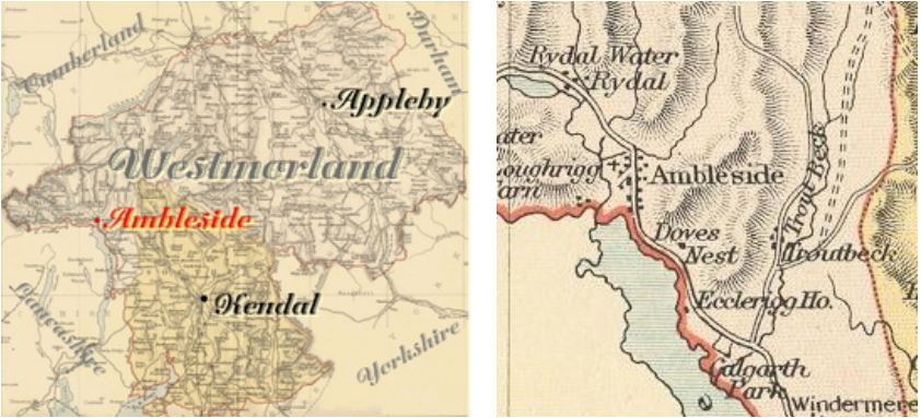
Ambleside is a parish in Kendal Ward. Formerly a township in Windermere parish.
Hide
Returns do not survive for the 'census' of 1787.
Census returns are available from the usual sources for 1841-1911.
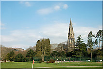
 | St Mary. Church of England. 1850-4 by Sir G G Scott. Impressive spire. Stained glass windows to Wordsworth, Matthew Arnold and W E Forster. This and other photographs on Geograph site Historical and architectural notes on National Heritage List (English Heritage). Church plans (1850-54) from ICBS archive on Church Plans Online . Photograph(s) and description on VisitCumbria site. Access and contact details on Church of England site |
Parish Registers and Bishop's Transcripts are held by Cumbria Archives :
originals at Kendal RO and microfilm copies at Carlisle RO.
| Baptism registers | 1642-1977 |
| Marriage registers | 1680-1973 |
| Banns registers | 1835-1966 |
| Burial registers | 1675-1959 |
| Bishops transcripts | 1795-1876 |
Search the CASCAT online catalogue for information on these and other parish records..
For searching on LDS familysearch.org see IGI batch numbers (compiled by Jake Prescott)
or use the batch number search site (by Hugh Wallis).
The University of Leicester History, Directory & Gazetteer of Cumberland & Westmorland, 1829
- Ask for a calculation of the distance from Ambleside to another place.
Magna Britannica et Hibernia.Volume 6: Westmorland by Thomas Cox (Vicar of Bromfield, Essex) 45 pages, printed in 1731. Transcription by Sarah Reveley, Joan Fisher and Lisl Schoenwald. (Rootsweb Westmorland Listmembers) (c) 2003
"AMBLESIDE, a small Market-Town, situate on the upper End of the Lake, known by the Name of Winandermere, whose Market is weekly on Wednesday, and Fair yearly on (blank). It was antiently a large City, as appears, not only from the many Ruins of the Walls, and from the Rubbish of old Buildings still to be seen without the Walls. The Romans had a Fort here of an oblong Figure, fortified with a Ditch and Rampire, in Length an Hundred and thirty-two Ells, and in Breadth eighty. That it was a work of the Romans, not Saxons or Danes, is evident from the British Bricks and Mortar tempered with small Pieces of Brick. To which, if we add, that little Urns, glass Vials, and Roman Coins are commonly met with here, together with round Stones like Mill stones (of which, being sodered together, they used of old to make Pillars) and paved Ways leading to it, we have Proofs beyond Contradiction. But the old Name is quite lost, unless we may infer from the Name Ambleside, that it was the Amboglana, mentioned in the Notitia, where the Cohers prima Ælia Dacorum had their Quarters; but against that Conjecture it is said,
1. That the Notitia places it ad Lineam Valli, which, if we interpret of the Line or Track of the Picts Wall itself, it is not possible it should be meant of this Place; but if we suppose it to signify (as it may well) the Line of Communication, which several Auxiliaries had with those who were quartered upon the Picts Wall, our Opinion may be reconcilable enough with the Notitia. But some farther object,
2. That it is beyond all Doubt, that the Cohors prima Ælia Dacorum was quartered at Williford in Cumberland, as appears by several Inscriptions, which have been found at a little Distance from it (which see in Cumberland). But to this it may be answered, there was at Williford (or rather at the Bank-End) A Fort assigned for that Cohort, when they were called out upon extraordinary Occasions to defend the Picts Wall; but Ambleside was their chief Station or standing Quarters, of which this is a good Argument, that many Pieces of Roman Antiquities have been found here, about the old Works, viz. several Medals of Gold, Silver, and Copper, some of which are in the Collection, which Mr. Thomas Brathwaite of Ambleside gave by Deed, dated Novemb. 26. 1674, to the Library at the University of Oxford.
A small Mile North of the Town stands Ridal-Hall, a convenient and large, but antient House; and in the Manor is a very high Mountain called Ridal-Head, from the Top of which there is so large a Prospect, that in a clear Day, Lancaster-Castle and much farther may be seen. The Manor antiently belonged to the Family of Lancaster, to whom it defended from the Brus's of Skelton, by the Marriage of Margaret de Brus, one of the Coheirs of Peter de Brus, with Roger de Lancaster; for he & Edw. I procured a Grant and Confirmation of the Forest of Ridal, which his Wife had before made over to him, which proves 'twas her Inheritance. From the Family of Lancaster it passed to that of Plaiz by the female Heir 8 Edw. III. And from them by the Howards to the Flemmings in the Reign of King Hen. IV. Who had seen Lords of it ever since. Sir Daniel Flemming, a Lover of antient Learning, was of this Family, who was very helpful to the late Editors of the Britannia, in giving them several useful Informations in this County and Lancashire."
Records relating to the Barony of Kendale, CWAAS, William Farrer & JF. Curwen (editors) available on British History Online (also Supplementary Records for Ambleside and Troutbeck)
Cumbria County History Trust has published a "Jubilee Digest" for the township of Ambleside
You can see maps centred on OS grid reference NY387061 (Lat/Lon: 54.446567, -2.946766), Ambleside which are provided by:
- OpenStreetMap
- Google Maps
- StreetMap (Current Ordnance Survey maps)
- Bing (was Multimap)
- Old Maps Online
- National Library of Scotland (Old Ordnance Survey maps)
- Vision of Britain (Click "Historical units & statistics" for administrative areas.)
- English Jurisdictions in 1851 (Unfortunately the LDS have removed the facility to enable us to specify a starting location, you will need to search yourself on their map.)
- Magic (Geographic information) (Click + on map if it doesn't show)
- GeoHack (Links to on-line maps and location specific services.)
- All places within the same township/parish shown on an Openstreetmap map.
- Nearby townships/parishes shown on an Openstreetmap map.
- Nearby places shown on an Openstreetmap map.
Wills for Ambleside will be at Carlisle since about 1858 but before that will be at the Preston R.O as it was in the Diocese of Chester until that time.
Hearth Tax records for 1674 Ambleside transcribed on Edenlinks.
