Hide
Great Asby
hide
Hide
hide
Hide

Hide
Hide
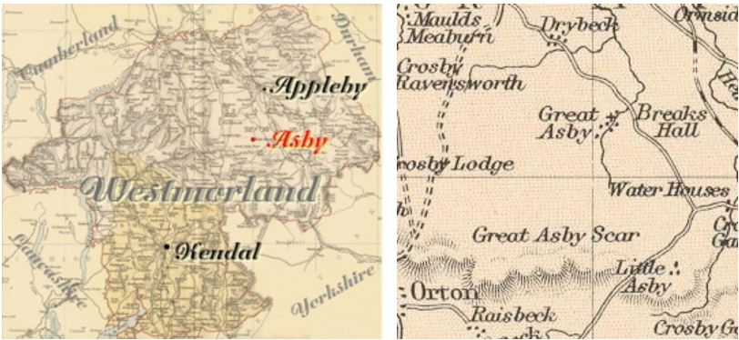
"ASBY, a parish in EAST ward, county of WESTMORLAND, 4 miles (S. by W.) from Appleby, comprising the townships of Asby-Coatsforth, Little Asby, and Asby-Winderwath, and containing 421 inhabitants. The living is a rectory, in the archdeaconry and diocese of Carlisle, rated in the king's books at £23. 13. 4., and in the patronage of Sir F. F. Vane, Bart. The church, dedicated to St. Peter, is a small ancient edifice. A chapel, dedicated to St. Leonard, formerly stood at Little Asby. The parish is bounded on the south by Crosby Garret and Orton fells, and is intersected by numerous rivulets, on the margin of one of which, in a hollow called Asby Gill, is Pate Hole, a remarkable cavern, one thousand yards in depth, through which runs a small stream. "
[From Samuel Lewis A Topographical Dictionary of England (1831) - copyright Mel Lockie 2016]
Hide
M.I.s for Asby were transcribed in Monumental Inscriptions of Westmorland by E. Bellasis 1888-89 and are available on Westmorland Papers.
Returns do not survive for the 'census' of 1787.
Census returns are available from the usual sources for 1841-1911.
Transcript and index for 1851 has been published by the Cumbria Family History Society and also in 'North Westmorland - An Index to the 1851 Census' compiled by David Lowis and Barbara Slack.
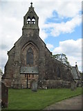
 | St Peter Grey stone church of 1866 by Messrs Hay This and other photographs are on Geograph site |
Parish Registers and Bishop's Transcripts are held by Cumbria Archives :
originals at Kendal RO and microfilm copies at Carlisle RO.
| Baptism registers | 1657-1979 |
| Marriage registers | 1657-1971 |
| Banns registers | - |
| Burial registers | 1657-1939 |
| Bishops transcripts | 1662-1874 |
See the CASCAT online calogue for WPR1 for information on these and other parish records..
For searching on LDS familysearch.org see IGI batch numbers (compiled by Jake Prescott)
or use the batch number search site (by Hugh Wallis).
Nicolson and Burn: The history and antiquities of the counties of Westmorland and Cumberland. 1777. Transcribed by Anne Nichols.
"Asby was anciently written Askeby, probably from the same origin as Askham...
This parish is bounded on the East by the parishes of Ormshead, Warcop, and Crosby Garret; on the South, by the parishes of Crosby Garret and Orton; on the West, by the parish of Crosby Ravensworth; and on the North, by the parishes of Crosby Ravensworth and St. Laurence Appleby: And contains about 72 families, all of the church of England.
The church is dedicated to St. Peter; and is a rectory: in the patronage of Walter Fletcher of Hutton in the Forest in the county of Cumberland esquire. The church of Asby is an ancient building, with three bells.
It seemeth that anciently all the Askebys (which now make three distinct manors) were one undivided entire manor. Afterwards, the same became distinguished into Little Asby and Great Asby. Little Asby seems to have originally been the principal place; for in ancient writings we sometimes find it styles Old Askeby (Askeby Vetus) .
Great Asby became again divided into moieties, Askeby Wynanderwath and Askeby Cotesford. There is a Winanderwath in the parish of Cliburn, and Winandermere in the barony of Kendal. But from whence any of them derive their name, we have not certainly found; most likely, from the name of the owner. Asby Cotesford .. had its name of distinction evidently from the owner. At Little Asby was a chapel, dedicated to St. Leonard.
Garthorne... seems to have belonged to the hospital of St. Leonard's York... a small part of it is in the manor of Crosby Ravensworth."
The University of Leicester History, Directory & Gazetteer of Cumberland & Westmorland, 1829
- Ask for a calculation of the distance from Great Asby to another place.
The Later Records relating to North Westmorland by John F. Curwen (1932) on British History Online
Cumbria County History Trust has published a "Jubilee Digest" for the township of Asby
You can see maps centred on OS grid reference NY679115 (Lat/Lon: 54.497958, -2.496525), Great Asby which are provided by:
- OpenStreetMap
- Google Maps
- StreetMap (Current Ordnance Survey maps)
- Bing (was Multimap)
- Old Maps Online
- National Library of Scotland (Old Ordnance Survey maps)
- Vision of Britain (Click "Historical units & statistics" for administrative areas.)
- English Jurisdictions in 1851 (Unfortunately the LDS have removed the facility to enable us to specify a starting location, you will need to search yourself on their map.)
- Magic (Geographic information) (Click + on map if it doesn't show)
- GeoHack (Links to on-line maps and location specific services.)
- All places within the same township/parish shown on an Openstreetmap map.
- Nearby townships/parishes shown on an Openstreetmap map.
- Nearby places shown on an Openstreetmap map.
Hearth Tax records for 1674 Little Asby transcribed on Edenlinks.
Hearth Tax records for 1674 Asby Coatforth transcribed on Edenlinks.
Hearth Tax records for 1674 Asby Winderwath transcribed on Edenlinks.
Window Tax records for 1777 Asby Coatsforth & Little transcribed on Edenlinks.
Window Tax records for 1777 Asby Winderwath transcribed on Edenlinks.
