Hide
Beetham
hide
Hide
hide
Hide

Hide
Hide
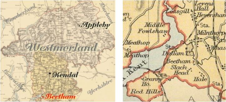
"BEETHAM, a parish in KENDAL ward, county of WESTMORLAND, comprising the chapelry of Witherslack, and the townships of Beetham, Farleton, Haverbrack, and Methop with Ulpha, and containing 1618 inhabitants, of which number, 830 are in the township of Beetham, 3 miles (N.W. by W.) from Burton in Kendal. The living is a discharged vicarage, in the archdeaconry of Richmond, and diocese of Chester, rated in the king's books at £13. 7. 4., endowed with £400 private benefaction, and £400 royal bounty, and in the patronage of the King, as Duke of Lancaster. The church is dedicated to St. Michael. This mountainous parish is situated at the south-western extremity of the county, on both sides of the estuary of the river Kent, which is navigable for small craft as far as the hamlet of Storth, and on the shore of which are two wharfs, where slate and other articles are shipped for various ports on the western coast."
[From Samuel Lewis A Topographical Dictionary of England (1831) - copyright Mel Lockie 2016]
Hide
Arnside later became a parish in its own right (but does not have its own page on this site)
Hide
M.I.s for Beetham were transcribed in Monumental Inscriptions of Westmorland by E. Bellasis 1888-89 and are available on Westmorland Papers.
Returns do not survive for the 'census' of 1787.
Census returns are available from the usual sources for 1841-1911.

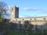
| St Michael Norman S arcade. Late C12th W off-set tower but with C16th bell-stage. Historical and architectural notes on National Heritage List (English Heritage site). History and description on Wikipedia. Photograph(s) and description on VisitCumbria. Access and contact details on Church of England site More details and maps in Genuki Westmorland Church Database |

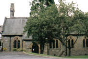
| St James, Arnside 1866. By Miles Thompson. Enlarged 1905 and 1914. Church plans (1863-66) from ICBS archive) on Church Plans Online (Lambeth Palace Library). VisitCumbria. Access and contact details on Church of England site. More details and maps in Genuki Westmorland Church Database |
Parish Registers and Bishop's Transcripts are held by Cumbria Archives :
originals at Kendal RO and microfilm copies at Carlisle RO.
| Beetham WPR43 | Arnside WPR39 | |
| Baptism registers | 1604-1858 | 1866-1934 |
| Marriage registers | 1604-1923 | 1873-1968 |
| Banns registers | 1754-1946 | 1889-1986 |
| Burial registers | 1604-1892 | |
| Bishops transcripts | 1689-1870 |
See the CASCAT online calogue for WPR43 for information on these and other parish records..
See the CASCAT online calogue for WPR39 for information on these and other parish records.
For searching on LDS familysearch.org see IGI batch numbers (compiled by Jake Prescott)
or use the batch number search site (by Hugh Wallis).
Nicolson and Burn: The history and antiquities of the counties of Westmorland and Cumberland. 1777. Transcribed by Anne Nichols.
"Betham seems to have had its name from the river Betha, which runs through the village, and so by Milnthorp into the sea; as much as to say, the hamlet or village on the river Betha. This river is now called Bela, by corruption as it seemeth; for in Mr. Machel's account it is invariably written Betha, without any imtimation of its having any other name. And Mr. Leland who travelled through this country in the reign of king Henry the eighth, says, "By Bytham runneth Byth water, a pretty river." And especially, in a grant of landss and other possessions to the priory of Conishead (as hereafter mentioned), it is expressly called the water of Betha.
Sometimes the name of the place is written Bethom; in which respect it may be understood to signify the holme ground adjoining the river.
This parish is bounded on the East by the parish of Burton (indeed it runs almost quite through and intersects the said parish of Burton, which part is called Farleton); on the South, by the parish of Warton in the county of Lancaster; on the West, by the sea; on the North-west by the parish of Cartmell in the said county of Lancaster; and on the North, by the parish of Heversham.
The church, according to Mr. Machel's account, is dedicated to St. Leoth or Lyth, otherwise called Lioba or Liobgytha; but according to Mr. Brown Willis it is dedicated to St. Michael. It is a vicarage, in the patronage of the crown, and in the presentation (under the crown) of the chancellor of the duchy of Lancaster. In the parish of Betham there are three divisions (exclusive of Witherslack) which seem anciently to have been all one manor or lordship, to wit, Betham, Haverbrack, and Farleton. ...Witherslack, Methop and Ulva, are included within a peninsula (as it were) between Winster beck, Brigsteer moss, and the Sands... by reason of their great distance from the parish church, a chapel was anciently erected... ... consecrated in the year 1671, by the name of the chapel of St. Paul."
The University of Leicester History, Directory & Gazetteer of Cumberland & Westmorland, 1829
- Ask for a calculation of the distance from Beetham to another place.
Records relating to the Barony of Kendale, CWAAS, William Farrer & John F. Curwen (editors) on British History Online for:
- Beetham & Supplementary Records - Beetham
- Haverbrack and Arnside & Supplementary Records - Haverbrack and Arnside
- Farleton & Supplementary Records - Farleton
Cumbria County History Trust has published a "Jubilee Digest" for the township of Beetham , Arnside, Haverbrack , Meathop and Ulpha and Farleton.
Magna Britannica et Hibernia.Volume 6: Westmorland by Thomas Cox 45 pages, printed in 1731. Transcription by S Reveley, J Fisher and L Schoenwald.
"Betham, a small Village-standing near the River Can, famous only for a Catadupa or Waterfall, made by the Waters tumbling Headlong from an higher Ground, with an hideous Noise. The Neighbours form a Prognostication of the Weather from it thus: When the Noise of it sounds clear, they are sure of Rain and Mists. There is another Waterfall in this River at Levens, a Village lying above this Northward, of which in its Place: The Earl of Derby hath a Seat here, called Betham-Castle."
You can see maps centred on OS grid reference SD490790 (Lat/Lon: 54.204046, -2.783301), Beetham which are provided by:
- OpenStreetMap
- Google Maps
- StreetMap (Current Ordnance Survey maps)
- Bing (was Multimap)
- Old Maps Online
- National Library of Scotland (Old Ordnance Survey maps)
- Vision of Britain (Click "Historical units & statistics" for administrative areas.)
- English Jurisdictions in 1851 (Unfortunately the LDS have removed the facility to enable us to specify a starting location, you will need to search yourself on their map.)
- Magic (Geographic information) (Click + on map if it doesn't show)
- GeoHack (Links to on-line maps and location specific services.)
- All places within the same township/parish shown on an Openstreetmap map.
- Nearby townships/parishes shown on an Openstreetmap map.
- Nearby places shown on an Openstreetmap map.
Wills for Beetham will be at Carlisle since about 1858 but before that will be at the Preston R.O. as it was in the Diocese of Chester until that time.
Hearth Tax records for 1674 Beetham transcribed on Edenlinks.
Hearth Tax records for 1674 Farleton (Beetham) transcribed on Edenlinks
