Hide
Bolton
hide
Hide
hide
Hide

Hide
Hide
"BOLTON, a chapelry in the parish of MORLAND, WEST ward, county of WESTMORLAND, 4 miles (N W. by W.) from Appleby, containing 445 inhabitants. The living is a perpetual curacy, in the archdeaconry and diocese of Carlisle, endowed with £400 private benefaction, and £600 royal bounty, and in the patronage of the Landowners. The chapel is dedicated to All Saints, and a grant of £100 was lately assigned by the Incorporated Society for the enlargement of churches and chapels for its re-erection on a more extended plan. A meeting-house for the Methodists was built in 1818. A free school for the instruction of fourteen children is endowed with £14. 10. per annum, being the produce of various benefactions, and is under the control of eleven trustees: the school-room was built by subscription. In 1816, a chain bridge, thirty yards in length, was constructed across the Eden, about a mile north of the village, at the expense of the landowners."
[From Samuel Lewis A Topographical Dictionary of England (1831) - copyright Mel Lockie 2016]
Hide
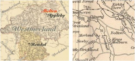
Bolton is a parish in the West Ward of the county adjacent to Cliburn, Temple Sowerby, Appleby and Morland.
It was formerly part of the parish of Morland.
Hide
Returns survive for the 'census' of 1787 and are held at the Kendal Record Office of Cumbria Archives Service. The Record Office reference is WQ/SP/C. They are transcribed in Vital Statistics published by Curwen Archives Trust 1992. ISBN 1897590008. The returns for Bolton are transcribed on EdenLinks.
Census returns are available from the usual sources for 1841-1911.
Transcript and index for 1851 has been published by the Cumbria Family History Society and also in 'North Westmorland - An Index to the 1851 Census' compiled by David Lowis and Barbara Slack.
| Bolton, Wesleyan Methodist |

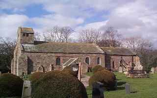
| All Saints Norman doorways and sculpture. Additions of C17 and 18th. C14th effigy. Historical and architectural notes on National Heritage List (English Heritage site). Photograph(s) and description on VisitCumbria. Access and contact details on Church of England site More details and maps in Genuki Westmorland Church Database |
Parish Registers and Bishop's Transcripts are held by Cumbria Archives :
originals at Kendal RO and microfilm copies at Carlisle RO.
| Baptism registers | 1647-1878 |
| Marriage registers | 1647-1971 |
| Banns registers | 1754-1899 |
| Burial registers | 1647-1951 |
| Bishops transcripts | 1665-1879 |
See the CASCAT online calogue for WPR25 for information on these and other parish records..
For searching on LDS familysearch.org see IGI batch numbers (compiled by Jake Prescott)
or use the batch number search site (by Hugh Wallis).
Nicolson and Burn: The history and antiquities of the counties of Westmorland and Cumberland. 1777.
"Bolton was variously written in ancient times; as Boelthun, Boeltun, Bovelthun, Botheltun: From all which may be conjectured that it received its name from the owner, Bothel, Bovel, Boel, or the like. Bovel, and Bolt, are names yet in use in Westmorland."
The University of Leicester History, Directory & Gazetteer of Cumberland & Westmorland, 1829
- Ask for a calculation of the distance from Bolton to another place.
There is a dissertation deposited at Kendal Record Office:
Bolton in Westmorland - an Eden Valley Community 18th. and early 19th centuries.Derek Longmire University of Lancaster Certificate in Local History. 1999.
The name Bolton is perhaps derived from O.E. botl-tun - dwelling enclosure, collection of houses, village.
Cumbria County History Trust has published a "Jubilee Digest" for the township of Bolton
You can see maps centred on OS grid reference NY627235 (Lat/Lon: 54.605321, -2.578879), Bolton which are provided by:
- OpenStreetMap
- Google Maps
- StreetMap (Current Ordnance Survey maps)
- Bing (was Multimap)
- Old Maps Online
- National Library of Scotland (Old Ordnance Survey maps)
- Vision of Britain (Click "Historical units & statistics" for administrative areas.)
- English Jurisdictions in 1851 (Unfortunately the LDS have removed the facility to enable us to specify a starting location, you will need to search yourself on their map.)
- Magic (Geographic information) (Click + on map if it doesn't show)
- GeoHack (Links to on-line maps and location specific services.)
- All places within the same township/parish shown on an Openstreetmap map.
- Nearby townships/parishes shown on an Openstreetmap map.
- Nearby places shown on an Openstreetmap map.
Bolton is in the diocese of Carlisle and wills will be in Carlisle Record Office.
