Hide
Firbank
hide
Hide
hide
Hide

Hide
Hide
"FIRBANK, a chapelry in the parish of KIRKBYLONSDALE, LONSDALE ward, county of WESTMORLAND, 10 miles (N.) from Kirkby-Lonsdale, containing 209 inhabitants. The living is a perpetual curacy, in fee archdeaconry of Richmond, and diocese of Chester, endowed with £200 private benefaction, and £600 royal bounty, and in the patronage of the Vicar of Kirkby Lonsdale. The chapel and burying-ground are on the edge of an extensive moor. The chapelry is bounded on the west by the river Lune, which separates it from Yorkshire."
[From Samuel Lewis A Topographical Dictionary of England (1831) - copyright Mel Lockie 2016]
Hide
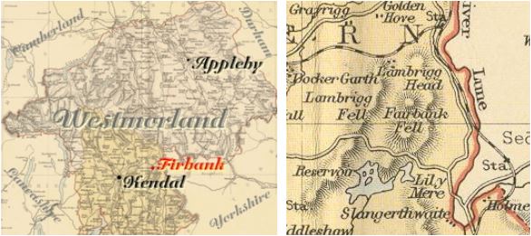
Firbank is a parish in Lonsdale Ward in the South East of the county. It adjoins the West Riding of Yorkshire.
It was formerly part of Kirkby Lonsdale parish. Other nearby parishes are Killington, Old Hutton, New Hutton and Greyrigg.
Hide
Returns do not survive for the 'census' of 1787.
Census returns are available from the usual sources for 1841-1911.

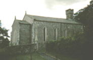
| St John Evangelist 1842 by Bateman. Nave and short chancel. Photograph(s) and description on VisitCumbria. More details and maps in Genuki Westmorland Church Database |
Parish Registers and Bishop's Transcripts are held by Cumbria Archives :
originals at Kendal RO and microfilm copies at Carlisle RO.
| Baptism registers | 1746-1812 |
| Marriage registers | 1746-1969 |
| Banns registers | 1757-1801 |
| Burial registers | 1756-1810 |
| Bishops transcripts | 1813-1867 |
See the CASCAT online calogue for WPR32 for information on these and other parish records..
For searching on LDS familysearch.org see IGI batch numbers (compiled by Jake Prescott)
or use the batch number search site (by Hugh Wallis).
The University of Leicester History, Directory & Gazetteer of Cumberland & Westmorland, 1829
- Ask for a calculation of the distance from Firbank to another place.
Cumbria County History Trust has published a "Jubilee Digest" for the township of Firbank
You can see maps centred on OS grid reference SD615945 (Lat/Lon: 54.344777, -2.594286), Firbank which are provided by:
- OpenStreetMap
- Google Maps
- StreetMap (Current Ordnance Survey maps)
- Bing (was Multimap)
- Old Maps Online
- National Library of Scotland (Old Ordnance Survey maps)
- Vision of Britain (Click "Historical units & statistics" for administrative areas.)
- English Jurisdictions in 1851 (Unfortunately the LDS have removed the facility to enable us to specify a starting location, you will need to search yourself on their map.)
- Magic (Geographic information) (Click + on map if it doesn't show)
- GeoHack (Links to on-line maps and location specific services.)
- All places within the same township/parish shown on an Openstreetmap map.
- Nearby townships/parishes shown on an Openstreetmap map.
- Nearby places shown on an Openstreetmap map.
Wills for Firbank will be at Carlisle since about 1858 but before that will be at the Preston R.O. as it was in the Diocese of Chester until that time.
Hearth Tax records for 1674 Firbank transcribed on Edenlinks.
