Hide
Hutton Roof
hide
Hide
hide
Hide

Hide
Hide
"HUTTON-ROOF, a chapelry in the parish of KIRKBY-LONSDALE, LONSDALE ward, county of WESTMORLAND, 3 miles (W. by S.) from Kirkby-Lonsdale, containing, with the hamlet of Newbiggin, 257 inhabitants. The living is a perpetual curacy, in the archdeaconry of Richmond, and diocese of Chester, endowed with £200 -rivate benefaction, and £800 royal bounty, and in the patronage of the Vicar of Kirkby-Lonsdale. The chapel, a small edifice, was built in 1757. A school-room was erected by subscription in 1773, and endowed by Thomas Chamney with £100; the income is £ 10 per annum. Here are several quarries of limestone. (1831)."
[From Samuel Lewis A Topographical Dictionary of England (1831) - copyright Mel Lockie 2016]
Hide
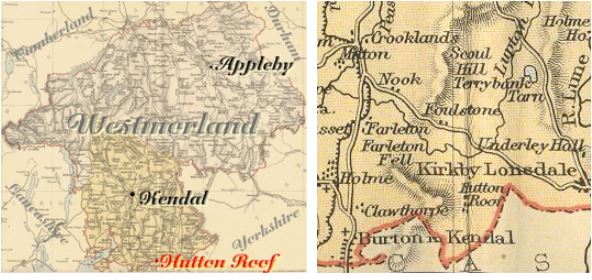
Hutton Roof is a parish in Lonsdale Ward in the very South of the county bordering on Lancashire.
It was formerly part of Kirkby Lonsdale parish.
Nearby parishes are Home, Burton in Kendal and Mansergh.
Hide
Returns do not survive for the 'census' of 1787.
Census returns are available from the usual sources for 1841-1911.
| Hutton Roof, Wesleyan Methodist |
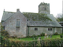
| St John 1881-2 Paley & Austin. Bellcote from earlier church of 1757 in vicarage garden. This and other photographs are on Geograph site. Historical and architectural notes on National Heritage List (English Heritage site). Church plans (1877-81) from ICBS archive on Church Plans Online (Lambeth Palace Library). Photograph(s) and description on VisitCumbria. Access and contact details on Church of England site. |
Parish Registers and Bishop's Transcripts are held by Cumbria Archives :
originals at Kendal RO and microfilm copies at Carlisle RO.
| Baptism registers | 1813-1879 |
| Marriage registers | 1799-1975 |
| Banns registers | - |
| Burial registers | - |
| Bishops transcripts | 1813-1871 |
See the CASCAT online calogue for WPR21 for information on these and other parish records.
For searching on LDS familysearch.org see IGIbatch numbers (compiled by Jake Prescott) or use the batch number search site (by Hugh Wallis).
Baptisms for 1813-1879 and marriages for 1796-1900 are indexed on the LDS Vital Records CD-ROM.
The University of Leicester History, Directory & Gazetteer of Cumberland & Westmorland, 1829
- Ask for a calculation of the distance from Hutton Roof to another place.
Cumbria County History Trust has published a "Jubilee Digest" for the township of Hutton Roof.
You can see maps centred on OS grid reference SD565783 (Lat/Lon: 54.198532, -2.668565), Hutton Roof which are provided by:
- OpenStreetMap
- Google Maps
- StreetMap (Current Ordnance Survey maps)
- Bing (was Multimap)
- Old Maps Online
- National Library of Scotland (Old Ordnance Survey maps)
- Vision of Britain (Click "Historical units & statistics" for administrative areas.)
- English Jurisdictions in 1851 (Unfortunately the LDS have removed the facility to enable us to specify a starting location, you will need to search yourself on their map.)
- Magic (Geographic information) (Click + on map if it doesn't show)
- GeoHack (Links to on-line maps and location specific services.)
- All places within the same township/parish shown on an Openstreetmap map.
- Nearby townships/parishes shown on an Openstreetmap map.
- Nearby places shown on an Openstreetmap map.
Wills for Hutton Roof will be at Carlisle since about 1858 but before that will be at the Preston R.O. as it was in the Diocese of Chester until that time.
Hearth Tax records for 1674 Hutton Roof transcribed on Edenlinks.

