Hide
Levens
hide
Hide
hide
Hide

Hide
Hide
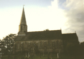
"LEVENS, a chapelry partly in the parish of HEVERSHAM, and partly in that of KENDAL, KENDAL ward, county of WESTMORLAND, 5 miles (S. S. W.) from Kendal, containing, with Beathwaite-Green, Sizergh- Fell-side, and part of Brigsteer, 760 inhabitants. A handsome chapel, with a low tower surmounted by an octagonal spire, was erected, in 1828, at an expense of £2000, defrayed by the Hon. Fulk Greville Howard, who also built the parsonage-house; he appoints the minister, and allows him an annual stipend of £200. A school for forty poor girls was established, in 1810, by Lady Howard, who pays for! their education, and partly clothes them. Another school was erected, in 1825, by Colonel Howard, and is supported at his expense; it is conducted on the Madras system, and is attended by about one hundred and forty children."
[From Samuel Lewis A Topographical Dictionary of England (1831) - copyright Mel Lockie 2016]
Hide
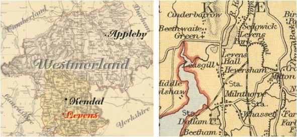
Levens is a parish in Kendal Ward. It was formerly in Heversham parish.
Nearby parishes include Witherslack, Crosthwaite, Helsington, Natland and Crosscrake.
Levens was Lefuenes in the Domesday Book.
Hide
Returns do not survive for the 'census' of 1787.
Census returns are available from the usual sources for 1841-1911.

| St John the Evangelist Photograph(s) and description on VisitCumbria. Other photographs are on the Geograph site. Access and contact details on Church of England site More details and maps in Genuki Westmorland Church Database |
Parish Registers and Bishop's Transcripts are held by Cumbria Archives :
originals at Kendal RO and microfilm copies at Carlisle RO.
| Baptism registers | 1836-1924 |
| Marriage registers | 1868-1979 |
| Banns registers | 1868-1923 |
| Burial registers | - |
| Bishops transcripts | 1865-1912 |
See the CASCAT online calogue for WPR98 for information on these and other parish records..
For searching on LDS familysearch.org see IGI batch numbers (compiled by Jake Prescott)
or use the batch number search site (by Hugh Wallis).
Beathwaite Green Wesleyan Chapel register for births and baptisms 1797-1835 is at Kendal Record Office and at Public Record Office, London.
The University of Leicester History, Directory & Gazetteer of Cumberland & Westmorland, 1829
- Ask for a calculation of the distance from Levens to another place.
Magna Britannica et Hibernia.Volume 6: Westmorland by T Cox 1731.
"Levens, where there is another Catadupa, or Water-fall of the River Can, from which is a Conjecture of fair Weather made, as is said at Betham, that doth of Rain and Mists.
Here is also a fair Bridge over the River Can, or Kent.
Records relating to the Barony of Kendale, CWAAS, William Farrer & John F. Curwen (editors) are available on British History Online (also Supplementary Records)
Cumbria County History Trust has published a "Jubilee Digest" for the township of Levens
Levens History Project data is available from Levens History Group website
You can see maps centred on OS grid reference SD487865 (Lat/Lon: 54.271852, -2.788703), Levens which are provided by:
- OpenStreetMap
- Google Maps
- StreetMap (Current Ordnance Survey maps)
- Bing (was Multimap)
- Old Maps Online
- National Library of Scotland (Old Ordnance Survey maps)
- Vision of Britain (Click "Historical units & statistics" for administrative areas.)
- English Jurisdictions in 1851 (Unfortunately the LDS have removed the facility to enable us to specify a starting location, you will need to search yourself on their map.)
- Magic (Geographic information) (Click + on map if it doesn't show)
- GeoHack (Links to on-line maps and location specific services.)
- All places within the same township/parish shown on an Openstreetmap map.
- Nearby townships/parishes shown on an Openstreetmap map.
- Nearby places shown on an Openstreetmap map.
Wills for Levens will be at Carlisle since about 1858 but before that will be at the Preston R.O. as it was in the Diocese of Chester until that time.
Hearth Tax records for 1674 Levens transcribed on Edenlinks.
