
Hide
Staveley
hide
Hide
hide
Hide
Hide
Hide
"Staveley and Hugill... Having now advanced to the furthest extremity of the parish towards the north-west, we turn southwards to Staveley and Hugill. Staveley and Hugill are bounded on the east by Long Sleddale, being divided therefrom by the ridge of Potter Fell; on the south by Underbarrow, being divided by the top of Ratherhead; on the west by Crook, being divided by the ridge of Brackenthwait Fell; and on the north by Kentmere, being divided by Blackbeck which runs by Milrigg. The chapel of Staveley is a fair building, with a handsome steeple and three good bells. To what saint it was dedicated is not certain: From the inscription on one of the bells, it seems to have been St. Margaret. Staveley and Hugill were originally one chapelry. But afterwards a separate chapel was erected at Ings in Hugill, so called from a long Ing or watery meadow, at the head of which it stands. As Grasgarth there was anciently a chapel called St. Anne's, about a quarter of a mile north-west from the present chapel of Ings."
[Nicolson and Burn: The history and antiquities of the counties of Westmorland and Cumberland. 1777. Transcribed by Anne Nichols.]
Hide
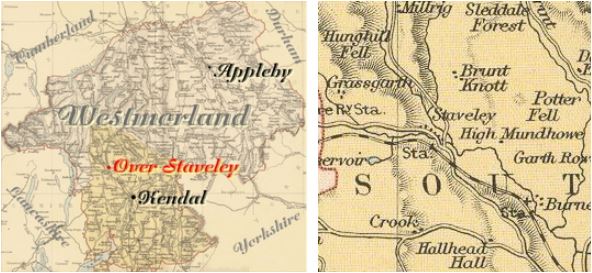
Staveley (or Over Staveley) is a parish in Kendal Ward. It was formerly in Kendal parish.
The parishes of Hugill, Kentmere, Long Sleddale, Burnside and Crook are nearby.
Hide
Returns do not survive for the 'census' of 1787.
Census returns are available from the usual sources for 1841-1911.
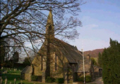
| St James 1864-5. By Crowther. Church plans from ICBS archive on Church Plans Online (Lambeth Palace Library). |
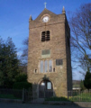
| St Margaret Church tower of 1388 only remains. Historical and architectural notes on National Heritage Register (English Heritage site). Photograph(s) and description on VisitCumbria. Access and contact details on Church of England site. More details and maps in Genuki Westmorland Church Database |
Parish Registers and Bishop's Transcripts are held by Cumbria Archives :
originals at Kendal RO and microfilm copies at Carlisle RO.
| Baptism registers | 1651-1943 |
| Marriage registers | 1651-1935 |
| Banns registers | 1756-1977 |
| Burial registers | 1651-1959 |
| Bishops transcripts | 1756-1857 |
See the CASCAT online calogue for WPR68 for information on these and other parish records..
For searching on LDS familysearch.org see IGI batch numbers (compiled by Jake Prescott)
or use the batch number search site (by Hugh Wallis).
The University of Leicester History, Directory & Gazetteer of Cumberland & Westmorland, 1829
- Ask for a calculation of the distance from Staveley to another place.
Records relating to the Barony of Kendale, CWAAS, William Farrer & John F. Curwen (editors) are available on British History Online (also Supplementary Records)
Cumbria County History Trust has published a "Jubilee Digest" for the township of Staveley, Over
You can see maps centred on OS grid reference SD463991 (Lat/Lon: 54.38479, -2.828363), Staveley which are provided by:
- OpenStreetMap
- Google Maps
- StreetMap (Current Ordnance Survey maps)
- Bing (was Multimap)
- Old Maps Online
- National Library of Scotland (Old Ordnance Survey maps)
- Vision of Britain (Click "Historical units & statistics" for administrative areas.)
- English Jurisdictions in 1851 (Unfortunately the LDS have removed the facility to enable us to specify a starting location, you will need to search yourself on their map.)
- Magic (Geographic information) (Click + on map if it doesn't show)
- GeoHack (Links to on-line maps and location specific services.)
- All places within the same township/parish shown on an Openstreetmap map.
- Nearby townships/parishes shown on an Openstreetmap map.
- Nearby places shown on an Openstreetmap map.
Wills for Staveley will be at Carlisle since about 1858 but before that will be at the Preston R.O. as it was in the Diocese of Chester until that time.
Hearth Tax records for 1674 Upper Staveley transcribed on Edenlinks.
Hearth Tax records for 1674 Nether Staveley transcribed on Edenlinks.