Hide
Underbarrow
hide
Hide
hide
Hide

Hide
Hide
"Underbarrow and Bradley Field... This is the last division that remains to be spoken of in the parish of Kendal. Underbarrow hath its name from its situation under the barrow, hill, or scar, which extends from north to south all along in this division. That part which is called Bradley Field received its denomination from a family of the name of Bradley, which came from Bradley in Lancashire. There was an ancient chapel at this place [Underbarrow]. In the year 1708, this chapel was rebuilt at the expence of the inhabitants of Underbarrow only (for Bradley Field is not in the chapelry). "
[Nicolson and Burn: History and antiquities of the counties of Westmorland and Cumberland. 1777.]
Hide
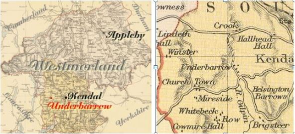
Underbarrow is a parish in Kendal Ward. It was formerly included in the extremely large Kendal parish.
The adjacent parishes are Crook, Winster, Crosthwaite and Helsington.
Hide
Returns do not survive for the 'census' of 1787.
Census returns are available from the usual sources for 1841-1911.

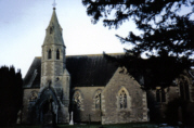
| All Saints |
Parish Registers and Bishop's Transcripts are held by Cumbria Archives :
originals at Kendal RO and microfilm copies at Carlisle RO.
| Baptism registers | 1735-1868 |
| Marriage registers | 1735-1975 |
| Banns registers | 1755-1918 |
| Burial registers | 1821-1925 |
| Bishops transcripts | 1813-1865 |
See the CASCAT online calogue for WPR26 for information on these and other parish records..
For searching on LDS familysearch see IGIbatch numbers (compiled by Jake Prescott)
or use the batch number search site (by Hugh Wallis).
The University of Leicester History, Directory & Gazetteer of Cumberland & Westmorland, 1829
- Ask for a calculation of the distance from Underbarrow to another place.
Records relating to the Barony of Kendale, CWAAS, William Farrer & John F. Curwen (editors) are available on British History Online (Supplementary Records)
Cumbria County History Trust has published a "Jubilee Digest" for the township of Underbarrow and Bradleyfield
You can see maps centred on OS grid reference SD478923 (Lat/Lon: 54.32375, -2.804159), Underbarrow which are provided by:
- OpenStreetMap
- Google Maps
- StreetMap (Current Ordnance Survey maps)
- Bing (was Multimap)
- Old Maps Online
- National Library of Scotland (Old Ordnance Survey maps)
- Vision of Britain (Click "Historical units & statistics" for administrative areas.)
- English Jurisdictions in 1851 (Unfortunately the LDS have removed the facility to enable us to specify a starting location, you will need to search yourself on their map.)
- Magic (Geographic information) (Click + on map if it doesn't show)
- GeoHack (Links to on-line maps and location specific services.)
- All places within the same township/parish shown on an Openstreetmap map.
- Nearby townships/parishes shown on an Openstreetmap map.
- Nearby places shown on an Openstreetmap map.
Wills for Underbarrow will be at Carlisle since about 1858 but before that will be at the Preston R.O. as it was in the Diocese of Chester until that time.
Hearth Tax records for 1674 Underbarrow & Bradleyfield (Kendal) transcribed on Edenlinks.
