
Hide
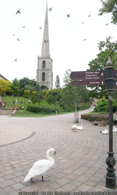
St Andrew, Worcester, Church of England
hide
Hide
Hide
St. Andrews
Deansway
Worcester
WR1
Hide
It was founded in 15th C. It closed in 1940 and was demolished in 1949 leaving only the tower and spire, now known as the glover's needle.
The war memorial is now at All Saints and transcribed here
http://www.rememberthefallen.co.uk/memorial/worcester-st-andrews-in-all-saints-church/
Parish register transcripts can be found here: https://mfhs.org.uk/projects-2/worcestershire-parish-records/
It was located at SO8488554778 (Lat/Lon 52.19103, -2.22252). You can see this on maps provided by:
- OpenStreetMap
- Google Maps
- StreetMap (Current Ordnance Survey maps)
- Bing (was Multimap)
- Old Maps Online
- National Library of Scotland (Old Ordnance Survey maps)
- Vision of Britain (Click "Historical units & statistics" for administrative areas.)
- English Jurisdictions in 1851 (Unfortunately the LDS have removed the facility to enable us to specify a starting location, you will need to search yourself on their map.)
- Magic (Geographic information) (Click + on map if it doesn't show)
- GeoHack (Links to on-line maps and location specific services.)