Hide
Yedingham
hide
Hide
hide
Hide
Hide
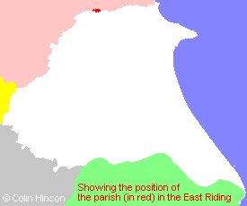
The Ancient Parish of YEDINGHAM
[Transcribed information mainly from the early 1820s]
"YEDINGHAM, a parish in the wapentake of Buckrose; 9 miles NE. of Malton. Situated on the banks of the Derwent, which is navigable from hence to the Humber for small craft. The parish church is a small structure, dedicated to St. John the Baptist (see Churches for photograph). Earl Fitzwilliam is the patron of the living. Population, 127.Yeddingham, formerly called Little Maries or De Parvo Marisco. Here Roger de Clerc, before the year 1168, founded a small Monastery for eight or nine Benedictine Nuns, to the honour of the Virgin Mary, granting them all the lands in this place, with other privileges. At the dissolution in 1534, their income amounted to 2lL. 16s. 8d. --Dugdale, and 26L. 6s. 8d. Speed. The site, in 1543, was granted to Robert Holgate, Bishop of Landaff, afterwards Archbishop of York. Sir William Dugdale says, "that there were delivered in this house, to the Prioress and Convent, 62 loaves daily; to 9 brethren 12 loaves a piece weekly, to brother James, 14 loaves; to three priests, four chaplains, and other officers accordingly; and canibus in singulis maneriis, trigenta novem panes de pane duriori; i.e. to the dogs in each manor, 39 loaves of the coarser sort of bread." These are supposed to have been wolf dogs kept, at first by permission, (wolves been anciently a royal game,) afterwards by obligation, to protect both cattle, inhabitants, and travellers, from those dangerous animals, which formerly abounded upon the Wolds. --Burton, -Dugdale. -Hist of Scarborough."
"COURTHOUSE, in the parish of Yedingham, and wapentake of Buckrose; 9 miles NE. of Malton. Population included with Yedingham."
"YEDINGHAM BRIDGE INN, a Posting House, in the parish of Yedingham, between Malton and Scarborough, adjoining Yedingam."
[Description(s) edited mainly from various 19th century sources by Colin Hinson. ©2010]
Hide
- Photographs of the over 80 gravestones and plaques at Yedingham with linked surname index.
- Here are 2 photographs of the Parish Church:
- St. John the Baptist's Church, Yedingham (view 1).
- St. John the Baptist's Church, Yedingham (view 2).
- Transcript of the entry for Yedingham in the "Collections relative to Churches and Chapels".
- The whereabouts and dates of the Registers etc. for the Parish of Yedingham.
- Transcript of the entry of "professions and trades" in the Baines's Directory of 1823, of the East Riding.
- Transcript of the entry of "professions and trades" in the Bulmers Directory of 1892. of the East Riding.
- Transcript of the entry of "professions and trades" in the The Scarborough Gazette of 1905,
- There is further information about this parish from the National Gazetteer 1868, Yorkshire extracts.
- There is further information about this parish from the Lewis's Topographical Dictionary of England 1835, Yorkshire extracts.
- There is further information about this parish from the Bulmer's 1892 History and Directory of the East Riding.
- Ask for a calculation of the distance from Yedingham to another place.

- For a detailed map of this parish see this parish boundaries map.
- For a more detailed map of the parishes in the riding please see the Yorkshire parish maps page.
- For a more detailed map of the county please see the Yorkshire map page.
- Here is a map showing the wapentakes for the county.
You can see maps centred on OS grid reference SE894794 (Lat/Lon: 54.202564, -0.630982), Yedingham which are provided by:
- OpenStreetMap
- Google Maps
- StreetMap (Current Ordnance Survey maps)
- Bing (was Multimap)
- Old Maps Online
- National Library of Scotland (Old Ordnance Survey maps)
- Vision of Britain (Click "Historical units & statistics" for administrative areas.)
- English Jurisdictions in 1851 (Unfortunately the LDS have removed the facility to enable us to specify a starting location, you will need to search yourself on their map.)
- Magic (Geographic information) (Click + on map if it doesn't show)
- GeoHack (Links to on-line maps and location specific services.)
- All places within the same township/parish shown on an Openstreetmap map.
- Nearby townships/parishes shown on an Openstreetmap map.
- Nearby places shown on an Openstreetmap map.
- A transcription of the School Timetables, around 1902-3 in Adobe pdf format.
- This parish is covered (or partly covered) by the following Societies:
- The 1834 Electoral Roll for this parish

