Hide
Alne
hide
Hide
hide
Hide
Hide
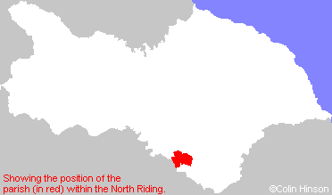
The Ancient Parish of ALNE
[Transcribed information mainly from the early 1820s]
"ALNE, a parish in the wapentake of Bulmer, a part in the liberty of St. Peter's; 3½ miles SW. of Easingwold. The church is a handsome edifice, dedicated to St. Mary (see Churches for photograph), in the deanry of Bulmer. The living is a vicarage, and in the patronage of William John Bethel, Esq. of which the Rev. Henry Chaloner, A. M. is the incumbent. This village takes its name from the Latin word Alnus, (the alder tree) it being situated in a low swampy country, which formerly abounded with alders, and thence was called the Forest of Alders. Pop. 386.""ALDWARK, in the parish of Alne, and wapentake of Bulmer, a part in the liberty of St. Peter's; 2¼ miles WSW. of Alne, 5 miles ESE. of Boroughbridge. This village is situated on the eastern bank of the Ure, which is here navigable. Pop. 163.
This place carries evident marks of antiquity in its name; and through it, by the ferry, the Roman Road from Isvrium to Eboracum passed; then went through the Forest of Galtres to Beningbrough, and entered the city of York at Bootham-Bar. -Drake."
"FLAWITH, in the parish of Alne, wapentake of Bulmer and liberty of St. Peter's ; ¾ miles W. of Alne, 5 miles E. of Boroughbridge. Pop. 94."
"THOLTHORPE, in the parish of Alne, wapentake of Bulmer, and liberty of St. Peter's; 1½ miles WNW. of Alne, 5 miles SW. of Easingwold. Population, 238."
"TOLLERTON, in the parish of Alne, wapentake of Bulmer, and liberty of St. Peter's; 1¼ miles SE. of Alne, 4 miles S. of Easingwold. This village, situated on the verge of the great forest of Galtres, is supposed to be one of the places where travellers, on entering the forest, paid a certain toll, for which they were furnished with a guide, properly armed, to defend them from the attacks of robbers and wild beasts, with both of which that extensive forest is said to have abounded. Here is a Methodist chapel and Sunday school. At the western extremity of the village runs a small rivulet, which tradition says was once a navigable river, named Carr or Kyle, and, in digging for the foundation of a water mill, in 1815, part of a ship was discovered, at the depth of from ten to twelve feet below the surface. There is here a fair for sheep and cattle on the 15th of August. Population. 481."
"YOULTON, in the parish of Alne, and wapentake of Bulmer; 1¼ miles SSW. of Alne, 5 miles SSW. of Easingwold. Pop. 56. of Easingwold. Pop. 56."
[Description(s) edited mainly from various 19th century sources by Colin Hinson. ©2010]
Hide
- The list of Benefactions in St. Mary's Church, Alne.
- Here are photographs of Churches etc. in the parish:
- The Church of St. Mary the Virigin, Alne.
- Internal view looking down the nave
- The East Window
- The massive 12th century font
- St. Stephen's Church, Aldwark (view 1).
- Internal view looking down the aisle
- St. Stephen's Church, Aldwark (view 2).
- St. Michael's Chapel, Tollerton.
- Tholthorpe Methodist Church, Tholthorpe. (Originally the Methodist Chapel). (The Church's website is here.)
- The Church of St. Mary the Virigin, Alne.
- Transcript of the entry for Alne in the "Collections relative to Churches and Chapels".
- The whereabouts and dates of the Registers etc. for the Parish of Alne.
- The List of Vicars of St. Mary's Church, Alne.
- A transcription of the Alne Burials 1781 to 1792 by Carol Ryan.
- Transcript of the entry of "professions and trades" in the Baines's Directory of 1823, of the North Riding.
- Transcript of the entry of "professions and trades" in the White's Directory of 1840, Yorkshire section.
- Transcript of the entry of "professions and trades" in the Bulmers Directory of 1890. of the North Riding.
- There is further information about this parish from the National Gazetteer 1868, Yorkshire extracts.
- There is further information about this parish from the Lewis's Topographical Dictionary of England 1835, Yorkshire extracts.
- There is further information about this parish from the Stephen Whatley's Gazetteer 1750, Yorkshire extracts.
- There is further information about this parish from the Bulmer's 1890 History and Directory of the North Riding.
- Ask for a calculation of the distance from Alne to another place.

- For a detailed map of this parish see this parish boundaries map.
- For a more detailed map of the parishes in the riding please see the Yorkshire parish maps page.
- For a more detailed map of the county please see the Yorkshire map page.
- Here is a map showing the wapentakes for the county.
You can see maps centred on OS grid reference SE497655 (Lat/Lon: 54.083026, -1.241791), Alne which are provided by:
- OpenStreetMap
- Google Maps
- StreetMap (Current Ordnance Survey maps)
- Bing (was Multimap)
- Old Maps Online
- National Library of Scotland (Old Ordnance Survey maps)
- Vision of Britain (Click "Historical units & statistics" for administrative areas.)
- English Jurisdictions in 1851 (Unfortunately the LDS have removed the facility to enable us to specify a starting location, you will need to search yourself on their map.)
- Magic (Geographic information) (Click + on map if it doesn't show)
- GeoHack (Links to on-line maps and location specific services.)
- All places within the same township/parish shown on an Openstreetmap map.
- Nearby townships/parishes shown on an Openstreetmap map.
- Nearby places shown on an Openstreetmap map.
- The World War I and II Memorial Plaque in St. Mary's Church, Alne.
- The following places are within the boundaries of this (ancient) parish, but I have no further information on them other than the Ordnance Survey Landranger Grid reference shown:
- (SE504667) Alne Station
- This parish is covered by the following Society:

