Hide
Brafferton
hide
Hide
hide
Hide
Hide
hide
Hide
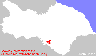
The Ancient Parish of BRAFFERTON
[Transcribed information mainly from the early 1820s]
"BRAFFERTON, a parish in the wapentakes of Bulmer and Halikeld, and liberty of St. Peter's; 5 miles W. of Easingwold. Population, 178. Here is a National School for children of both sexes, supported by subscription. Brafferton and Helperby are apparently but one village, occupying opposite sides of the same street. The village takes its name from a ford across the Swale, it being originally Broad-Ford-Town, and now by a natural contraction Brafferton. This village has a parish church dedicated to St. Peter (see Churches for photograph); the living is a vicarage, in the patronage of the Crown.On the outside of the chancel (south) are the arms of the Nevilles and other quarterings, carved on stone, and underneath, running round in Saxon Monastic Characters: "orate pro animo Radulphi Neville fundatoris hujus Ecclesioe" - "soi deo honor et gloria!" and on the largest bell is also inscribed "Radulphus Neville Armiger, I.H.S. 1598.""
"HELPERBY, in the parish of Brafferton, wapentake of Bulmer, and liberty of St. Peter's; ¼ mile S. of Brafferton, 4 miles NE. of Boroughbridge. Population, 611."
"THORNTON BRIDGE, in the parish of Brafferton, wapentake of Halikeld, and liberty of Richmondshire; 4 miles NE. of Boroughbridge. Pop. 43.
Here stood, till lately, a very ancient mansion of brick, lofty and spacious, successively the residence of the ancient families of Courtney, Nevile, and Strickland, of whom Sir Thomas Strickland was one of the Privy Council to King James II. whose fortunes he followed into France, and died there. --Hargrove. It is now, with some extensive farms adjoining, in the hands of the crown.
About 6 or 7 years ago, a quantity of silver coins was found, here, in removing an old wall, chiefly of the reign of William and Mary, in 5s. and 2s. 6d. pieces. Mr Paley, the present tenant, sent them to government -value upwards of 40L. as old silver.
Thornton-Bridge came to the Stricklands, by the marriage of Sir Walter Strickland, Knight, with Catharine, daughter of Sir Ralph Nevile, descended from a Sir Ralph, a son of Ralph Lord Raby." "The Stricklands forfeited Thornton-Bridge by being concerned in the rebellion of 1715." --Tunstal's remarks."
[Description(s) edited mainly from various 19th century sources by Colin Hinson. ©2010]
Hide
- Here are photographs of churches in the parish:
- St. Peter's Church, Brafferton view 1, from the front.
- St. Peter's Church, Brafferton view 2, from the back (in the rain).
- The Disused Methodist Church, Helperby.
- Transcript of the entry for Brafferton in the "Collections relative to Churches and Chapels".
- The whereabouts and dates of the Registers etc. for the Parish of Brafferton.
- Garry Stockdill's Yorksview website contains a description and photographs of Brafferton and Helperby.
- Transcript of the entry of "professions and trades" in the Baines's Directory of 1823, of the North Riding.
- Transcript of the entry of "professions and trades" in the White's Directory of 1840, Yorkshire section.
- Transcript of the entry of "professions and trades" in the Bulmers Directory of 1890. of the North Riding.
- There is further information about this parish from the National Gazetteer 1868, Yorkshire extracts.
- There is further information about this parish from the Lewis's Topographical Dictionary of England 1835, Yorkshire extracts.
- There is further information about this parish from the Bulmer's 1890 History and Directory of the North Riding.
- Ask for a calculation of the distance from Brafferton to another place.

- For a detailed map of this parish see this parish boundaries map.
- For a more detailed map of the parishes in the riding please see the Yorkshire parish maps page.
- For a more detailed map of the county please see the Yorkshire map page.
- Here is a map showing the wapentakes for the county.
You can see maps centred on OS grid reference SE439702 (Lat/Lon: 54.12579, -1.329761), Brafferton which are provided by:
- OpenStreetMap
- Google Maps
- StreetMap (Current Ordnance Survey maps)
- Bing (was Multimap)
- Old Maps Online
- National Library of Scotland (Old Ordnance Survey maps)
- Vision of Britain (Click "Historical units & statistics" for administrative areas.)
- English Jurisdictions in 1851 (Unfortunately the LDS have removed the facility to enable us to specify a starting location, you will need to search yourself on their map.)
- Magic (Geographic information) (Click + on map if it doesn't show)
- GeoHack (Links to on-line maps and location specific services.)
- All places within the same township/parish shown on an Openstreetmap map.
- Nearby townships/parishes shown on an Openstreetmap map.
- Nearby places shown on an Openstreetmap map.
- This parish is covered by the following Society:

