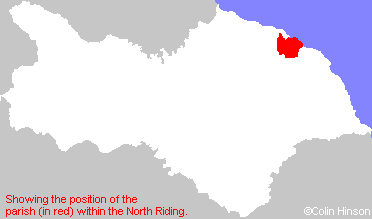
Hide
Lythe
hide
Hide
hide
Hide
Hide
The Ancient Parish of LYTHE
[Transcribed information mainly from the early 1820s]
"LYTHE, a parish in the wapentake and liberty of Langbargh; 4 miles WNW. of Whitby. Lythe is pleasantly situated near the eastern extremity of Cleveland, about 1 mile distant from the sea. Peter de Mausley, III. in the 38th of Henry the Third, obtained a licence for a weekly market, and a fair yearly, to be held on the Eve of St. Oswald, but being in the vicinity of Whitby, both the fairs and market have long been discontinued. The lord of the manor is the Earl of Mulgrave, who resides here, in a stately mansion, which stands a little South of the village, upon the brow of a gently rising hill, commanding a pleasing and extensive prospect of the country and the sea. The Church, dedicated to St. Oswald (see Churches for photograph), is an ancient structure, but owing to a thorough repair, which it received in 1819, has rather a modern appearance at first sight. The living is a vicarage, in the patronage of the Archbishop of York. There is also a Methodist Chapel, built in 1822. Pop. 1134."Information on the following places in this Parish is contained on a supplementary page.
|
|
|
[Description(s) edited mainly from various 19th century sources by Colin Hinson. ©2010]
Hide
- Some of the Monumental inscriptions and other information are given in an 1888 book on the History of Lythe. These have been transcribed by Caroline Gaden.
- Here are photographs of Churches in the parish:
- St Oswald's Church, Lythe.
- Internal view looking down the aisle
- The East Window
- The font
- St Mary's Church, Sandsend.
- Internal view looking down the nave
- The font
- Christ Church, Ugthorpe.
- Internal view looking down the nave
- The East Window
- The font
- St. Anne's Roman Catholic Church, Ugthorpe.
- The Congregational Church, Mickleby.
- St Oswald's Church, Lythe.
- A transcript of Mickleby Congregational Church History
- Transcript of the entry for Lythe in the "Collections relative to Churches and Chapels".
- The whereabouts and dates of the Registers etc. for the Parish of Lythe.
- The list of Rectors and Vicars in St. Oswald's Church, Lythe.
- The list of Curates and Vicars in Christ Church, Ugthorpe.
- Transcript of the entry of "professions and trades" in the Baines's Directory of 1823, of the North Riding.
- Transcript of the entry of "professions and trades" in the White's Directory of 1840, Yorkshire section.
- Transcript of the entry of "professions and trades" in the Bulmers Directory of 1890. of the North Riding.
- There is further information about this parish from the Pigot's 1834 Directory, Yorkshire section.
- There is further information about this parish from the National Gazetteer 1868, Yorkshire extracts.
- There is further information about this parish from the Lewis's Topographical Dictionary of England 1835, Yorkshire extracts.
- There is further information about this parish from the Stephen Whatley's Gazetteer 1750, Yorkshire extracts.
- There is further information about this parish from the Bulmer's 1890 History and Directory of the North Riding.
- Ask for a calculation of the distance from Lythe to another place.

- For a detailed map of this parish see this parish boundaries map.
- For a more detailed map of the parishes in the riding please see the Yorkshire parish maps page.
- For a more detailed map of the county please see the Yorkshire map page.
- Here is a map showing the wapentakes for the county.
You can see maps centred on OS grid reference NZ846131 (Lat/Lon: 54.506165, -0.694986), Lythe which are provided by:
- OpenStreetMap
- Google Maps
- StreetMap (Current Ordnance Survey maps)
- Bing (was Multimap)
- Old Maps Online
- National Library of Scotland (Old Ordnance Survey maps)
- Vision of Britain (Click "Historical units & statistics" for administrative areas.)
- English Jurisdictions in 1851 (Unfortunately the LDS have removed the facility to enable us to specify a starting location, you will need to search yourself on their map.)
- Magic (Geographic information) (Click + on map if it doesn't show)
- GeoHack (Links to on-line maps and location specific services.)
- All places within the same township/parish shown on an Openstreetmap map.
- Nearby townships/parishes shown on an Openstreetmap map.
- Nearby places shown on an Openstreetmap map.
- The World War I Memorial Plaques in Christ Church, Ugthorpe.
- This parish is covered by the following Society:

