Hide
Barnoldswick
hide
Hide
hide


Hide
Hide
The Ancient Parish of BARNOLDSWICK
[Transcribed information mainly from the early 1820s]
"BARNOLDSWICK, or GILL CHURCH, a parish-town in the east division and liberty of Staincliffe; 5 miles N. of Colne, 4 miles from Gisburn, (Lanc.) 49 from York. Pop. 1334. The Church is a perpetual curacy, dedicated to St. Mary, in the deanry of Craven, value p.r. £62. 9s. 6d. Patron Sir John Lister Kaye, Bart.The church here, which seems to have been built soon after the Monks left this place, is situated near a mile and a half from the village, upon the brink of a deep glen, whence it has obtained the name of Gill Church.
In 1147 Henry de Lacy founded a monastery here, and translated hither twelve Monks and ten Conversi, under Alexander, Prior of Fountains, for the support of which he assigned the whole town of Barnoldswick. The old church was levelled to the ground by the Abbot. After six years residence in continual warfare with the Rector and Parishioners, and frequent ravages committed upon their lands by the Scots, they abandoned Barnoldswick, and went to Kirkstall. Tanner. The situation of this Monastery was on the margin of the brook, west of the village. --Whitaker's Craven."
"ADMERGILL, a farm-house in the township of Brogden, and parish of Barnoldswick, east-division and liberty of Staincliffe; 2 miles from Guisburn."
"BARNOLDSWICK COATES, in the parish of Barnoldswick, east-division and liberty of Staincliffe; 6 miles from Colne, (Lanc.) 7 from Skipton, 11 from Burnley, (Lanc.) Pop. 97. The large hall House, built by the Drakes, is now converted into cottages."
"BROGDEN, a hamlet in the parish of Barnoldswick, east-division and liberty of Staincliffe; 5 miles NW. of Colne, (Lanc.) 9 from Skipton, 11 from Burnley, (Lanc.) Pop. 233."
"SALTERFORTH, in the parish of Barnoldswick, east-division and liberty of Staincliffe; 4 miles N. of Colne, (Lanc.) 10 from Skipton and Burnley, (Lanc.) Pop. 686."
[Description(s) edited from various 19th century sources by Colin Hinson © 2013]
Hide
- Barnoldswick: The story of Barnoldswick, a mill town in the Pennine hills of England, by Stanley Graham. Published by Lulu.com, ISBN: 978-1-4092-4787-6.
- Photograph taken in the Cemetery, Ghyll lane:
- The Mortuary Chapel at Ghyll Cemetery, Barnoldswick.
- Here are photographs of Churches etc. in the parish:
- Holy Trinity Church, Barnoldswick.
- St. Andrew's Methodist Church, Barnoldswick.
- The Independent Methodist Church, Barnoldswick.
- The Baptist Church Centre, Barnoldswick. (The Church's website is here.)
- The Free Presbyterian Church of Scotland, Barnoldswick. (The Church's website is here.)
- St. Joseph's Roman Catholic Church, Barnoldswick.
- The Kingdom Hall of Jehovah's Witnesses, Barnoldswick.
- The Baptist Church, Salterforth. (The Church's website is here.)
- The Inghamite Church, Salterforth. This church is in private ownership and services take place on a regular basis. Funerals also take place regulary due to the ground floor being a chapel of rest.
- The Church of St. Mary le Gill, Gill.
- Internal view looking down the nave
- Internal view looking up the nave
- Internal view - the multi tier pulpit
- Internal view from the pulpit
- A transcription of Barnoldswick Baptist Church History
- A transcription of Salterforth Baptist Church History
- Transcript of the entry for Barnoldswick in the "Collections relative to Churches and Chapels".
- The whereabouts and dates of the Registers etc. for the Parish of Barnoldswick.
- The List of Vicars of Gill Church, Barnoldswick.
- One Guy from Barlick: History, Genealogy, News, Events, Memoirs, Pictures and Local Gossip are just some of the topics you will find within the site.
- Transcript of the entry of "professions and trades" in the Baines's Directory and Gazetteer, Vol I, West Riding.
- Transcript of the entry of "professions and trades" in the Craven Household Almanack 1911, XXX
- There is further information about this parish from the Pigot's 1834 Directory, Yorkshire section.
- There is further information about this parish from the National Gazetteer 1868, Yorkshire extracts.
- There is further information about this parish from the Lewis's Topographical Dictionary of England, Yorkshire extracts.
- Ask for a calculation of the distance from Barnoldswick to another place.

- For a detailed map of this parish see this parish boundaries map.
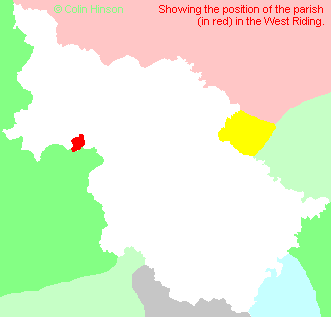
- For a more detailed map of the parishes in the riding please see the Yorkshire parish maps page.
- For a more detailed map of the county please see the Yorkshire map page.
- Here is a map showing the wapentakes for the county.
You can see maps centred on OS grid reference SD877467 (Lat/Lon: 53.916297, -2.18875), Barnoldswick which are provided by:
- OpenStreetMap
- Google Maps
- StreetMap (Current Ordnance Survey maps)
- Bing (was Multimap)
- Old Maps Online
- National Library of Scotland (Old Ordnance Survey maps)
- Vision of Britain (Click "Historical units & statistics" for administrative areas.)
- English Jurisdictions in 1851 (Unfortunately the LDS have removed the facility to enable us to specify a starting location, you will need to search yourself on their map.)
- Magic (Geographic information) (Click + on map if it doesn't show)
- GeoHack (Links to on-line maps and location specific services.)
- All places within the same township/parish shown on an Openstreetmap map.
- Nearby townships/parishes shown on an Openstreetmap map.
- Nearby places shown on an Openstreetmap map.
- The War Memorial at Salterforth
- The war memorial to those from Barnoldswick who fell in the two world wars.
- The following places are within the boundaries of this (ancient) parish, but I have no further information on them other than the Ordnance Survey Landranger Grid reference shown:
- (SD884448) Park Close
- (SD870477) Aynhams
- This parish is covered by the following Society:
- Try the Lancashire FHHS

