Hide
Ferry Fryston
hide
Hide
hide
Hide
Hide
The Ancient Parish of FERRY FRYSTON
[Transcribed information mainly from the early 1820s]
"FERRY FRYSTON, a parish-town in the wapentake of Osgoldcross, liberties of St. Peter, and Pontefract; 1 mile from Ferrybridge, 2 from Pontefract, 15 from Doncaster, 22 from York. Pop. 777. The Church is a vicarage, dedicated to St. Andrew, in the deanry of Pontefract, value ~£5. 19s. 2d. p.r. *£113. 8s. 10d. Patrons, Succentar and Vicars Choral of York.On the 23rd of March, 1822, a massive and curious piece of antiquity was discovered at Fryston, near Ferrybridge. As two labourers were digging ground for liquorice, in a field called the Paper Mill Field, on the Fryston Hall estate, in the possession of James Brook, they penetrated to a mass of stone, only about eleven inches below the surface, which, on being cleared, proved to be an ancient coffin of undressed stone, without inscription. The lid projected over the sides about two inches, and on being raised in the centre, presented a complete skeleton, of large dimensions, in a high state of preservation. The skull was placed between the thigh bones, and the occupant of this narrow mansion, who had probably, in his day filled a considerable space in society, had evidently suffered decapitation. In the place where the head would have lain in an unmutilated body was a stone. The teeth were all perfect, and the bones that of a strong athletic man, cut off, apparently, in the meridian of life, and when the coffin was opened they were all entire; but immediately on being exposed to the air, the ribs fell in. Nothing remains of the flesh, but some hard white chalky substances. The coffin is of the dimensions of six feet five inches in length, and nineteen inches in width within, with sides about six inches thick; it has been cut out of the solid stone, and is supposed to weigh about a ton and a half. The place where these relics were found, is about a mile and a quarter from Ferrybridge, in a valley near the road leading to Castleford, and the prevailing opinion is, that these are the remains of Thomas Earl of Lancaster, the unfortunate leader of the insurgent barons, in the battle of Boroughbridge, fought in the year 1321, and who was beheaded at Pontefract, by order of his Nephew, Edward. The coffin and remains, which have attracted a great deal of public attention, are now removed to Fryston Hall. --Leeds Mercury."
Information on the following places in this Parish is contained on a supplementary page.
|
[Description(s) edited from various 19th century sources by Colin Hinson © 2013]
Hide
- Transcript of the entry for Ferry Fryston in the "Collections relative to Churches and Chapels".
- The whereabouts and dates of the Registers etc. for the Parish of Ferry Fryston.
- Transcript of the entry of "professions and trades" in the Baines's Directory and Gazetteer, Vol I, West Riding.
- There is further information about this parish from the Pigot's 1829 Directory, Yorkshire section.
- There is further information about this parish from the Pigot's 1834 Directory, Yorkshire section.
- There is further information about this parish from the National Gazetteer 1868, Yorkshire extracts.
- There is further information about this parish from the Lewis's Topographical Dictionary of England, Yorkshire extracts.
- Ask for a calculation of the distance from Ferry Fryston to another place.
- Ferrybridge history (on Archive.org)
- Site of St. Andrew's Church Ferry Fryston
- Site of St. Peter's Church Fryston

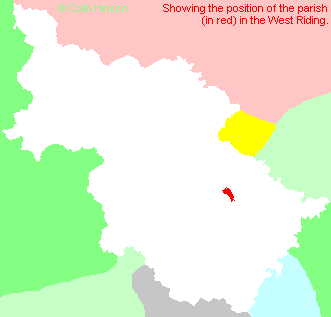
- For a detailed map of this parish see this parish boundaries map.
- For a more detailed map of the parishes in the riding please see the Yorkshire parish maps page.
- For a more detailed map of the county please see the Yorkshire map page.
- Here is a map showing the wapentakes for the county.
You can see maps centred on OS grid reference SE480250 (Lat/Lon: 53.719211, -1.274109), Ferry Fryston which are provided by:
- OpenStreetMap
- Google Maps
- StreetMap (Current Ordnance Survey maps)
- Bing (was Multimap)
- Old Maps Online
- National Library of Scotland (Old Ordnance Survey maps)
- Vision of Britain (Click "Historical units & statistics" for administrative areas.)
- English Jurisdictions in 1851 (Unfortunately the LDS have removed the facility to enable us to specify a starting location, you will need to search yourself on their map.)
- Magic (Geographic information) (Click + on map if it doesn't show)
- GeoHack (Links to on-line maps and location specific services.)
- All places within the same township/parish shown on an Openstreetmap map.
- Nearby townships/parishes shown on an Openstreetmap map.
- Nearby places shown on an Openstreetmap map.
- Transcription and photograph of Ferrybridge war memorial
- Transcription and photograph of Fryston war memorial
- The following places are within the boundaries of this (ancient) parish, but I have no further information on them other than the Ordnance Survey Landranger Grid reference shown:
- (SE453258) Airedale
- (SE453270) New Fryston
- (SE441253) Red Hill
- (SE456266) Wheldale
- This parish is covered (or partly covered) by the following Societies:
- A list of those paying the 1379 Subsidy Rolls (Poll Tax) for this parish.

