Hide
Hampsthwaite
hide
Hide
hide
Hide
Hide
The Ancient Parish of HAMPSTHWAITE
[Transcribed information mainly from the early 1820s]
"HAMPSTHWAITE, a parish-town, in the lower-division of Claro, liberty of Knaresborough; 2 miles SW. of Ripley, 7 from Knaresborough, 8 from Ripon, 25 from York. Pop. 490. The Church is a vicarage, dedicated to St. Thomas a Beckitt, in the deanry of the Ainsty, value, £13. 6s. 8d. Patrons, Messrs. Shanns.This village was part of the possessions of the Lords Viptoft; It is a long straggling village, pleasantly situated on the southern bank of the river Nidd. The patronage of the church was given to the Priory of Knaresborough. --Hist. Knaresborough."
Information on the following places in this Parish is contained on a supplementary page.
|
|
[Description(s) edited from various 19th century sources by Colin Hinson © 2013]
Hide
- Here are photographs of Churches etc. in the parish:
- The Church of St. Thomas A Beckett, Hampsthwaite.
- The Methodist Church, Hampsthwaite.
- Internal view looking down the nave
- St. James' Church, Birstwith. (view 1) (The Church's website is here.)
- St. James' Church, Birstwith. (view 2)
- St. Saviour's Church, Thornthwaite.
- Internal view looking down the nave
- Nidderdale Evangelical Free Church (Brow Chapel), Thornthwaite (originally Wesleyan, built in 1875).
- Felliscliffe Chapel of Ease, Kettlesing Bottom (view 1).
- Felliscliffe Chapel of Ease, Kettlesing Bottom (view 2).
- Kettlesing Chapel, Kettlesing.
- Transcript of the entry for Hampsthwaite in the "Collections relative to Churches and Chapels".
- Transcript of the entry for Thornthwaite in the "Collections relative to Churches and Chapels".
- The whereabouts and dates of the Registers etc. for the Parish of Hampsthwaite.
- The whereabouts and dates of the Registers etc. for the Chapelry of Thornthwaite.
- The Hampsthwaite Village community website.
- Transcript of the entry of "professions and trades" in the Baines's Directory and Gazetteer, Vol I, West Riding.
- There is further information about this parish from the Pigot's 1834 Directory, Yorkshire section.
- There is further information about this parish from the National Gazetteer 1868, Yorkshire extracts.
- There is further information about this parish from the Lewis's Topographical Dictionary of England, Yorkshire extracts.
- Ask for a calculation of the distance from Hampsthwaite to another place.
- The Hampsthwaite village web-site contains a History section.

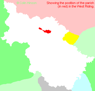
- For a detailed map of this parish see this parish boundaries map.
- For a more detailed map of the parishes in the riding please see the Yorkshire parish maps page.
- For a more detailed map of the county please see the Yorkshire map page.
- Here is a map showing the wapentakes for the county.
You can see maps centred on OS grid reference SE260587 (Lat/Lon: 54.023649, -1.60463), Hampsthwaite which are provided by:
- OpenStreetMap
- Google Maps
- StreetMap (Current Ordnance Survey maps)
- Bing (was Multimap)
- Old Maps Online
- National Library of Scotland (Old Ordnance Survey maps)
- Vision of Britain (Click "Historical units & statistics" for administrative areas.)
- English Jurisdictions in 1851 (Unfortunately the LDS have removed the facility to enable us to specify a starting location, you will need to search yourself on their map.)
- Magic (Geographic information) (Click + on map if it doesn't show)
- GeoHack (Links to on-line maps and location specific services.)
- All places within the same township/parish shown on an Openstreetmap map.
- Nearby townships/parishes shown on an Openstreetmap map.
- Nearby places shown on an Openstreetmap map.
- The following places are within the boundaries of this (ancient) parish, but I have no further information on them other than the Ordnance Survey Landranger Grid reference shown:
- (SE241584) Birstwith Hall
- (SE215587) Cinder Hills
- (SE244590) Clapham Green
- (SE217569) Cold Cotes
- (SE216578) Cote Hill
- (SE249578) Cote Syke
- (SE222578) Crow Trees
- (SE210583) Dicken-Dyke
- (SE208588) Fringill
- (SE239597) Grosvenor House
- (SE227586) High Birstwith
- (SE246587) Hirst Grove
- (SE227573) Kettlesing Bottom
- (SE232567) Knabs Grove
- (SE234560) Knabs Ridge
- (SE226579) Longscales
- (SE207590) Low Green
- (SE237592) Meg Gate
- (SE226596) Reynard Crag
- (SE257576) Rowden
- (SE265572) Saltergate Hill
- (SE268573) Shutt Nook
- (SE219574) Staupes
- (SE250582) Swincliffe
- (SE233578) Tang
- (SE217593) The Holme
- (SE210585) Turner Ing
- (SE207579) Turpin Lair
- This parish is covered by the following Society:

