Hide
Selby
hide
Hide
hide
Hide
Hide
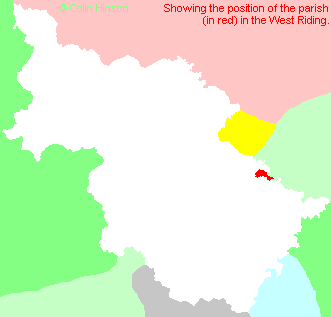
The Ancient Parish of SELBY
[Transcribed information mainly from the early 1820s]
"SELBY, a market and parish-town, in the wapentake of Barkston-Ash, a part in the liberty of St. Peter; 8 miles from Snaith, 10 from Howden, 11 from Ferrybridge, 12½ from Tadcaster, 14 from Pontefract, 15 from York, 18 from Market Weighton, 20 from Leeds, 183 from London. Market, Monday. Fairs, Easter Tuesday; the Monday after Boroughbridge Barnabas Fair, and old Michaelmas day, for horses, horned cattle, sheep, &c., the horse show commences September 20, and ends on the 26th; Line Fairs are on every Thursday six weeks, from Michaelmas to Saint Peter's day, old style. Bankers, Messrs. Scholfield, Clarkson, and Co. draw on Messrs. Spooner, and Co. 27, Gracechurch Street Principal Inns, George, and Kings Head. Pop. 4,097. The Church, peculiar, is a vicarage, dedicated to St. Mary and St. Germain, in the deanry of the Ainsty, value, p.r. !£101. Patron, the Archbishop of York." (There is further information for Selby)."ROSCARRS, a farm-house in the township and parish of Selby; 2 miles E. of Selby, 9 from Snaith."
"SPARK HAGG, a farm-house in the township and parish of Selby; 1¾ miles NW. of Selby."
"STAYNOR HALL, (or Stainer Hall), a farm-house in the township and parish of Selby; 1¼ miles S. of Selby, 7¾ from Snaith."
"THORPE HALL, a farm-house in the township and parish of Selby; 2 miles W. of Selby, 9 from Ferrybridge."
[Description(s) edited from various 19th century sources by Colin Hinson © 2013]
Hide
- Photographs of 49 War Graves in Selby Cemetery with linked surname index.
- Here are photographs of Churches etc. in the parish:
- Selby Abbey, (view 1). (The Church's website is here.)
- Internal view looking down the nave
- Internal view showing the choir and the altar
- The East Window
- Internal view looking west up the nave
- Another of the stained glass windows
- and yet another of the windows
- Selby Abbey, (view 2).
- Selby Abbey floodlit.
- The Church of St. James the Apostle, Selby.
- The Methodist Church, Selby (view 1).
- The Methodist Church, Selby (view 2).
- The Roman Catholic Church, East Common.
- St. Mary's Roman Catholic Church, Selby. (The Church's website is here.)
- St. Richard's Chapel (1961), Selby.
- The Church of Jesus Christ of Latter Day Saints, Selby.
- The Kingdom Hall of Jehovah's Witnesses, Selby.
- St. Michael's Chapel, Selby.
- Selby Abbey, (view 1). (The Church's website is here.)
- A transcription of the Selby-Mill-Gate Congregational Church History
- A transcription of the Selby Congregational Church History
- Transcript of the entry for Selby in the "Collections relative to Churches and Chapels".
- The whereabouts and dates of the Registers etc. for the Parish of Selby.
- The List of Abbots and Vicars in Selby Abbey.
- Transcript of the entry of "professions and trades" in the Baines's Directory and Gazetteer, Vol I, West Riding.
- Transcript of the entry of "professions and trades" in the Pigot's 1829 Directory, Yorkshire section.
- Transcript of the entry of "professions and trades" in the Pigot's 1834 Directory, Yorkshire section.
- Transcript of the entry of "professions and trades" in the White's 1837 Gazetteer, History and Directory, of the West Riding.
- There is further information about this parish from the Pigot's 1829 Directory, Yorkshire section.
- There is further information about this parish from the Pigot's 1834 Directory, Yorkshire section.
- There is further information about this parish from the White's 1837 Gazetteer, History and Directory, of the West Riding.
- There is further information about this parish from the National Gazetteer 1868, Yorkshire extracts.
- There is further information about this parish from the Lewis's Topographical Dictionary of England, Yorkshire extracts.
- There is further information about this parish from the Stephen Whatley's Gazetteer 1750, Yorkshire extracts.
- Ask for a calculation of the distance from Selby to another place.
- A transcription of the Selby-Mill-Gate Congregational Church History
- A transcription of the Selby Congregational Church History

- For a detailed map of this parish see this parish boundaries map.
- For a more detailed map of the parishes in the riding please see the Yorkshire parish maps page.
- For a more detailed map of the county please see the Yorkshire map page.
- Here is a map showing the wapentakes for the county.
You can see maps centred on OS grid reference SE616324 (Lat/Lon: 53.784288, -1.066575), Selby which are provided by:
- OpenStreetMap
- Google Maps
- StreetMap (Current Ordnance Survey maps)
- Bing (was Multimap)
- Old Maps Online
- National Library of Scotland (Old Ordnance Survey maps)
- Vision of Britain (Click "Historical units & statistics" for administrative areas.)
- English Jurisdictions in 1851 (Unfortunately the LDS have removed the facility to enable us to specify a starting location, you will need to search yourself on their map.)
- Magic (Geographic information) (Click + on map if it doesn't show)
- GeoHack (Links to on-line maps and location specific services.)
- All places within the same township/parish shown on an Openstreetmap map.
- Nearby townships/parishes shown on an Openstreetmap map.
- Nearby places shown on an Openstreetmap map.
- The War Memorial Plaques in Selby Abbey.
- The following places are within the boundaries of this (ancient) parish, but I have no further information on them other than the Ordnance Survey Landranger Grid reference shown:
- (SE623315) East Common
- This parish is covered (or partly covered) by the following Societies:
- A list of those paying the 1379 Subsidy Rolls (Poll Tax) for this parish.

