Hide
Whiston
hide
Hide
hide
Hide
Hide
The Ancient Parish of WHISTON
[Transcribed information mainly from the early 1820s]
"WHISTON, a parish-town, in the upper-division of Strafforth and Tickhill, liberty of Hallamshire; 2 miles SE. of Rotherham, 7½ from Sheffield, 11 from Tickhill, 50 from York. Pop. 859. The Church is a rectory, dedicated to St. James (see Churches for photograph), in the deanry of Doncaster, value, £10. Patron, Lord Howard of Effingham.The Church is an ancient rectory, having belonged to the Lovetots, and descended from them to the Furnivals, Talbots, and Howards, Lords of Sheffield. In the 9th Edward II. Thomas de Furnival was Lord of this Manor, which still belongs to his representative, the Duke of Norfolk. Here is a small endowed School, by Frances Mansel, in 1728, value about £30. per ann. --Hunter's Hallamshire."
"CANKLOW, a hamlet in the township and parish of Whiston, upper-division of Strafforth and Tickhill; 1½ miles S. of Rotherham."
"GUILTHWAITE, a hamlet in the township of Whiston, and parishes of Whiston and Rotherham, upper-division of Stainforth and Tickhill; (Gilthwaite Hall, the seat of John Outram, Esq.) 2 miles from Rotherham, 5 from Sheffield, 12 from Worksop, (Notts.)
Here was a mineral spring discovered in 1664, by Mr. George Westby, of this place, who made a large Bath and built a house over it. --Short. The waters had some reputation; but after the death of Mr. Westby, and of Dr. Yarburgh, of Newark, who sent many patients, they sunk into a state of almost utter neglect. --Hunter's Hallamshire."
"HERRINGTHORPE, a hamlet in the township and parish of Whiston; 2 miles E. of Rotherham."
"MORTHEN, a hamlet in the township of Whiston, and parishes of Whiston and Rotherham, upper-division of Strafforth and Tickhill; (Morthen Hall, the seat of Nicholas Timm, Esq.) 4 miles SE. of Rotherham, 9 from Sheffield, 11 from Tickhill."
"UPPER WHISTON, a hamlet in the township and parish of Whiston, 2½ miles SE. of Rotherham, 8 from Sheffield."
Hide
- Here are photographs of Churches etc. in the parish:
- St. Mary Magdalene's Church, Whiston. (The Church's website is here.)
- St. Cuthbert's Church, Whiston.
- The Methodist Church, Whiston.
- The United Reformed Church, Herringthorpe.
- The Methodist Church, Broom.
- Whiston Parish Church is dedicated to St. Mary Magdalene. In the 18th and 19th centuries it was usually described as "the Parish Church of St James". Canon Raine, an eminent church historian of the 19th cent., stated that "St James" was a modern ascription and that the original dedication was St Mary Magdalene. The "St James" ascription was most likely adopted under Puritan influence"
"The parish, now greatly reduced in area compared with earlier centuries, was formerly in the old Deanery of Doncaster which formed a part of the Archdeaconry of York within the Diocese of York. In 1884 the parishes of the old Deanery of Doncaster became part of the newly formed Archdeaconry of Sheffield, still within the Diocese of York. Whiston`s immediate administrative ties with York were finally severed in 1913 when the Diocese of Sheffield was created."
Extract from "The Parish Church of St.Mary Magdalene, Whiston" by John D. Griffin (1967).
The Patron is now the Bishop of Sheffield.
- Transcript of the entry for Whiston in the "Collections relative to Churches and Chapels".
- The whereabouts and dates of the Registers etc. for the Parish of Whiston.
- Transcript of the entry of "professions and trades" in the Baines's Directory and Gazetteer, Vol I, West Riding.
- There is further information about this parish from the National Gazetteer 1868, Yorkshire extracts.
- There is further information about this parish from the Lewis's Topographical Dictionary of England, Yorkshire extracts.
- Ask for a calculation of the distance from Whiston to another place.

- For a detailed map of this parish see this parish boundaries map.
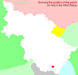
- For a more detailed map of the parishes in the riding please see the Yorkshire parish maps page.
- For a more detailed map of the county please see the Yorkshire map page.
- Here is a map showing the wapentakes for the county.
You can see maps centred on OS grid reference SK457901 (Lat/Lon: 53.405747, -1.314051), Whiston which are provided by:
- OpenStreetMap
- Google Maps
- StreetMap (Current Ordnance Survey maps)
- Bing (was Multimap)
- Old Maps Online
- National Library of Scotland (Old Ordnance Survey maps)
- Vision of Britain (Click "Historical units & statistics" for administrative areas.)
- English Jurisdictions in 1851 (Unfortunately the LDS have removed the facility to enable us to specify a starting location, you will need to search yourself on their map.)
- Magic (Geographic information) (Click + on map if it doesn't show)
- GeoHack (Links to on-line maps and location specific services.)
- All places within the same township/parish shown on an Openstreetmap map.
- Nearby townships/parishes shown on an Openstreetmap map.
- Nearby places shown on an Openstreetmap map.
- The World War I Memorial Plaque in the Lych Gate at St. Mary's Church, Whiston.
- The World War II Memorial Plaque in the Lych Gate at St. Mary's Church, Whiston.
- Whiston Heritage Society.
- This parish is covered by the following Society:
- A list of those paying the 1379 Subsidy Rolls (Poll Tax) for this parish.

