
Hide
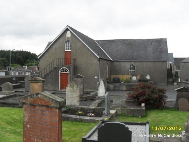
1st Presbyterian, Windmill Street, Ballynahinch, Presbyterian
hide
Hide
Hide
1st Presbyterian Church,
Windmill Street,
Ballynahinch
Windmill Street,
Ballynahinch
Hide
1655: Congregation formed.
1755: Present church built, and referred to as Strongs Meeting House (after the minister at that time).
It is located at NW4733607787 (Lat/Lon 54.402632, -5.894556). You can see this on maps provided by:
- OpenStreetMap
- Google Maps
- Bing (was Multimap)
- Vision of Britain (Click "Historical units & statistics" for administrative areas.)
- Copy
1st Presbyterian, Windmill Street, Ballynahinch, Presbyterianand paste it along with the county name into the search box at Ordnance Survey Ireland. - GeoHack (Links to on-line maps and location specific services.)